Werdauer-Greiz Forest

Last updated

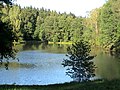
The Werdauer-Greizer forest, also known as the Greiz-Werdauer forest or the Werdauer forest, is the conservation forests around Greiz and Werdau and is one of the largest closed forest areas in Western Saxony and eastern Thuringia.

Contents

Location

A crossing in the forest Kreuzung Dreiflugel, Langenbernsdorfer Str.JPG
A crossing in the forest

The 62 km² large forested area extends mainly between the valley of the Pleiße and the White Elster. On its northern edge in Thuringia flows the Krebsbach. [1]

The northern spur forms the forest area near the village Trünzig. [2]

West of Greiz the Quirlbach forms a section of the conservation boundary. In the west, the forest area extends beyond the edge of the Elster Valley and ends southeast of the village Daßlitz. The northeastern tip of Werdau with the headwaters of the north adjacent Meiselbach goes into the Leubnitzer Waldsiedlung whose undeveloped area before 1945 still belonged to the Trünzig state forest. [3]

The forest borders the city of Werdau (Saxony) to the northeast and Greiz (Thuringia) to the southwest. In the middle of the forest there is a clearing, where the settlement Waldhaus is located.

The common border of the states of Saxony and Thuringia runs from Teichwolframsdorf going in a north-south direction along a road in the direction of Reudnitz through the forest.

Conservation area

The former Gera district created a conservation area in the Thuringian part of the forest in 1961. The Werdauer forest on the Saxon side was declared a conservation in 1968 by the administration of the former Karl-Marx-Stadt district.

Related Research Articles

Thuringia State in Germany

Thuringia, officially the Free State of Thuringia, is a state of Germany. Located in central Germany, it covers 16,171 square kilometres (6,244 sq mi), being the sixth smallest of the sixteen German States. It has a population of about 2.15 million.

Saale River in Germany

The Saale, also known as the Saxon Saale and Thuringian Saale, is a river in Germany and a left-bank tributary of the Elbe. It is not to be confused with the smaller Franconian Saale, a right-bank tributary of the Main, or the Saale in Lower Saxony, a tributary of the Leine.

Altenburger Land is a district in Thuringia, Germany. It is bounded by the district of Greiz, the Burgenlandkreis (Saxony-Anhalt), and the districts Leipzig, Mittelsachsen and Zwickau in Saxony. The district is a member of the Central German Metropolitan Region.

The Vogtlandkreis is a Landkreis in the southwest of the Free State of Saxony, Germany, at the borders to Thuringia, Bavaria, and the Czech Republic. Neighboring districts are Hof, Saale-Orla, Greiz, Zwickau and Erzgebirgskreis. Plauen is the administrative center of the district.

Gera Place in Thuringia, Germany

Gera is, with around 93,000 inhabitants, the third-largest city of Thuringia after Erfurt and Jena as well as the easternmost city of the Thüringer Städtekette, an almost straight string of cities consisting of the six largest Thuringian cities from Eisenach in the west, via Gotha, Erfurt, Weimar and Jena to Gera in the east. Gera is the largest city in the Vogtland, and one of its historical capitals along with Plauen, Greiz and Weida. The city lies in the East Thuringian Hill Country, in the wide valley of the White Elster, between Greiz (upstream) and Leipzig (downstream). Gera is located in the Central German Metropolitan Region, approximately 60 kilometres south of Saxony's largest city of Leipzig, 80 km east of Thuringia's capital Erfurt and 120 km west of Saxony's capital Dresden.

Greiz is a Kreis (district) in the east of Thuringia, Germany. Neighboring districts are Saale-Holzland, Saale-Orla, district-free city Gera, the Burgenlandkreis in Saxony-Anhalt, Altenburger Land, and the two Saxon districts Zwickauer Land and Vogtlandkreis.

Zeulenroda-Triebes Place in Thuringia, Germany

Zeulenroda-Triebes is a German town in the district of Greiz in the state of Thuringia.

Vogtland German region

Vogtland is a region spanning the German states of Bavaria, Saxony and Thuringia and north-western Bohemia in the Czech Republic. It overlaps with and is largely contained within Euregio Egrensis. The name alludes to the former leadership by the Vögte of Weida, Gera and Plauen.

Greiz Place in Thuringia, Germany

Greiz is a town in Thuringia, and it is the capital of the district of Greiz. Greiz is situated in eastern Thuringia on the river White Elster.

Hilbersdorf Place in Thuringia, Germany

Hilbersdorf is a German municipality in the Thuringian district of Greiz. It belongs to the Verwaltungsgemeinschaft of Wünschendorf/Elster and lies in upper Wipsetal.

Münchenbernsdorf Place in Thuringia, Germany

Münchenbernsdorf is a town in the district of Greiz, in Thuringia, Germany. It is situated approximately 16 km southwest of Gera. The town is seat of a municipal association with eight members.

Dresden Heath

The Dresden Heath is a large forest in the city of Dresden. The heath is the most important recreation area in the city and is also actively forested. Approximately 6,133 hectares of the Dresden Heath are designated as a nature preserve, making it one of the largest municipal forests in Germany by area. Though mainly agricultural areas border the forest in the east, in all other directions the Dresden Heath is bordered by districts of the city and reaches nearly to the city centre in the southwest.

Leipzig–Probstzella railway

The Leipzig–Probstzella railway is a line in the German states of Saxony, Saxony-Anhalt and Thuringia. It runs from Leipzig through the valley of the White Elster via Zeitz, Gera, Triptis, the Orlasenke lowland and Saalfeld to Probstzella. Since it runs parallel with the Saal Railway but is higher, it is also called the Obere Bahn.

Gera Süd–Weischlitz railway

The Gera Süd–Weischlitz railway is a main railway line in the German federal states of Thuringia and Saxony, which was originally built and operated by the Saxon-Thuringian Railway Company. It runs in the valley of the White Elster from Gera via Greiz and Plauen to Weischlitz.

Kirnitzsch River in Germany

The Kirnitzsch (German), in Bohemia also called the Kirnischt, Czech: Křinice, is a right tributary of the River Elbe, which passes through the Czech Republic and the German Free State of Saxony.

Külf Mountain ridge in Germany

The Külf is a ridge, up to 260 m above NN, in the Leine Uplands in the district of Hildesheim in the German state of Lower Saxony.

Neumark–Greiz railway

The Neumark–Greiz railway was a branch line in the German states of Saxony and Thuringia, which was built by the Greiz-Brunn Railway Company. It ran from Neumark in the Vogtland district of Saxony to Greiz in Thuringia, but was closed in 1999.

Mohlsdorf-Teichwolframsdorf Place in Thuringia, Germany

Mohlsdorf-Teichwolframsdorf is a municipality in the district of Greiz, in Thuringia, Germany. It was formed on 1 January 2012 by the merger of the former municipalities Mohlsdorf and Teichwolframsdorf.

The Werdau–Mehltheuer railway is a branch line in the German states of Saxony and Thuringia, originally built and operated by the Royal Saxon State Railways. The section from Werdau to Weida via Wünschendorf is now closed. The section between Weida and Mehltheuer is part of the Gera–Hof link.

The Falkensteiner Vorwald is the gently rolling westernmost part of the Bavarian Forest in northern Lower Bavaria and southern Upper Palatinate in the German state of Bavaria.

References

  1. Naturerholungsgebiet Werdauer Wald.
  2. de: Reichsamt für Landesaufnahme: Meßtischblatt Nr. 5239, Langenbernsdorf. 1908 (Berichtigungen 1926)
  3. de:Reichsamt für Landesaufnahme: Meßtischblatt Nr. 5240, Zwickau. 1910 (Berichtigungen 1937)