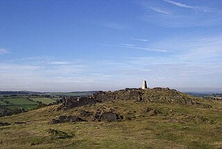
Charnwood Forest is a hilly tract in north-western Leicestershire, England, bounded by Leicester, Loughborough and Coalville. The area is undulating, rocky and picturesque, with barren areas. It also has some extensive tracts of woodland; its elevation is generally 600 feet (180 m) and upwards, the area exceeding this height being about 6,100 acres (25 km2). The highest point, Bardon Hill, is 912 feet (278 m). On its western flank lies an abandoned coalfield, with Coalville and other former mining villages, now being regenerated and replanted as part of the National Forest. The M1 motorway, between junctions 22 and 23, cuts through Charnwood Forest.
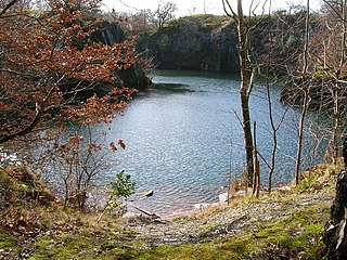
Swithland Wood and The Brand is a 87.9 hectares biological Site of Special Scientific Interest south of Woodhouse Eaves in Leicestershire. Swithland Wood is a Nature Conservation Review site, Grade II. The Brand is designated a Precambrian site in the Geological Conservation Review, but the dating has been changed due to the discovery of trace fossils from the succeeding Cambrian period.
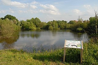
Rixton Clay Pits is a former clay extraction site in Rixton, near Hollins Green, Warrington, England. Formerly farmland, boulder clay extraction started in the 1920s for brick making in the adjacent brickworks, and ceased in 1965 - since then it has been allowed to return to nature. It is now an area of ponds, scrub, woodland and damp grassland. It is owned and managed by Warrington Borough Council as a local amenity.
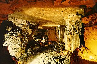
Brown's Folly or Brown's Folly is a folly tower sitting within a 39.9 hectare biological and geological Site of Special Scientific Interest (SSSI) near the village of Bathford in Somerset, notified in 1974: the site itself is known as the Farleigh Down Stone Quarry, and is managed as a nature reserve by the Avon Wildlife Trust (AWT). The tower was built in 1848 and is a Grade II listed building.

Roswell Pits is an 8 hectare nature reserve on the eastern outskirts of Ely in Cambridgeshire. It is managed by the Environment Agency. It is part of the Ely Pits and Meadows Site of Special Scientific Interest (SSSI)) and Geological Conservation Review site. The SSSI designation for both biological and geological interest. The site was formerly managed by the Wildlife Trust for Bedfordshire, Cambridgeshire and Northamptonshire.
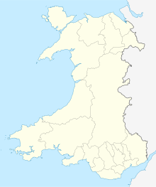
Aberbargoed Grasslands is a Site of Special Scientific Interest in the Rhymney Valley in Mid & South Glamorgan, South Wales. The area was designated a national nature reserve in 2012 largely due to its population of marsh fritillary butterflies. It is managed by Caerphilly County Borough.

Braeburn Park is a 22.3-hectare (55-acre) nature reserve in Crayford in the London Borough of Bexley. It is managed by the London Wildlife Trust, and includes Wansunt Pit, a 1.9-hectare (4.7-acre) geological Site of Special Scientific Interest.

Inholms Clay Pit is a 8.4-hectare (21-acre) Local Nature Reserve south of Dorking in Surrey. It is owned by Mole Valley District Council and from 2009 - 2019 was managed by Surrey Wildlife Trust and since then by Mole Valley District Council.
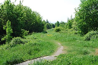
Bonc yr Hafod is a country park, on the former site of Hafod Colliery, near Johnstown and Pentre Bychan in Wrexham County Borough, Wales. The country park is centred on a former spoil tip hill, known locally as "Picnic Mountain", rising up 150 metres (490 ft). The country park is 90 acres (0.36 km2) in size of mainly woodlands and grasslands. The park is home to one of the largest community woodlands in North East Wales.
