West Creek (New Jersey)

Last updated

West Creek is a 12.3-mile-long (19.8 km) [1] tributary of Delaware Bay in Cape May County, New Jersey in the United States. [2]

Tributary stream or river that flows into a main stem river or lake

A tributary or affluent is a stream or river that flows into a larger stream or main stem river or a lake. A tributary does not flow directly into a sea or ocean. Tributaries and the main stem river drain the surrounding drainage basin of its surface water and groundwater, leading the water out into an ocean.

Delaware Bay The estuary outlet of the Delaware River on the Northeast seaboard of the United States

Delaware Bay is the estuary outlet of the Delaware River on the Northeast seaboard of the United States. Approximately 782 square miles (2,030 km2) in area, the bay's fresh water mixes for many miles with the salt water of the Atlantic Ocean.

Cape May County, New Jersey County in the United States

Cape May County is the southernmost county in the U.S. state of New Jersey. Much of the county is located on the Cape May Peninsula, bounded by the Delaware Bay to the west, and the Atlantic Ocean to the south and east. Adjacent to the Atlantic coastline are five barrier islands that have been built up as seaside resorts. A consistently popular summer destination with 30 miles (48 km) of beaches, Cape May County attracts vacationers from New Jersey and surrounding states, with the summer population exceeding 750,000. Tourism generates annual revenues of about $6 billion as of 2015, making it the county's single largest industry, with leisure and hospitality being Cape May's largest employment category. Its county seat is the Cape May Court House section of Middle Township.

Contents

The name "West Creek" is derived from the Lenape word "westeconk," meaning "place of fat meat." It rises in the swamps to the west of Halberton, in Maurice River Township, and flows southward towards Belleplain State Forest. It was formerly dammed at Hoffman's Mill, but the pond is now drained. Southward, two dams still intact form Hands Millpond and Pickle Factory Pond. Below Pickle Factory Pond, it forms part of the boundary between Cape May and Cumberland Counties. It enters the tidal marshes, passing along the west side of the Stipson Island peninsula, near the south end of which is located an old landing, and empties into the bay.

Belleplain State Forest

Belleplain State Forest is a 21,320-acre (86.3 km2) New Jersey State Forest in northern Cape May County and eastern Cumberland County. It has many young pine, oak and Atlantic white cedar trees, having better soil than the northern Pine Barrens. It was established in 1928 and the Civilian Conservation Corps (CCC) set up camps here in 1933, converted Meisle Cranberry Bog into Lake Nummy and constructing the original forest headquarters, maintenance building, a road system, bridges, and dams.
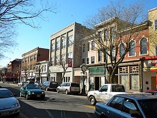
Cumberland County, New Jersey County in the United States

Cumberland County is a county located in the U.S. state of New Jersey. As of the 2017 Census estimate, the county's population was 152,538, making it the state's 16th-largest county, representing a 2.8% decrease from the 156,898 enumerated at the 2010 United States Census, in turn increasing by 10,460 (+7.1%) from the 146,438 counted in the 2000 Census, retaining its position as the state's 16th-most populous county. Its county seat is Bridgeton. Cumberland County is named for Prince William, Duke of Cumberland. The county was formally created from portions of Salem County as of January 19, 1748.

Tributaries

See also

Related Research Articles

Hackensack River river in New Jersey

The Hackensack River is a river, approximately 45 miles (72 km) long, in the U.S. states of New York and New Jersey, emptying into Newark Bay, a back chamber of New York Harbor. The watershed of the river includes part of the suburban area outside New York City just west of the lower Hudson River, which it roughly parallels, separated from it by the New Jersey Palisades. It also flows through and drains the New Jersey Meadowlands. The lower river, which is navigable as far as the city of Hackensack, is heavily industrialized and forms a commercial extension of Newark Bay. Once believed to be among the most polluted water courses in the United States, it staged a modest revival by the late 2000s.

Tuckahoe River (New Jersey) river in the United States of America

The Tuckahoe River is a 27.6-mile-long (44.4 km) blackwater river in southern New Jersey in the United States.

Raccoon Creek is a 22.6-mile-long (36.4 km) tributary of the Delaware River in southern New Jersey in the United States.

Lemon Creek (Staten Island) river in the United States of America

Lemon Creek is a stream located on the South Shore of Staten Island, one of the five boroughs of New York City. It is one of the few remaining ground-level creeks in New York City.

Nantuxent Creek is a 5.5-mile-long (8.9 km) estuary of Delaware Bay in Cumberland County, New Jersey in the United States.

Manantico Creek, spelled Menantico on federal maps, is an 11.1-mile-long (17.9 km) tributary of the Maurice River in Cumberland County, New Jersey in the United States.

The North Branch Raritan River is a tributary of the Raritan River in central New Jersey in the United States.

East Creek is a 4.8-mile-long (7.7 km) tributary of Delaware Bay in Cape May County, New Jersey in the United States.

Dennis Creek is an 8.8-mile-long (14.2 km) tributary of Delaware Bay in Cape May County, New Jersey in the United States.

Sluice Creek is a 5.3-mile-long (8.5 km) tributary of Dennis Creek in Cape May County, New Jersey in the United States.

Clove Brook is a 12.0-mile-long (19.3 km) tributary of Papakating Creek in Sussex County, New Jersey in the United States.

The New Jersey Coastal Heritage Trail Route extends along eastern and southern coast of New Jersey for nearly 300 miles. It travels along the Raritan Bay from Perth Amboy to Sandy Hook, along Jersey Shore at the Atlantic Ocean to Cape May, and along the Delaware Bay to the Delaware Memorial Bridge. The trail encompasses a variety of New Jersey state parks along with facilities under the jurisdiction of the National Park Service.

Green Creek, New Jersey Unincorporated community in New Jersey, United States

Green Creek is an unincorporated community located within Middle Township, in Cape May County, New Jersey, United States. It is located on Route 47. It is a very low-lying area with a highest elevation of just above 20 feet (6.1 m). The community is located about 3 miles (4.8 km) west of Rio Grande and about 2 miles (3.2 km) from the Delaware Bay. It is mostly residential with areas of agriculture and commerce along the main road, Delsea Drive. The United States Postal Service ZIP Code is 08219.

Southern Shore Region

The Southern Shore Region is located in the southeastern part of State of New Jersey in the United States of America. It is one of six tourism regions established by the New Jersey State Department of Tourism, the others being the Gateway Region, Greater Atlantic City, the Delaware River Region, the Shore Region and the Skylands Region. The area includes Cape May County and Cumberland County. The coast is along the Atlantic Ocean and Delaware Bay, while the inland areas are part of the New Jersey Pine Barrens.

Willow Creek Winery winery in New Jersey

Willow Creek Winery is a winery in West Cape May in Cape May County, New Jersey. Formerly a produce farm, the vineyard was first planted in 2005, and opened to the public in 2012. Willow Creek has 40 acres of grapes under cultivation, and produces 6,000 cases of wine per year. The winery is named for a large willow tree near the owner's residence, and the Pond Creek, a stream that borders the farm.

Jessie Creek Winery

Jessie Creek Winery is a winery in the Dias Creek section of Middle Township in Cape May County, New Jersey. The vineyard was first planted in 2002, and opened to the public in 2012. Jessie Creek has 5 acres of grapes under cultivation, and produces 1,200 cases of wine per year. The winery's name is an amalgamation of Jessie, the name of the former owner's mother, and Dias Creek.

Neepaulakating Creek stream in Sussex County, New Jersey

Neepaulakating Creek is a 2.4-mile long (3.8 km) tributary of Papakating Creek in Wantage Township in Sussex County, New Jersey in the United States. It is one of three streams feeding the Papakating Creek, a major contributor to the Wallkill River. Although the stream was dammed in the 1950s to create Lake Neepaulin as the focal point of a private residential development, the stream did not receive a name until 2002. Residents chose a name that combined elements of the names "Neepaulin" and "Papakating", and submitted a proposal to the United States Board of Geographic Names. The name was approved in 2004.

Swartswood Lake

Swartswood Lake is a freshwater lake located in Stillwater and Hampton townships in Sussex County, New Jersey in the United States. The lake is a 520-acre (210 ha) glacial lake that is the third-largest freshwater lake in New Jersey. The lake stretches 3 miles (north-to-south) and 1 mile wide ; and has an average depth of 22 feet (6.7 m) with a maximum depth of 42 feet (13 m). The lake is the focus of Swartswood State Park a 3,460-acre (14.0 km2) protected area administered by the New Jersey Division of Parks and Forestry.

The Cape May Peninsula AVA is an American Viticultural Area located in extreme southern New Jersey. The 126,635 acres (51,000 ha) wine appellation includes most of Cape May county and a small portion of Cumberland county. The region is characterized by well-drained sandy or sandy loam soils of low to moderate fertility, and a relatively long growing season. The climate is strongly moderated by the influence of the Atlantic Ocean and Delaware Bay. The region is in hardiness zones 6b, 7a, and 7b. The AVA is entirely contained within the larger Outer Coastal Plain AVA, but is distinguished from it primarily by a more moderate temperature, providing for a longer growing season.

References

  1. U.S. Geological Survey. National Hydrography Dataset high-resolution flowline data. The National Map, accessed April 1, 2011
  2. Gertler, Edward. Garden State Canoeing, Seneca Press, 2002. ISBN   0-9605908-8-9

Coordinates: 39°14′26″N74°54′12″W / 39.240526°N 74.903251°W / 39.240526; -74.903251

Geographic coordinate system Coordinate system

A geographic coordinate system is a coordinate system that enables every location on Earth to be specified by a set of numbers, letters or symbols. The coordinates are often chosen such that one of the numbers represents a vertical position and two or three of the numbers represent a horizontal position; alternatively, a geographic position may be expressed in a combined three-dimensional Cartesian vector. A common choice of coordinates is latitude, longitude and elevation. To specify a location on a plane requires a map projection.