Orange County is a county located in the Los Angeles metropolitan area in the U.S. state of California. As of the 2010 census, the population was 3,010,232, making it the third-most populous county in California, the sixth most populous in the U.S., and more populous than 21 U.S. states. Although mostly suburban, it is the second most densely populated county in the state, behind San Francisco County. The county's three most populous cities are Anaheim, Santa Ana, and Irvine, each of which has a population exceeding 250,000. Santa Ana is also the county seat. Six cities in Orange County are on the Pacific coast, including Seal Beach, Huntington Beach, Newport Beach, Laguna Beach, Dana Point, and San Clemente.

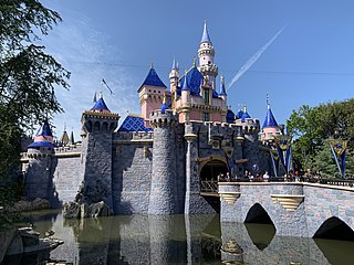
Anaheim is a city in Orange County, California, part of the Los Angeles metropolitan area. As of the 2010 United States Census, the city had a population of 336,265, making it the most populous city in Orange County, the 10th-most populous city in California, and the 55th-most populous city in the United States. Anaheim is the second-largest city in Orange County in terms of land area, and is known for being the home of the Disneyland Resort, the Anaheim Convention Center, and two major sports teams: the Anaheim Ducks ice hockey club and the Los Angeles Angels baseball team.

Mission Viejo is a commuter city located within Orange County, California, United States in the Saddleback Valley. Mission Viejo is considered one of the largest master-planned communities ever built under a single project in the United States and is rivaled only by Highlands Ranch, Colorado in its size. Its population as of 2019 was estimated at 94,381.

Yorba Linda is a suburban city in northeastern Orange County, California, approximately 37 miles (60 km) southeast of Downtown Los Angeles. The suburb's most famous resident was Richard Nixon. His birthplace is a National Historic Landmark, at his presidential library and museum located there. Yorba Linda is part of the Los Angeles metropolitan area according to the US Census. As of the 2010 census, its population was 64,234.

Corona is a city in Riverside County, California, United States. As of the 2010 census, the city had a population of 152,374, up from 124,966 at the 2000 census. The cities of Norco and Riverside lie to the north and northeast, Chino Hills and Yorba Linda to the northwest, and the Cleveland National Forest and the Santa Ana Mountains to the southwest, and unincorporated Riverside County along the rest of the border, respectively. Corona is approximately 48 miles southeast of Los Angeles and 95 miles (153 km) north-northwest of San Diego.

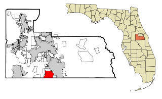
Meadow Woods is a census-designated place and an unincorporated suburban development area located in southern Orange County, Florida, United States, between Orlando International Airport and Kissimmee. The population was 25,558 at the 2010 census, up from 11,286 in 2000. It is part of the Orlando–Kissimmee–Sanford, Florida Metropolitan Statistical Area.

Pine Hills is a census-designated place (CDP) and unincorporated subdivision in Orange County, Florida, United States, west of Orlando. As of the 2010 U.S. Census, Pine Hills had a population of 60,076. It is a part of the Orlando–Kissimmee–Sanford, Florida Metropolitan Statistical Area.

Springfield is a census-designated place (CDP) in Fairfax County, Virginia, United States. The Springfield CDP is recognized by the U.S. Census Bureau with a population of 30,484 as of the 2010 census. Homes and businesses in bordering CDPs including North Springfield, West Springfield, and Newington are usually given a Springfield mailing address. The population of the collective areas with Springfield addresses is estimated to exceed 100,000. The CDP is a part of Northern Virginia, the most populous region of the Washington Metropolitan Area.

Buckhead is the uptown commercial and residential district of the city of Atlanta, Georgia, comprising approximately the northernmost fifth of the city. Buckhead is the third largest business district within the Atlanta city limits, behind Downtown and Midtown, a major commercial and financial center of the Southeast.

State Route 261 is state highway in the U.S. state of California that is part of the Eastern Transportation Corridor toll road system in Orange County. It runs from Walnut Avenue and Jamboree Road in Irvine to State Route 241, another highway of the Eastern Transportation Corridor. SR 261 does not directly connect with Interstate 5 in Irvine, as surface streets must be used to make the connection.

Area code 949 is a California telephone area code that was split from area code 714 on April 18, 1998. It is an area mostly within southern Orange County. It also includes a small adjacent area of northwest San Diego County, specifically parts of Marine Corps Base Camp Pendleton and San Onofre State Park. Costa Mesa is shared between the 949 and 657/714 area codes, being split at Wilson Street and along Newport Boulevard. A very small portion of Irvine is also in the 657/714 area code, from the north side of Culver Drive at the I-5 to Jamboree Road in the Marketplace, in the neighborhood of Northpark Irvine.

The South Coast Metro is a district in Orange County, California within the cities of Santa Ana and Costa Mesa. The area is a dense mix of residential, office, and retail developments that spreads out from the South Coast Plaza mall. It forms part of the South Coast Plaza–John Wayne Airport edge city, a concentration of business, shopping, and entertainment outside a traditional central business district. The edge city's area is defined to include John Wayne Airport, the Irvine Business Complex (IBC), The District and The Market Place shopping centers, and the University of California, Irvine campus. This larger definition extends into Newport Beach, Irvine, and Tustin.
The Market Place is an outdoor shopping center located in Orange County, California that straddles the borders of Tustin and Irvine. Opened in 1988, the center is located along Jamboree Road, just northeast of Interstate 5. Anchor tenants include Best Buy, Barnes & Noble, Dick's Sporting Goods, T.J. Maxx, The Home Depot, Target, and Edwards Theaters. The property is owned and managed by The Irvine Company.
Tustin Ranch is a community located in the city of Tustin, California in Orange County, California. The property is historically part of the Irvine Ranch, and was a land preserve up until the creation of the community. The Irvine Company decided to build the planned community in 1982; it was approved for construction in 1986 by the County of Orange. It was annexed to the city of Tustin in 1986, and formed the 92782 ZIP Code. The Tustin Ranch was formerly a citrus ranch prior to the 1980s before its development. Today, no citrus ranches can be found on the Tustin Ranch plan, but almost all of the community streets are named after components of the former ranch.

Irvine is a master-planned city in Orange County, California, United States in the Los Angeles metropolitan area. The Irvine Company started developing the area in the 1960s and the city was formally incorporated on December 28, 1971. The 66-square-mile (170 km2) city had a population of 212,375 as of the 2010 census; in 2019, the California Department of Finance estimated the city's population at 287,401, making it the 72nd-most populous city in the United States.

Lewis Center is an unincorporated community in northwestern Orange Township, Delaware County, Ohio, United States, in the Columbus, OH Metropolitan Statistical Area.

Jamboree Road is a 15.8-mile (25.4 km) long major arterial road through Orange County, California, running through the cities of Newport Beach, Irvine, Tustin, and Orange.
The community of Forest Park consists of almost 2900 private residential properties, plus apartments, condominiums, commercial properties, city-owned parks and schools, in approximately 1.4 square miles (3.6 km2) of the Northland area of northeast Columbus, Ohio. These properties adjoin a total of 132 distinct streets and courts maintained by the City of Columbus. The community's approximate center is near the intersection of Karl Road and Sandalwood Place in Columbus.

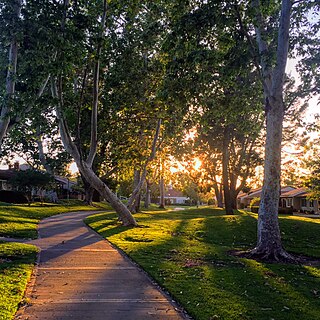
University Park is a master-planned neighborhood in Irvine, California. It is bounded by University Drive to the south, Culver Drive to the west, and the San Diego (I-405) Freeway to the north. Commercially advertised as Irvine's first "village", the neighborhood was named University Park due to its proximity to the University of California, Irvine. University Park celebrated its 50th anniversary in July 2016.

Mesa Verde is a neighborhood in Costa Mesa, California. It is bounded by Gisler Avenue to the north, Harbor Boulevard to the east, Victoria Street to the south, and the Santa Ana River to the west. The community is bisected by Adams Avenue and contains the Fairview Channel, a Santa Ana River tributary that connects to Fairview Park, a wetland and riparian natural area. The neighborhood is home to two golf course complexes–the Costa Mesa Golf Course and the Mesa Verde Country Club.


