
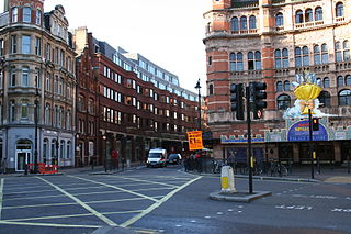
Charing Cross Road is a street in central London running immediately north of St Martin-in-the-Fields to St Giles Circus, which then merges into Tottenham Court Road. It leads from the north in the direction of Charing Cross at the south side of Trafalgar Square. It connects via St Martin's Place and the motorised east side of the square.

The London Borough of Islington is a London borough which forms part of Inner London, England. Islington has an estimated population of 215,667. It was formed in 1965, under the London Government Act 1963, by the amalgamation of the metropolitan boroughs of Islington and Finsbury.
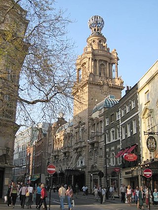
Cambridge Circus is the partly pedestrianised intersection where Shaftesbury Avenue crosses Charing Cross Road on the eastern edge of Soho, central London. Side-streets Earlham, West, Romilly and Moor streets also converge at this point. It is halfway between Tottenham Court Road station, Oxford Street and the centre of Leicester Square, which is southwest of Charing Cross Road via Cranborne Street.
Aldersgate is a Ward of the City of London, England, named after one of the northern gates in the London Wall which once enclosed the City.

The Ambassadors Theatre, is a West End theatre located in West Street, near Cambridge Circus on Charing Cross Road in the City of Westminster. It is one of the smallest of the West End theatres, seating a maximum of 444, with 195 people in the dress circle and 251 in the stalls.

Llantwit Major is a town and community in Wales on the Bristol Channel coast. It is one of four towns in the Vale of Glamorgan, with the third largest population after Barry and Penarth, and ahead of Cowbridge. It is 4+1⁄2 miles (7.2 km) from Cowbridge, 9 miles (14 km) from Bridgend, 10 miles (16 km) from Barry, and 15 miles (24 km) from Cardiff. It had a population of 9,530 in 2021.
St Martin's Lane is a street in the City of Westminster, which runs from the church of St Martin-in-the-Fields, after which it is named, near Trafalgar Square northwards to Long Acre. At its northern end, it becomes Monmouth Street. St Martin's Lane and Monmouth Street together form the B404.

The Savoy was a manor and liberty located between the Liberty of Westminster, on two sides, the Inner and Middle Temple part of City of London and the River Thames. It was in the county of Middlesex. Named for the Savoy Palace, it came to be held by the Duchy of Lancaster, and was also known as the Liberty of the Duchy of Lancaster. The duchy continues to have land holdings within the area. The manor, enjoying the status of a liberty, comprised the precinct of the Savoy, the southern half and detached south-west of the parish of St Clement Danes and about three quarters of St Mary le Strand as it only, in a tiny part, extended north of Strand whereas those parishes straddled this ancient road.
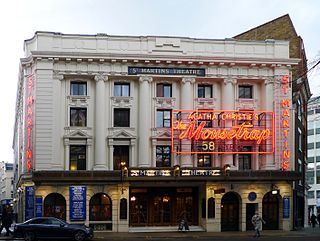
St Martin's Theatre is a West End theatre which has staged the production of The Mousetrap since March 1974, making it the longest continuous run of any show in the world.
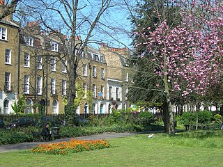
Clapton Square is the second largest garden square in the London Borough of Hackney, located in Lower Clapton, Clapton. It is lined by buildings on three sides. Its Conservation Area designated in 1969 – extended in 1991 and 2000 – takes in a larger green space separated by a stretch of open road: St John's Gardens. Those gardens have the tallest and largest building visible from all parts of the square's garden, the Church of St John-at-Hackney, rebuilt in 1792-97 which contains older monuments. Two sides of the square are lined with tall, partly stone-dressed, classical, Georgian terraced houses.

St. Martin's Le Grand is a former liberty within the City of London, and is the name of a street north of Newgate Street and Cheapside and south of Aldersgate Street. It forms the southernmost section of the A1 road. For many years St. Martin's Le Grand was "often used as a synonym for the chief postal authorities, as Scotland Yard is used to designate the police", the headquarters of the General Post Office having been there from 1829-1984.

Wellclose Square is a public square in the London Borough of Tower Hamlets, between Cable Street to the north and The Highway to the south.

Woodham is a suburban village in Surrey next to New Haw and contiguous with two suburbs of Woking: Sheerwater and West Byfleet.

Drypool is an area within the city of Kingston upon Hull, in the ceremonial county of the East Riding of Yorkshire, England.

Saint Augustine's, Kilburn, is a Church of England church in the area of Kilburn, in North London, England. Because of its large size and ornate architecture, it is sometimes affectionately referred to as "the Cathedral of North London", although the church is not a cathedral in any official sense.

South Audley Street is a major shopping street in Mayfair, London. It runs north to south from the southwest corner of Grosvenor Square to Curzon Street.

Sardinia Street, formerly Duke Street was the northern continuation of Kemble Street. It ended, like its successor, on the west side (carriageway) of Lincoln's Inn Fields in the north, but further north. It was joined on its western side by King's Head Yard (demolished) and Wild Street, and opposite by Vere Street (demolished). On the eastern side at the northern end was a Roman Catholic chapel and chapel yard.

The Bull and Mouth Inn was a coaching inn in the City of London that dated from before the Great Fire of London in 1666. It was located between Bull and Mouth Street in the north and Angel Street in the south. It was once an important arrival and departure point for coaches from all over Britain, but particularly for the north of England and Scotland. It became the Queen's Hotel in 1830 but was demolished in 1887 or 1888 when new post office buildings were built in St Martin's Le Grand.

Bull and Mouth Street was a street in the City of London that ran between Edward Street and St Martin's Le Grand. On part of its site stands Postman's Park.

