
The Capital Beltway is a 64-mile (103 km) auxiliary Interstate Highway in the Washington metropolitan area that surrounds Washington, D.C., the capital of the United States, and its inner suburbs in adjacent Maryland and Virginia. It is the basis of the phrase "inside the Beltway", used when referring to issues dealing with US federal government and politics. The highway is signed as Interstate 495 (I-495) for its entire length, and its southern and eastern half runs concurrently with I-95.

West Virginia Route 127 is an east–west state highway located in northeast West Virginia. The western terminus is at West Virginia Route 29 near Forks of Cacapon in Hampshire County. The eastern terminus is at the Virginia state line west of U.S. Route 522 and east of Good, where WV 127 continues eastward as State Route 127.

West Virginia Route 901 is an east–west state highway in West Virginia's Eastern Panhandle. The route, located entirely in Berkeley County, serves as a connector route between West Virginia Route 9 and U.S. Route 11. The western terminus of WV 901 is at WV 9 in Hedgesville. The eastern terminus is at US 11 south of Falling Waters.

West Virginia Route 23 is a north–south state highway in the northern portion of the U.S. state of West Virginia. The northern terminus of the route is at West Virginia Route 18 in Tyler, Tyler County. The southern terminus is at old U.S. Route 50 in Salem, Harrison County.

West Virginia Route 27 is an east–west state highway located within the Northern Panhandle county of Brooke in West Virginia. The western terminus of the route is at West Virginia Route 2 in Wellsburg. The eastern terminus is at the Pennsylvania state line five miles (8 km) east of Wellsburg, where WV 27 continues east into the border town of Independence as Pennsylvania Route 844.

West Virginia Route 58 is an east–west state highway in Harrison County, West Virginia. The western terminus of the route is at West Virginia Route 20 outside Stonewood. The eastern terminus is at U.S. Route 50 in Bridgeport.

West Virginia Route 75 is an east–west state route located within Wayne County, West Virginia. The western terminus of the route is at U.S. Route 60 in Kenova. From US 60, WV 75 proceeds to the south then east towards its eastern terminus at West Virginia Route 152 north of Lavalette.

West Virginia Route 83 is an east–west state highway located within McDowell County, West Virginia. The western terminus is at the Virginia state line six miles west of Jolo, where WV 83 continues west as Virginia State Route 83. The eastern terminus is at West Virginia Route 16 in War.

West Virginia Route 98 is an east–west state highway located in the Clarksburg, West Virginia area. The western terminus of the route is at U.S. Route 50 west of Clarksburg. The eastern terminus is at West Virginia Route 20 in Nutter Fort, immediately south of Clarksburg.

West Virginia Route 331 is an east–west state highway located entirely in Jackson County, West Virginia. The western terminus of the route is at West Virginia Route 2 and West Virginia Route 62 in Mount Alto. The eastern terminus is at WV 62 near Cottageville.

West Virginia Route 161 is a north–south state highway located entirely within McDowell County, West Virginia. The southern terminus of the route is at West Virginia Route 16 in Bishop less than 900 feet (270 m) from the Virginia state line. The northern terminus is at U.S. Route 52 in Elkhorn.

West Virginia Route 131 is a north–south state highway located in northern West Virginia. The northern terminus is at U.S. Route 19 in Shinnston. The southern terminus is at U.S. Route 50 in Bridgeport.

West Virginia Route 105 is an east–west state highway located within Weirton, West Virginia, United States. The western terminus of the route is at West Virginia Route 2 north of downtown Weirton. The eastern terminus is at U.S. Route 22 in Weirton Heights, just 1/2 mile west of the Pennsylvania state line.

West Virginia Route 103 is an east-west state highway located in McDowell County, West Virginia. The eastern terminus of the route is at West Virginia Route 161 southwest of Pageton. The western terminus is at U.S. Route 52 and West Virginia Route 16 in southern Welch.
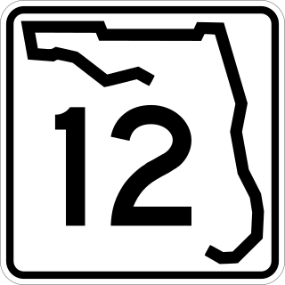
State Road 12 (SR 12) is an east–west route in the Florida Panhandle, running from SR 20 in Bristol to U.S. Route 27 (US 27) in Havana.
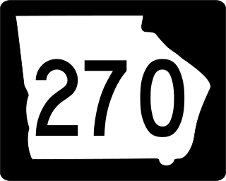
State Route 270 (SR 270) is a 12.7-mile-long (20.4 km) east–west state highway located in the southern part of the U.S. state of Georgia. Its route is within Mitchell and Colquitt counties.

A total of eight special routes of U.S. Route 65 exist, divided between the U.S. states of Arkansas and Missouri. Currently, they are all business loops, although a spur route in Pine Bluff, Arkansas and bypass routes in Baton Rouge, Louisiana and Springfield, Missouri both existed in the past.

West Virginia Route 279 is an east-west highway within the state of West Virginia. Its western terminus is at County Route 707, which leads to WV 131. Its eastern terminus is an interchange with US 50.

