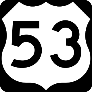
U.S. Route 53, or U.S. Highway 53 (U.S. 53), is a north–south U.S. highway that runs for 404 miles (650 km) from La Crosse, Wisconsin to International Falls, Minnesota. It is the primary north–south route in northwestern Wisconsin, serving as a vital link between I-94 at Eau Claire, Wisconsin and the Twin Ports of Superior, Wisconsin, and Duluth, Minnesota. The entire route from Eau Claire to the city limits of Superior is a four lane divided highway. The highway's northern terminus is at the Fort Frances–International Falls International Bridge in International Falls, Minnesota, at the Canada–US border. Its southern terminus is in La Crosse, Wisconsin, at U.S. Highway 14.

U.S. Route 117 (US 117) is a north–south United States Highway located completely within the state of North Carolina. A spur route of US 17, the highway runs for 114 miles (183 km) from the Port of Wilmington, south of downtown Wilmington, to US 301 near Wilson. From its southern terminus, US 117 runs along Shipyard Boulevard and College Road, concurrent with North Carolina Highway 132 (NC 132) through Wilmington. US 117 intersects the eastern terminus of Interstate 40 (I-40) and parallels the interstate until reaching Faison, passing through Burgaw, Wallace, and Warsaw. The highway diverges from I-40 in Faison, running north-northeast through Mount Olive, Goldsboro, and Pikeville to its northern terminus. US 117 meets the southern end of I-795 in Goldsboro, and parallels that route before reaching its northern terminus at US 301 south of Wilson.

U.S. Route 258 is a spur of US 58 in the U.S. states of North Carolina and Virginia. The U.S. Highway runs 220.15 miles (354.30 km) from US 17 Business and NC 24 Business in Jacksonville, North Carolina north to Virginia State Route 143 at Fort Monroe in Hampton, Virginia. In North Carolina, US 258 connects Jacksonville with the Inner Banks communities of Kinston, Snow Hill, Farmville, Tarboro, and Murfreesboro. The U.S. Highway continues through the Virginia city of Franklin, where the highway intersects US 58, and the town of Smithfield on its way to the Hampton Roads metropolitan area. US 258 crosses the James River on the James River Bridge and follows Mercury Boulevard through Newport News and Hampton.

Interstate 295 (I-295) is a highway which runs eastward and northward bypass of the cities of Richmond and Petersburg in the US state of Virginia. The southern terminus is an interchange with I-95 southeast of Petersburg. I-295 then has an interchange with I-64 east of Richmond, crosses I-95 north of Richmond, and continues westward to its other terminus at a second interchange with I-64.

West Virginia Route 46 is an east–west state highway split into two segments in Mineral County, West Virginia, United States. The western terminus of the western segment is at West Virginia Route 42 in Elk Garden. The eastern terminus is at the Maryland state line north of Beryl, where WV 46 crosses the Potomac River and intersects Maryland Route 135 on the north bank.

West Virginia Route 28 is a north–south route through the Potomac Highlands of the U.S. state of West Virginia. The southern terminus of the route is at West Virginia Route 39 in Huntersville. The northern terminus is at the Maryland state line in Wiley Ford, where the route continues into Cumberland as Canal Parkway upon crossing the North Branch Potomac River.

West Virginia Route 55 is an east–west state highway in West Virginia. The western terminus of the route is at U.S. Route 19 in Muddlety. The eastern terminus is at the Virginia state line six miles (10 km) east of Wardensville, where WV 55 continues as Virginia State Route 55. From Moorefield to the Virginia state line, WV 55 is concurrent with U.S. Route 48. This portion includes the Clifford Hollow Bridge.

West Virginia Route 16 is a north–south route located in the U.S. State of West Virginia. The southern terminus of the route is at the Virginia state line in Bishop, McDowell County, where the route continues south as Virginia State Route 16. The northern terminus is at West Virginia Route 2 in St. Marys, Pleasants County, on the south bank of the Ohio River. WV 16 continues as a same-numbered route into Virginia and North Carolina, ultimately ending in Waxhaw, south of Charlotte and just north of the South Carolina border. The total length of highway is just under 475 miles long.

West Virginia Route 20 is a major north–south state highway in the U.S. state of West Virginia. The southern terminus of the route is at U.S. Route 52 in Bluewell, a small unincorporated suburb of Bluefield. The northern terminus is at West Virginia Route 7 three miles (5 km) east of New Martinsville. WV Route 20 is the longest state route in West Virginia.
West Virginia Route 27 is an east–west state highway located within the Northern Panhandle county of Brooke in West Virginia. The western terminus of the route is at West Virginia Route 2 in Wellsburg. The eastern terminus is at the Pennsylvania state line five miles (8 km) east of Wellsburg, where WV 27 continues east into the border town of Independence as Pennsylvania Route 844.

West Virginia Route 39 is an east–west state highway in West Virginia. The western terminus of the route is at U.S. Route 60 and West Virginia Route 16 in Gauley Bridge. The eastern terminus is at the Virginia state line four miles (6.4 km) east of Minnehaha Springs, where WV 39 continues east into Virginia as State Route 39.

West Virginia Route 62 is a north–south state highway in western West Virginia. The southern terminus of the route is at West Virginia Route 25 in Dunbar. The northern terminus is at Interstate 77 and U.S. Route 33 in Ripley.

Virginia State Route 311 and West Virginia Route 311 are adjoining state highways in the U.S. states of Virginia and West Virginia. The two state highways together run 58.7 miles (94.5 km) from U.S. Route 11 in Salem, Virginia north to Interstate 64 and U.S. Route 60 near White Sulphur Springs, West Virginia. The two Virginia portions of Route 311 are maintained by the Virginia Department of Transportation, with the exception of the city-maintained portion within Salem. The West Virginia segments are maintained by the West Virginia Division of Highways.

State Route 20 is a primary state highway in the U.S. state of Virginia. The state highway runs 89.79 miles (144.50 km) from U.S. Route 15 in Dillwyn north to SR 3 in Wilderness. SR 20 is a C-shaped route that connects Charlottesville with Farmville in Southside Virginia. The state highway also links Charlottesville to Fredericksburg by way of Orange County, within which SR 20 is the main east–west highway and intersects US 15 again in the county seat of Orange.
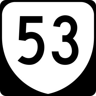
State Route 53 is a primary state highway in the U.S. state of Virginia. Known as Thomas Jefferson Parkway, the state highway runs 18.32 miles (29.48 km) from SR 20 near Charlottesville east to U.S. Route 15 in Palmyra. SR 53 connects the county seats of Albemarle and Fluvanna counties. The state highway also provides access to the community of Lake Monticello and Monticello, the estate of Thomas Jefferson. The route of SR 53 became a state highway in 1930; the highway receives its present designation in 1947.

State Route 100 is a primary state highway in the U.S. state of Virginia. The state highway runs 53.31 miles (85.79 km) from U.S. Route 221 in Hillsville north to SR 61 in Narrows. SR 100 is one of the major highways of the New River Valley, connecting Narrows and Pearisburg in Giles County with Dublin, Pulaski, and Interstate 81 (I-81) in Pulaski County.

State Route 155 is a primary state highway in the U.S. state of Virginia. Known as Courthouse Road, the state highway runs 13.53 miles (21.77 km) from SR 5 in Charles City north to SR 249 at Carps Corner. SR 155 connects Charles City and New Kent, the county seats of Charles City County and New Kent County, respectively, with each other and with U.S. Route 60 and Interstate 64 (I-64).

State Route 354 is a primary state highway in the U.S. state of Virginia. Known as River Road, the state highway runs 13.53 miles (21.77 km) from a dead end near Bertrand north to SR 3 near Litwalton in western Lancaster County.

