
The Westbourne or Kilburn, also known as the Ranelagh Sewer, is a culverted small River Thames tributary in London, rising in Hampstead and Brondesbury Park and which as a drain unites and flows southward through Kilburn and Bayswater to skirt underneath the east of Hyde Park's Serpentine lake then through central Chelsea under Sloane Square. It passes centrally under the south side of Royal Hospital Chelsea's Ranelagh Gardens before discharging into Inner London's old-fashioned, but grandiose combined sewer system, with exceptional discharges into the Inner London Tideway. Since the latter 19th century, the population of its catchment has risen further but to reduce the toll it places on the Beckton Sewage Treatment Works and related bills its narrow basin has been assisted by private soakaways, and public surface water drains. Its depression has been replaced with and adopted as a reliable route for a gravity combined sewer. The formation of the Serpentine relied on the water, a lake with a long, ornate footbridge and various activities associated, which today uses little-polluted water from a great depth.

Richmond Green is a recreation area near the centre of Richmond, a town of about 20,000 inhabitants situated in south-west London. Owned by the Crown Estate, it is leased to the London Borough of Richmond upon Thames. The Green, which has been described as "one of the most beautiful urban greens surviving anywhere in England", is roughly square in shape and its open grassland, framed with broadleaf trees, extends to roughly twelve acres. On the north-east side there is also a smaller open space called Little Green. Richmond Green and Little Green are overlooked by a mixture of period townhouses, historic buildings and municipal and commercial establishments including the Richmond Lending Library and Richmond Theatre.

Dodington Park is a country house and estate in Dodington, South Gloucestershire, England. The house was built by James Wyatt for Christopher Bethell Codrington. The family had made their fortune from sugar plantations in the Caribbean and were significant owners of slaves. It remained in the Codrington family until 1980; it is now owned by the British businessman James Dyson.

Leinster Gardens is a street in Bayswater, London. It is lined with tall, ornate, mid-Victorian terraced houses, many of which are listed buildings.

Hyde Park Gardens, also known as Hyde Park Terrace consists of two roads running adjacent to the north western corner of Hyde Park, Westminster, Greater London. Number 1 Hyde Park Gardens runs up to Number 23 with a large private communal garden and then the road separates to allow access to The Ring and into Hyde Park and the neighbouring Kensington Gardens. This section contains the High Commission of Sri Lanka. Numbers 24 to 31 continue on a private gated road also with their own communal gardens buffering them from the busy Bayswater Road. They are amongst the most exclusive properties on the northern side of Hyde Park and date from the early 19th century. Grand white stucco fronted houses now converted into equally grand flats. Access is strictly controlled via 24-hour porterage.

All Saints' Church is the ancient parish church of Fulham, in the County of Middlesex, pre-dating the Reformation. The parish was founded in the precinct of Fulham Manor, currently adjacent to it, which was in the possession of the Bishops of London, since the 8th century. Hence it began as the parish church of the bishops of London and several of them are buried there. It is now an Anglican church in Fulham, London, sited close to the River Thames, beside the northern approach to Putney Bridge. The church tower and interior nave and chancel are Grade II* listed.

Caledonian Road in the London Borough of Islington, England, connects North London, from Camden Road near its junction with Holloway Road, and central London's Pentonville Road in the south. A mile and a half long, it is known colloquially as the Cally and forms the entirety of the A5203.

Park Square is a large garden square or private appendix to Regent's Park in London and is split from a further green, the long northern side of Park Crescent, by Marylebone Road and (single-entrance) Regent's Park tube station. It consists of two facing rows of large, very classically formed, stuccoed, terraced houses with decorative lower floor balconies and a colonnade of consecutive porticos by architect John Nash, and was built in 1823–24. Alike, shorter-length terraces flank its corners at right angles, equally Grade I listed buildings: Ulster Terrace, Ulster Place, St Andrew's Place and Albany Terrace.

The Avenues is an area of high status Victorian housing located in the north-west of Kingston upon Hull, England. It is formed by four main tree-lined straight avenues running west off the north-north-east/south-south-west running Princes Avenue.

Porchester Square is an archetypal-format, narrow London garden square in Bayswater on the cusp of inter-related Westbourne. It is lined with tall white Victorian classical architecture residential buildings.
The Marquis of Clanricarde is a Grade II listed public house at 36 Southwick Street, Paddington, London, W2.

Leinster Square and Prince's Square are mirroring garden squares in Bayswater on the cusp of Westbourne and Notting Hill. One street overlaps the two squares. It is within the large additions of 1965 to the City of Westminster, London, W2.

The Terrace is a street in Barnes in the London Borough of Richmond upon Thames. It forms part of the A3003, and runs west from its junction with Barnes High Street and Lonsdale Road to the east, where it becomes Mortlake High Street. Only one side of the street has houses; they all overlook the River Thames.

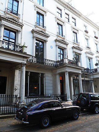
Hyde Park Square is a residential, tree-planted, garden square one block north of Hyde Park fronted by classical buildings, many of which are listed and marks a crossover of Lancaster Gate and Connaught Village neighbourhoods of Bayswater, London. It measures (internally) 200 by 500 feet, of which the bulk is the private communal garden – the rest is street-lit, pavemented streets with low railings in front of the houses. Connaught Street runs eastwards from the square towards the Edgware Road.

Chepstow Place is a street in London that runs from the junction of Westbourne Grove and Pembridge Villas in the north to Pembridge Square in the south. It is crossed by Dawson Place and joined on its eastern side by Rede Place. The east side is in the City of Westminster and the west side in the Royal Borough of Kensington and Chelsea.
Westbourne Terrace is a street in the Paddington district of the City of Westminster in west London. The street runs between Westbourne Bridge in the north and the junction of Westbourne Crescent and Sussex Gardens in the south and was developed between 1839 and the late 1850s. It has been described as the "most spacious and dignified avenue" in Bayswater and "unrivalled in its class in London or even Great Britain". The street is not to be confused with Westbourne Terrace Road which runs north from Westbourne Bridge into Little Venice, and a large number of other Westbourne streets in the area.
Robert Palmer Browne was a British architect who was closely associated with the General Steam Navigation Company in the mid-nineteenth century but who also designed residential, church and public buildings, some of which are now listed by Historic England.

Westbourne Bridge is a grade II listed road bridge in the City of Westminster, London. It was built some time after 1909 for the Great Western Railway.

Orsett Terrace, originally known as Orsett Place, is a street in the Westbourne district of the City of Westminster, in London. It runs roughly east–west between Porchester Terrace in the west and the junction of Westbourne Bridge and Westbourne Terrace in the east. It is crossed midway by Gloucester Terrace.

Albion Street is a residential street located in Central London in the City of Westminster. Part of the Tyburnia area, it runs southwards from Connaught Street to the Bayswater Road on the edge of Hyde Park. It is notable for its Regency architecture.

