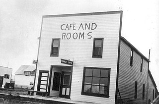
Grande Prairie is a city in northwest Alberta, Canada within the southern portion of an area known as Peace River Country. It is located at the intersection of Highway 43 and Highway 40, approximately 456 km (283 mi) northwest of Edmonton. The city is surrounded by the County of Grande Prairie No. 1.

Grande Cache is a hamlet within and administered by the Municipal District of Greenview No. 16 in west-central Alberta, Canada. It is located on Highway 40 approximately 145 kilometres (90 mi) northwest of Hinton and 435 kilometres (270 mi) west of Edmonton. Grande Cache overlooks the Smoky River, is at the northern edge of Alberta's Rockies, and serves as the gateway to the Willmore Wilderness Park. The hamlet held town status prior to 2019.

Wembley is a town in northern Alberta, Canada. It is located approximately 23 km (14 mi) west of Grande Prairie at the junction of Highway 43 and Highway 724. A resident of Wembley is known as a "Wemblian", or "Wembleyite".

Hythe is a village surrounded by the County of Grande Prairie No. 1 in northwestern Alberta, Canada. It is located on Highway 43 approximately 58 km (36 mi) northwest of the City of Grande Prairie and 73 km (45 mi) southeast of the City of Dawson Creek, British Columbia.

Bezanson is a hamlet in northern Alberta, Canada within the County of Grande Prairie No. 1. It is located approximately 30 kilometres (19 mi) east of Grande Prairie on Highway 43, west of the Smoky River.

Valhalla Centre is a hamlet in northern Alberta, Canada within the County of Grande Prairie No. 1.

La Glace is a hamlet in northern Alberta, Canada within the County of Grande Prairie No. 1. It is located along Highway 59 between Sexsmith and Valhalla Centre and has an elevation of 735 metres (2,411 ft).

Canyon Creek is a hamlet in northern Alberta, Canada within the Municipal District of Lesser Slave River No. 124. It is located on Highway 2, approximately 234 kilometres (145 mi) east of Grande Prairie.

Eaglesham is a hamlet in northern Alberta, Canada within Birch Hills County, located 6 kilometres (3.7 mi) north of Highway 49, approximately 89 kilometres (55 mi) northeast of Grande Prairie.

Enilda is a hamlet in northern Alberta within Big Lakes County, located 10 kilometres (6.2 mi) west of Highway 49, approximately97 kilometres (60 mi) northeast of Grande Prairie.

Joussard is a hamlet in northern Alberta within Big Lakes County, located 2 kilometres (1.2 mi) north of Highway 2, approximately 182 kilometres (113 mi) east of Grande Prairie.

Springbrook is a hamlet in central Alberta, Canada within Red Deer County. It is located 1 kilometre (0.62 mi) west of Highway 2A, approximately 11 kilometres (6.8 mi) southwest of Red Deer. Springbrook is also recognized by Statistics Canada as a designated place.

Wedgewood is a hamlet in northern Alberta, Canada within the County of Grande Prairie No. 1.

Whitelaw is a hamlet in northern Alberta, Canada within the Municipal District of Fairview No. 136. It is located 2 kilometres (1.2 mi) north of Highway 2, approximately 114 kilometres (71 mi) northeast of Grande Prairie.

Gift Lake Metis Settlement is a Metis settlement in northern Alberta, Canada within Big Lakes County. It is located along Highway 750, approximately 203 km (126 mi) northeast of Grande Prairie.

East Prairie Metis Settlement is a Metis settlement in northern Alberta, Canada within Big Lakes County. It is located approximately 20 km (12 mi) south of Highway 2 and 168 km (104 mi) east of Grande Prairie. It was founded in 1939.

Flyingshot Lake, or Flyingshot Lake Settlement, is an unincorporated community in Alberta, Canada within the County of Grande Prairie No. 1 that is recognized as a designated place by Statistics Canada. It is located approximately 2.4 km (1.5 mi) west of Highway 40, and 3.2 km (2.0 mi) south of Highway 43. It surrounds a lake of the same name, and is adjacent to the City of Grande Prairie to the northeast.

Riverview Pines Subdivision is an unincorporated community in Alberta, Canada within the County of Grande Prairie No. 1 that is recognized as a designated place by Statistics Canada. It is located on the east side of Range Road 72, 9 km (5.6 mi) south of Highway 43.

Westlake Estates is an unincorporated community in Alberta, Canada within Parkland County that is recognized as a designated place by Statistics Canada. It is located on the west side of Range Road 13, 0.7 km (0.43 mi) south of Highway 16A.


