
Ben Nevis is the highest mountain in the British Isles. Standing at 1,345 metres (4,411 ft) above sea level, it is at the western end of the Grampian Mountains in the Lochaber area of the Scottish Highlands, close to the town of Fort William.
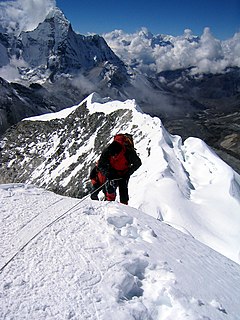
Mountaineering is the set of activities that involves ascending mountains. Mountaineering-related activities include traditional outdoor climbing, skiing, and traversing via ferratas. Indoor climbing, sport climbing and bouldering are also considered mountaineering by some.
The Ester Mountains are a small mountain range in Bavaria. They are classified either as part of Bavarian Prealps or the larger chain of Northern Limestone Alps. The range stretches for about 15 kilometres. From the west it is bordered by the valley of the river Loisach and from the east by Walchensee lake and the valley of the river Isar. With its highest peak being Krottenkopf, the highest part of the range just exceeds 2,000 m. The range is of composed of limestone. The treeline is around 1,700 m.
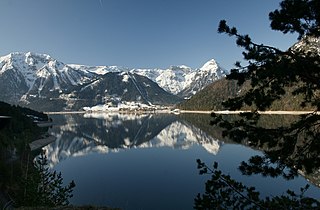
Pertisau is a small village on the Achensee Lake in the Tyrol region of Austria.
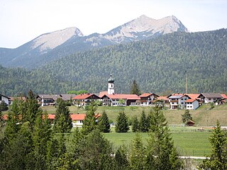
Krün is a municipality in the Upper Bavarian district of Garmisch-Partenkirchen. It belongs with Garmisch-Partenkirchen as district capital and cultural center as well as other municipalities to the region Werdenfelser Land. A few kilometers south runs the German-Austrian border.
Lieutenant-Colonel Edward Lisle Strutt, CBE, DSO was a British soldier and mountaineer, and President of the Alpine Club from 1935–38. After a distinguished military career he defended classical mountaineering against what he saw as unhelpful trends in the sport for speed.
Dammkarwurm is the name of an annually discharged German ski mountaineering competition, carried out by the German Alpine Club or DAV, for the first time in the end of the 1990s. The ranking of the Dammkarwurm is part of the German Skimountaineering Cup.

A summit cross is a cross on the summit of a mountain or hill that marks the top. Often there will be a summit register (Gipfelbuch) at the cross, either in a container or at least a weatherproof case.

The Mittenwald Railway, popularly known as the Karwendelbahn, is a railway line in the Alps in Austria and Germany. It connects Innsbruck via Seefeld and Mittenwald to Garmisch-Partenkirchen.
The International Ski Mountaineering Federation (ISMF) emerged from the International Council for Ski Mountaineering Competitions (ISMC) in 2008, is responsible for international competition ski mountaineering.
Plattenspitze or Plattenspitz may refer to the following mountains in central Europe:

The Karwendel is an international named express train service between Germany and Austria. The train was named after the Karwendel mountain range forming the German-Austrian border south of Garmisch-Partenkirchen, which it passes on the Mittenwald Railway (Karwendelbahn). Introduced in 1930, it is currently labelled as an Intercity-Express train connection operated by Deutsche Bahn AG.
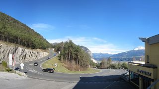
Seefelder Straße (B 177) is a 21.2 km long former federal road or Bundesstraße - now classified as a "priority road" or Straße mit Vorrang - in the Alps in the Austrian federal state of Tyrol. It links the Inn valley with Scharnitz and the Scharnitz Pass on the border with Germany, running past the Zirler Berg, over the Seefeld Saddle and past Seefeld. It is part of the E533 European route.

The Nördlinger Hut is an Alpine Club hut belonging to the German Alpine Club that is situated at a height of 2,239 m (AA) south of the summit of the Reither Spitze in the Austrian state of Tyrol. It is thus the highest refuge hut in the entire Karwendel range. It is located in the westernmost part of the Karwendel Alps, the Erlspitze Group, above the village and ski resort of Seefeld. From the hut there are expansive views over the Stubai Alps, the Inn valley and the Wetterstein Mountains.

The Seefeld Plateau is a montane valley and basin landscape in the North Tyrolean Limestone Alps about 500 metres above the Inn valley in the Austrian state of Tyrol. The plateau covers the valley basin around the villages of Seefeld in Tirol and Scharnitz as well as the valley of Leutaschtal.
Ernst Wilfer was a German engineer and inventor specializing in construction who made a name in site management and the operation of cable cars and chairlifts.

The Schaufelspitze is a mountain, 2,306 m (AA) in the Sonnjoch Group in the eastern Karwendel between Sonnjoch and the Bettlerkarspitze.

The Northern Karwendel Chain is the northernmost of the four great, largely parallel mountain chains in the Karwendel in the Alps. It is made from very pure Wetterstein limestone, which has its heart in the Karwendel and runs for a total length of c. 18 kilometres from Scharnitz in the northeast via Mittenwald to the Wörner, where it turns sharply east, until it finally ends west of the Johannestal valley. It has 25 main summits with an average height of 2,400 m. The highest peak is the Eastern Karwendelspitze. The boundary between Germany and Austria runs along the crest from the Brunnensteinspitze in the west to the Eastern Karwendelspitze in the east. The northwestern side is Bavarian, the southeastern flank is Tyrolean. The Northern Karwendel Chain should not be confused with the southernmost chain of the Karwendel, the Inn Valley Chain, which is known colloquially as the Nordkette or "North Chain" due to its location north of the city of Innsbruck.

The Nordkette Cable Car in the Austrian state of Tyrol is a gondola lift from Innsbruck to the Nordkette, the southernmost mountain chain of the Karwendel.


