Adelaide Metro is the public transport system of Adelaide, the capital city of South Australia. It is an intermodal system offering an integrated network of bus, tram, and train service throughout the metropolitan area to 63 million riders annually, with an average daily ridership of 173,000 people. The system has evolved heavily over the past fifteen years, and patronage increased dramatically during the 2014–15 period, a 5.5 percent increase on the 2013 figures due to electrification of frequented lines.

The Minuteman Bikeway is a 10-mile (16-kilometre) paved multi-use rail trail located in the Greater Boston area of Massachusetts. It runs from Bedford to Alewife station, at the northern end of the Red Line in Cambridge, passing through the towns of Lexington and Arlington along the way. Also along the route are several notable regional sites, including Alewife Brook Reservation, Spy Pond, "Arlington’s Great Meadows", the Battle Green in Lexington, and Hanscom Air Force Base.

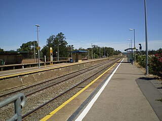
The Glenelg Tram is a light rail line in Adelaide. Apart from a short street-running section in Glenelg, the line has its own reservation, with minimal interference from road traffic.

Marion is a suburb in the City of Marion, around 10 kilometres (6.2 mi) south-west of the city centre of Adelaide, the capital of South Australia. Founded as a rural village in 1838 on the banks of the Sturt River, Marion was found to have rich soil and the population expanded rapidly. Colonel William Light laid out the plan for the village, as he had done with the City of Adelaide itself.
Glengowrie is a suburb of the Australian city of Adelaide, approximately 12 kilometres south west of the city centre. The name Glengowrie means "Glen of Gowrie", so called in honour of Lord Gowrie, Governor-General of Australia from 1936-1944.
Marino is a suburb in the south of Adelaide, South Australia. It sits on coastal hills overlooking Gulf St Vincent, within the City of Marion local government area. It neighbours Seacliff, Hallett Cove and Kingston Park.

Wayville is an inner-southern suburb of Adelaide in the City of Unley. It is most notable for hosting of the Royal Adelaide Show at the Adelaide Showgrounds.

The Patrick Jonker Veloway is a sealed bikeway for the exclusive use of cyclists that runs continuously alongside the Southern Expressway for a distance of 7 km — from Marion/Main South Road to the Panalatinga Tunnel. South of the Panalatinga Tunnel, the bikeway becomes a shared track for the remaining 12 km of the Southern Expressway. It provides important links to other cycling facilities in the area, notably the Sturt River recreational trail at the Veloway's northern end, and the Coast to Vines rail trail at both Panalatinga Road and Southern end of the shared track. The Northern end of veloway links to the Sturt River shared path, providing an almost non-stop bicycle route between Glenelg and Willunga.

The Metropolitan Adelaide Transport Study, or "MATS Plan" as it became known, was a comprehensive transport plan released in 1968 proposing a number of road and rail transport projects for the metropolitan area of Adelaide, South Australia.
The Washington Secondary Rail Trail is a rail trail located in Rhode Island.

The Sturt River, also known as the Sturt Creek and Warri Parri in the Kaurna language, is a river located in the Adelaide region of the Australian state of South Australia.
The Palmer Bikeway is a system of trails in Palmer Township, Pennsylvania. These include a towpath adjacent to the Lehigh River, along with extensions that go up through residential areas of the township. The bikeway is connected to other trails which extend into the cities of Easton and Bethlehem, and goes through a corner of Wilson Borough. The northern portion of the trail, which extends from Penn Pump Park to Tatamy Borough parallel to the Bushkill Creek, will eventually be linked to the rest of the Bikeway via an unbuilt section between Northwood Avenue and Bushkill Park Drive. Once an undeveloped portion of trail between Tatamy and Stockertown Borough is completed, the Palmer Bikeway will connect with the Plainfield Township Trail, creating a regional trail system.

The Amy Gillett Bikeway or Amy Gillett Rail Trail is a shared path in the Adelaide Hills on part of the alignment of the former Mount Pleasant railway line. It is a 17 kilometres (11 mi) sealed path suitable for recreational cycling, walking and horse riding.
The Barossa Trail is a 40 kilometres (25 mi) cycling and walking path through the Barossa Valley in South Australia. Until 2019 the 27km between Gawler and Tanunda was named the Jack Bobridge Track.

The Stuart O'Grady Bikeway is a 23 kilometres (14 mi) shared path in the northern suburbs of Adelaide, following the eastern side of the Max Fatchen Expressway. The northeastern end is adjacent to the on ramp from Two Wells Road to the Gawler Bypass Road. The southwestern end is adjacent to Port Wakefield Road. It is named after Stuart O'Grady.