The Taupo Volcanic Zone (TVZ) is a volcanic area in the North Island of New Zealand that has been active for the past two million years and is still highly active. Mount Ruapehu marks its south-western end and the zone runs north-eastward through the Taupo and Rotorua areas and offshore into the Bay of Plenty. It is part of the larger Central Volcanic Region that extends further westward through the western Bay of Plenty to the eastern side of the Coromandel Peninsula and has been active for four million years. The Taupo Volcanic Zone is widening east–west at the rate of about 8 mm per year. It is named after Lake Taupo, the flooded caldera of the largest volcano in the zone.

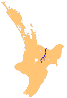
The Rangitikei River is one of New Zealand's longest rivers, 185 kilometres (115 mi) long.

Cape Turnagain is a prominent headland on the east coast of New Zealand's North Island, part way between Hawke Bay and Cook Strait, between the mouths of the Porangahau and Akitio Rivers.

The Ngaruroro River is located in the eastern North Island of New Zealand. It runs for a total of 164 kilometres southeast from the Kaweka Range, Kaimanawa Range and Ruahine Range and then east before emptying into Hawke Bay roughly halfway between the cities of Napier and Hastings, near the town of Clive. The river is mostly a single-thread channel down to Whanawhana, flowing through a greywacke rock gorge. Below Whanawhana, the river opens to wide braided channel and is joined by the Maraekakaho River. The Ngaruroro shares a river mouth with the Tutaekuri, Clive River and Muddy Creek. The meeting of these rivers forms the Waitangi Estuary.

Te Teko is a small inland township in the Bay of Plenty region of New Zealand's North Island. According to the 2006 New Zealand census, its population is 627, a decrease of 3 from the previous census in 2001.
Galatea is a settlement in the Whakatane district in the Bay of Plenty region of the North Island of New Zealand.
Rurima Island is a small island in the Bay of Plenty, off New Zealand's North Island. The island is the largest of the Rurima Rocks, with the smaller Moutoki and Tokata Islands lying about 1 km (0.62 mi) east and west respectively.
The Horomanga River is a river of the northeastern North Island of New Zealand. The river flows north through Te Urewera National Park, reaching its confluence with the Rangitaiki River 12 kilometres (7 mi) north of Murupara. There is a walking track through the forested section of the river and Midway Hut is about 7 kilometres (4 mi) upstream from where the river leaves the Ikawhenua Range.
The Mangatera River is a river of the Manawatu-Wanganui Region of New Zealand's North Island. It flows northwest from its origins in the Ruahine Range to reach the Rangitikei River 25 kilometres (16 mi) east of Taihape.
The Maraekakaho River is a river of the Hawke's Bay region, New Zealand. It flows into the Ngaruroro River.

The Taruheru River is a river of the Gisborne Region of New Zealand's North Island. It flows predominantly southeast from sources close to the settlement of Ormond before flowing through the city of Gisborne. Here it meets the waters of the Waimata River, and the combined waters flow to the northern end of Poverty Bay as the Turanganui River.
The Waikamaka River is a river of the Manawatu-Wanganui Region of New Zealand's North Island. It is a tributary of the Whakaurekou River, part of the Rangitikei River system. The Waikamaka flows northwest from its sources in the Ruahine Range to reach the Whakaurekou 15 kilometres (9 mi) east of Taihape.
The Whakaurekou River is a river of the Manawatu-Wanganui Region of New Zealand's North Island. It flows northwest from its origins in the Ruahine Range to reach the Rangitikei River 25 kilometres (16 mi) east of Taihape.
Iwitahi is a rural locality in the Taupo District and Bay of Plenty Region of New Zealand's North Island. It is situated on State Highway 5 between Taupo and Napier, about 20 km southeast of Taupo. It is a farming area, largely surrounded by forest, close to the plains of the upper Rangitaiki River. The locality was formerly known as Iwatahi.
The Otamatea River is a river of the northwestern Hawke's Bay region of New Zealand's North Island. It flows generally north from its origins in the northern foothills of the Ahimanawa Range, reaching the Rangitaiki River 25 kilometres southwest of Taupo amid the Kaingaroa Forest.
The Whirinaki River is a river of the Hawke's Bay and Bay of Plenty Regions of New Zealand's North Island. It flows generally north through the Whirinaki Te Pua-a-Tāne Conservation Park and Kaingaroa Forest to reach the Rangitaiki River 3 kilometres (2 mi) north of Murupara.
Thornton is a settlement in the Bay of Plenty Region of New Zealand. Thornton is located 13 kilometres (8.1 mi) west of Whakatane, and is on the true right of the Rangitaiki River. Thornton is where in 1911 the Rangitaiki River was put into a straight channel, which enabled draining the Rangitaiki Plains and converting this swamp land into dairy country.