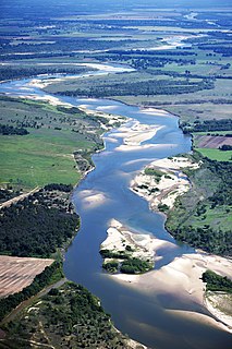
The Trinity River is a 710-mile-long (1,140 km) river in Texas, and is the longest river with a watershed entirely within the U.S. state of Texas. It rises in extreme northern Texas, a few miles south of the Red River. The headwaters are separated by the high bluffs on the southern side of the Red River.
The Obey River is a 47.8-mile-long (76.9 km) tributary of the Cumberland River in the U.S. state of Tennessee. It joins the Cumberland River near the town of Celina, which is generally considered to be the Cumberland's head of navigation. Via the Cumberland and Ohio rivers, the Obey River is part of the Mississippi River watershed.

Wright Patman Lake is a reservoir in northeast Texas in the United States. The lake is a U.S. Army Corps of Engineers reservoir formed on the Sulphur River in Bowie and Cass counties by Wright Patman Dam. The reservoir provides flood control and water conservation for the communities downstream from the dam. The lake is also a popular recreational destination. The Bowie County side of the lake is part of the Texarkana metropolitan area.
Bearwallow Creek is a 4.3-mile-long (6.9 km) tributary stream of Tearcoat Creek, itself a tributary of the North River, making it a part of the Potomac River and Chesapeake Bay watersheds. Bearwallow Creek is located in Hampshire County, West Virginia. It rises on Chestnut Oak Ridge, from which it flows southwest along the ridge's eastern flanks and then begins its course southeast along Bear Wallow Hollow Road and U.S. Route 50 until its confluence with Tearcoat Creek at Pleasant Dale.
Eagle Creek is a 58.5-mile-long (94.1 km) river located 50 miles (80 km) northwest of Clifton, Arizona, United States, at the base of the White Mountain Range. It is a tributary of the Gila River.
Big Cypress Creek is an 86-mile-long (138 km) river in Texas. It is part of the Red River watershed, with its water eventually flowing to the Atchafalaya River through the Atchafalaya Basin and entering the Gulf of Mexico.
Big Pine Creek is an 18.5-mile-long (29.8 km) river in Texas. It is a tributary of the Red River, part of the Mississippi River watershed. The creek flows entirely within Red River County, Texas.
Big Sandy Creek is a 58.0-mile-long (93.3 km) tributary of the Sabine River in Franklin, Wood and Upshur counties in northeastern Texas.
Bois d'Arc Creek is a 68.1-mile-long (109.6 km) river in Texas. It is a tributary of the Red River and is part of the Mississippi River watershed.
Lake Fork Creek is a 78.4-mile-long (126.2 km) river in Hunt, Rains, and Wood counties in Texas. It is a major tributary of the Sabine River, and has as its major tributaries Dry Creek, Glade Creek, Caney Creek, Little Caney Creek, Rainwater Creek, and Birch Creek.
Pecan Bayou is a 52.5-mile-long (84.5 km) tributary of the Red River in Texas. It is located entirely in Red River County, flowing west to east in a course north of Clarksville.
Village Creek is a river in Texas. It a branch of the Neches River.
The Alabaha River is a 20.6-mile-long (33.2 km) tributary of the Satilla River in the U.S. state of Georgia. It forms in northwestern Pierce County at the junction of Hurricane Creek and Little Hurricane Creek and flows southeast, past the county seat of Blackshear, and joins the Satilla River at the Pierce County/Brantley County boundary.

Temescal Creek is an approximately 29-mile-long (47 km) watercourse in Riverside County, in the U.S. state of California. Flowing primarily in a northwestern direction, it connects Lake Elsinore with the Santa Ana River. It drains the eastern slopes of the Santa Ana Mountains on its left and on its right the western slopes of the Temescal Mountains along its length. With a drainage basin of about 1,000 square miles (2,600 km2), it is the largest tributary of the Santa Ana River, hydrologically connecting the 720-square-mile (1,900 km2) San Jacinto River and Lake Elsinore watersheds to the rest of the Santa Ana watershed. However, flowing through an arid rain shadow zone of the Santa Ana Mountains, and with diversion of ground water for human use, the creek today is ephemeral for most of its length, except for runoff from housing developments and agricultural return flows.

White Oak Creek is a 30.5-mile-long (49.1 km) tributary of the Tennessee River in middle Tennessee in the United States. The area of the creek around the span of the Magnolia Bridge is a popular public park.
White Oak Creek is a stream in Harrison County in the U.S. state of Missouri. It is a tributary of Sampson Creek.
White Oak Township is a township in Henry County, in the U.S. state of Missouri.
Walnut Creek is a 30-mile-long (48 km) tributary of the South River in the U.S. state of Georgia. It originates in the city of Hampton in Henry County and flows into South River, which is a branch of the Ocmulgee River.
Walnut Creek is a 25-mile-long (40 km) tributary of the Ocmulgee River in the U.S. state of Georgia. It originates in the city of Gray in Jones County and flows into the Ocmulgee River in Macon at the southern corner of Ocmulgee National Monument.


