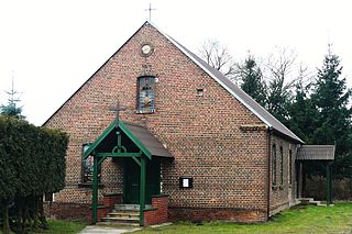
Wąsosz is a town in Góra County, Lower Silesian Voivodeship, in south-western Poland. It is the seat of the administrative district (gmina) called Gmina Wąsosz. It lies approximately 17 kilometres (11 mi) south-east of Góra, and 53 kilometres (33 mi) north-west of the regional capital Wrocław. The rivers Orla and Barycz meet here.

Ligota is a village in the administrative district of Gmina Góra, within Góra County, Lower Silesian Voivodeship, in south-western Poland. Prior to 1945 it was in Germany. It lies approximately 6 kilometres (4 mi) north-east of Góra and 71 km (44 mi) north-west of the regional capital Wrocław.

Ługi is a village in the administrative district of Gmina Wąsosz, within Góra County, Lower Silesian Voivodeship, in south-western Poland. Prior to 1945 it was in Germany. It lies approximately 4 kilometres (2 mi) south-east of Wąsosz, 21 km (13 mi) south-east of Góra, and 50 km (31 mi) north-west of the regional capital Wrocław.

Wrząca Śląska is a village in the administrative district of Gmina Wąsosz, within Góra County, Lower Silesian Voivodeship, in south-western Poland. Prior to 1945 it was in Germany. It lies approximately 6 kilometres (4 mi) south-west of Wąsosz, 20 km (12 mi) south-east of Góra, and 50 km (31 mi) north-west of the regional capital Wrocław.

Szczepanów is a village in the administrative district of Gmina Środa Śląska, within Środa Śląska County, Lower Silesian Voivodeship, in south-western Poland.

Skrodzkie is a village in the administrative district of Gmina Rajgród, within Grajewo County, Podlaskie Voivodeship, in north-eastern Poland. It lies approximately 6 kilometres (4 mi) west of Rajgród, 14 km (9 mi) north-east of Grajewo, and 76 km (47 mi) north-west of the regional capital Białystok.

Sierosław is a village in the administrative district of Gmina Moszczenica, within Piotrków County, Łódź Voivodeship, in central Poland. It lies approximately 7 kilometres (4 mi) west of Moszczenica, 13 km (8 mi) north-west of Piotrków Trybunalski, and 34 km (21 mi) south of the regional capital Łódź.

Zamłynie is a village in the administrative district of Gmina Tyszowce, within Tomaszów Lubelski County, Lublin Voivodeship, in eastern Poland. It lies approximately 29 km (18 mi) north-east of Tomaszów Lubelski and 107 km (66 mi) south-east of the regional capital Lublin.

Złota Góra is a village in the administrative district of Gmina Łyse, within Ostrołęka County, Masovian Voivodeship, in east-central Poland. It lies approximately 7 kilometres (4 mi) south-east of Łyse, 28 km (17 mi) north of Ostrołęka, and 129 km (80 mi) north of Warsaw.

Czachorowo is a village in the administrative district of Gmina Gozdowo, within Sierpc County, Masovian Voivodeship, in east-central Poland. It lies approximately 5 kilometres (3 mi) west of Gozdowo, 19 km (12 mi) south of Sierpc, and 109 km (68 mi) north-west of Warsaw.

Andrzejówka is a village in the administrative district of Gmina Policzna, within Zwoleń County, Masovian Voivodeship, in east-central Poland. It lies approximately 4 kilometres (2 mi) south of Policzna, 8 km (5 mi) north of Zwoleń, and 99 km (62 mi) south-east of Warsaw.

Stobnica is a village in the administrative district of Gmina Oborniki, within Oborniki County, Greater Poland Voivodeship, in west-central Poland. It lies approximately 16 kilometres (10 mi) north-west of Oborniki and 41 km (25 mi) north-west of the regional capital Poznań.

Miłkowo is a settlement in the administrative district of Gmina Świebodzin, within Świebodzin County, Lubusz Voivodeship, in western Poland. It lies approximately 11 kilometres (7 mi) south-east of Świebodzin, 27 km (17 mi) north of Zielona Góra, and 68 km (42 mi) south of Gorzów Wielkopolski.

Jabłoniec is a village in the administrative district of Gmina Jasień, within Żary County, Lubusz Voivodeship, in western Poland. It lies approximately 4 kilometres (2 mi) south of Jasień, 13 km (8 mi) north-west of Żary, and 42 km (26 mi) south-west of Zielona Góra.

Jasionna is a village in the administrative district of Gmina Jasień, within Żary County, Lubusz Voivodeship, in western Poland. It lies approximately 7 kilometres (4 mi) south-west of Jasień, 16 km (10 mi) north-west of Żary, and 46 km (29 mi) south-west of Zielona Góra.

Jędrzychowiczki is a village in the administrative district of Gmina Trzebiel, within Żary County, Lubusz Voivodeship, in western Poland, close to the German border. It lies approximately 5 kilometres (3 mi) south-east of Trzebiel, 19 km (12 mi) west of Żary, and 57 km (35 mi) south-west of Zielona Góra.

Siedlec is a village in the administrative district of Gmina Trzebiel, within Żary County, Lubusz Voivodeship, in western Poland, close to the German border. It lies approximately 5 kilometres (3 mi) south-west of Trzebiel, 26 km (16 mi) west of Żary, and 63 km (39 mi) south-west of Zielona Góra.

Gromoty is a village in the administrative district of Gmina Iława, within Iława County, Warmian-Masurian Voivodeship, in northern Poland. It lies approximately 11 kilometres (7 mi) east of Iława and 55 km (34 mi) west of the regional capital Olsztyn.

Kaborno is a village in the administrative district of Gmina Purda, within Olsztyn County, Warmian-Masurian Voivodeship, in northern Poland. It lies approximately 6 kilometres (4 mi) west of Purda and 11 km (7 mi) south-east of the regional capital Olsztyn.


