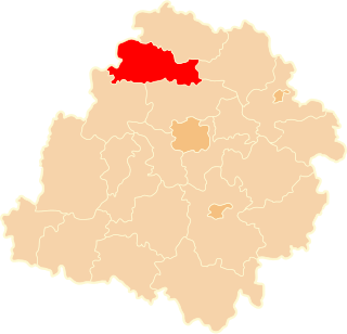
Jarochówek is a village in the administrative district of Gmina Daszyna, within Łęczyca County, Łódź Voivodeship, in central Poland. It lies approximately 3 kilometres (2 mi) west of Daszyna, 14 km (9 mi) north of Łęczyca, and 48 km (30 mi) north-west of the regional capital Łódź.
Błonie is a village in the administrative district of Gmina Łęczyca, within Łęczyca County, Łódź Voivodeship, in central Poland. It lies approximately 6 kilometres (4 mi) north-west of Łęczyca and 40 km (25 mi) north-west of the regional capital Łódź.
Borów is a village in the administrative district of Gmina Łęczyca, within Łęczyca County, Łódź Voivodeship, in central Poland. It lies approximately 10 kilometres (6 mi) west of Łęczyca and 41 km (25 mi) north-west of the regional capital Łódź.
Bronno is a village in the administrative district of Gmina Łęczyca, within Łęczyca County, Łódź Voivodeship, in central Poland. It lies approximately 8 kilometres (5 mi) west of Łęczyca and 40 km (25 mi) north-west of the regional capital Łódź.
Dzierzbiętów Duży is a village in the administrative district of Gmina Łęczyca, within Łęczyca County, Łódź Voivodeship, in central Poland. It lies approximately 4 kilometres (2 mi) south-east of Łęczyca and 32 km (20 mi) north-west of the regional capital Łódź.
Dzierzbiętów Mały is a village in the administrative district of Gmina Łęczyca, within Łęczyca County, Łódź Voivodeship, in central Poland. It lies approximately 3 kilometres (2 mi) south-east of Łęczyca and 33 km (21 mi) north-west of the regional capital Łódź.
Janków is a village in the administrative district of Gmina Łęczyca, within Łęczyca County, Łódź Voivodeship, in central Poland. It lies approximately 9 kilometres (6 mi) west of Łęczyca and 38 km (24 mi) north-west of the regional capital Łódź.
Leszcze is a village in the administrative district of Gmina Łęczyca, within Łęczyca County, Łódź Voivodeship, in central Poland. It lies approximately 3 kilometres (2 mi) north-west of Łęczyca and 37 km (23 mi) north-west of the regional capital Łódź.

Leźnica Mała is a village in the administrative district of Gmina Łęczyca, within Łęczyca County, Łódź Voivodeship, in central Poland. It lies approximately 9 kilometres (6 mi) west of Łęczyca and 39 km (24 mi) north-west of the regional capital Łódź.
Lubień is a village in the administrative district of Gmina Łęczyca, within Łęczyca County, Łódź Voivodeship, in central Poland. It lies approximately 4 kilometres (2 mi) south-east of Łęczyca and 32 km (20 mi) north-west of the regional capital Łódź.
Mniszki is a village in the administrative district of Gmina Łęczyca, within Łęczyca County, Łódź Voivodeship, in central Poland. It lies approximately 8 kilometres (5 mi) south-west of Łęczyca and 36 km (22 mi) north-west of the regional capital Łódź.
Siemszyce is a village in the administrative district of Gmina Łęczyca, within Łęczyca County, Łódź Voivodeship, in central Poland. It lies approximately 8 kilometres (5 mi) north-west of Łęczyca and 42 km (26 mi) north-west of the regional capital Łódź.
Topola Katowa is a village in the administrative district of Gmina Łęczyca, within Łęczyca County, Łódź Voivodeship, in central Poland. It lies approximately 3 kilometres (2 mi) south-west of Łęczyca and 34 km (21 mi) north-west of the regional capital Łódź.
Wichrów is a village in the administrative district of Gmina Łęczyca, within Łęczyca County, Łódź Voivodeship, in central Poland. It lies approximately 5 kilometres (3 mi) west of Łęczyca and 36 km (22 mi) north-west of the regional capital Łódź.
Wilczkowice Dolne is a village in the administrative district of Gmina Łęczyca, within Łęczyca County, Łódź Voivodeship, in central Poland. It lies approximately 4 kilometres (2 mi) west of Łęczyca and 38 km (24 mi) north-west of the regional capital Łódź.
Wilczkowice Górne is a village in the administrative district of Gmina Łęczyca, within Łęczyca County, Łódź Voivodeship, in central Poland. It lies approximately 5 kilometres (3 mi) west of Łęczyca and 38 km (24 mi) north-west of the regional capital Łódź.
Wilczkowice nad Szosą is a village in the administrative district of Gmina Łęczyca, within Łęczyca County, Łódź Voivodeship, in central Poland. It lies approximately 5 kilometres (3 mi) west of Łęczyca and 38 km (24 mi) north-west of the regional capital Łódź.
Rogaszyn is a village in the administrative district of Gmina Piątek, within Łęczyca County, Łódź Voivodeship, in central Poland. It lies approximately 4 kilometres (2 mi) north of Piątek, 22 km (14 mi) east of Łęczyca, and 36 km (22 mi) north of the regional capital Łódź.
Polusin is a village in the administrative district of Gmina Świnice Warckie, within Łęczyca County, Łódź Voivodeship, in central Poland. It lies approximately 4 kilometres (2 mi) north-west of Świnice Warckie, 21 km (13 mi) west of Łęczyca, and 50 km (31 mi) north-west of the regional capital Łódź.
Wargawka is a village in the administrative district of Gmina Witonia, within Łęczyca County, Łódź Voivodeship, in central Poland. It lies approximately 3 kilometres (2 mi) west of Witonia, 13 km (8 mi) north of Łęczyca, and 44 km (27 mi) north of the regional capital Łódź.