Related Research Articles

The Pecos River originates in north-central New Mexico and flows into Texas, emptying into the Rio Grande. Its headwaters are on the eastern slope of the Sangre de Cristo mountain range in Mora County north of Pecos, New Mexico, at an elevation of over 12,000 feet (3,700 m). The river flows for 926 miles (1,490 km) before reaching the Rio Grande near Del Rio. Its drainage basin encompasses about 44,300 square miles (115,000 km2).

Lavaca Bay is a northwestern extension of the Matagorda Bay system found mostly in Calhoun County, Texas, United States. The ports of Port Lavaca and Point Comfort have been established on the bay, and are the main areas of human habitation. Linnville was located on the bay until its abandonment after the Great Raid of 1840, and the major port of Indianola was found near the confluence with the main Matagorda Bay, until the town's final destruction following the massive hurricane of 1886. Smaller communities include Olivia, Alamo Beach and Magnolia Beach. Lavaca Bay is approximately 82 miles (130 km) northeast of Corpus Christi, about 121 miles (190 km) southwest of Houston, and 145 miles (230 km) southeast of San Antonio.
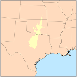
The term Cross Timbers, also known as Ecoregion 29, Central Oklahoma/Texas Plains, is used to describe a strip of land in the United States that runs from southeastern Kansas across Central Oklahoma to Central Texas. Made up of a mix of prairie, savanna, and woodland, it forms part of the boundary between the more heavily forested eastern country and the almost treeless Great Plains, and also marks the western habitat limit of many mammals and insects.
The Little River is a river in Central Texas in the Brazos River watershed. It is formed by the confluence of the Leon River and the Lampasas River near Little River, Texas in Bell County. It flows generally southeast for 75 miles (121 km) until it empties into the Brazos River about 5 miles (8.0 km) southwest of Hearne, at a site called Port Sullivan in Milam County. The Little River has a third tributary, the San Gabriel River, which joins the Little about 8 miles (13 km) north of Rockdale and five miles southwest of Cameron. Cameron, the county seat of Milam County and the only city of any significant size on the Little River, was established in 1846.
The history of Dallas, Texas, United States, from 1839 to 1855 concerns the city's original settlement and the establishment of Dallas County.
Wild Cat may refer to:
The Navidad River is a 90-mile (140 km)-long coastal river in the U.S. state of Texas that runs roughly parallel to its sister river, the Lavaca River. It is not spring fed, and all of its volume is runoff, which eventually provides for much of the water in Lake Texana.
Cayuga is an unincorporated community in northwestern Anderson County, Texas, United States. According to the Handbook of Texas, the community had a population of 200 in 2000. It is located within the Palestine, Texas micropolitan area.
Sulphur Bluff is an unincorporated community in northeastern Hopkins County, Texas, United States.
Princeton is a ghost town in Newton County, Texas, United States, along the Sabine River.
McGirk is a ghost town located in Hamilton County near the Lampasas River in Central Texas, United States. Founded in the early 1870s, the town acquired a post office in 1882. John A. McGirk, the town's namesake, also served as the first postmaster. A steam-operated cotton gin on the Lampasas River remained in place for many years. The post office closed by 1920 and the school was gone by the mid-1930s. The town still had a population of 25 in 1945, but post war opportunities drew off that meager number and the town became a ghost.

Tee Pee City is a ghost town located in eastern Motley County near Matador, Texas. The ghost town is near the confluence of Tee Pee Creek and the Middle Pease River in eastern Motley County. The site, originally a Comanche campground, derived its name from the numerous teepee poles found up and down the creek by early settlers.
Nashville was a community, now a ghost town, on the southeastern bank of the Brazos River in present-day Milam County, Texas, United States.
Preston, also known as Preston Bend, is an unincorporated community and census-designated place located on the Red River in Grayson County, Texas, United States. It grew in the 19th century at the intersection of several military and trade roads and was an important crossing on the Shawnee cattle trail. Preston lost prominence after the MK&T railroad bypassed the town to the east, leading to a decline in traveler and cattle drive traffic. Much of its former town site is submerged beneath the waters of Lake Texoma. Its population was 2,096 as of the 2010 census.
Carpenter's Bluff is a community in northeastern Grayson County, Texas, United States, located on the Red River and Farm to Market Road 120, twelve miles northeast of Sherman, connecting Grayson County and Bryan County, Oklahoma. Settled circa 1860, it derived its name from that of an early settler, E. E. Carpenter, who operated a ferry across the Red River. In the early twentieth century, the Missouri, Oklahoma and Gulf Railway constructed a bridge across the Red River at Carpenter's Bluff. By 1936, Carpenter's Bluff had a population of seventy-five and four businesses. Ten years later, the population had increased to 120, and the town still had four businesses.
The James River is located in Kimble and Mason Counties, in the U.S. state of Texas. The Llano River in Mason County is the location of the mouth of the James River, and it flows southeast for 36.5 miles (58.7 km) past the Kimble County ghost town of Noxville. The river intersects with the James River Spring and with the Little Devils River in southeastern Kimble County. The valleys along the James River became sites for 19th-century European settlements. The river is a destination for outdoor enthusiasts of whitewater kayaking and rafting.
Halls Bluff or Hall's Bluff is a ghost town in Houston County, Texas, United States.

Cuthbert is a ghost town in Mitchell County, Texas, United States. Cuthbert was established in 1890 when the founder D. T. Bozeman built a wagon yard and store. The community and post office were named for Thomas Cuthbertson, a family friend of the Bozemans. By the early 1920s, Cuthbert had a church, two stores, a blacksmith shop, a cotton gin, telephone office, and a school. In 1920, the T. and P. Abrams No. 1 oil well, one of the first commercial oil ventures in the Permian Basin, was drilled just over a mile north of the town. A post office, two businesses, and a population of twenty-five were reported at the community in 1936, the year that its school was consolidated with that of Colorado City. After World War II, the improvement of rural roads in the area led to Cuthbert's decline as it lost its trade to Colorado City. The Cuthbert post office was discontinued circa 1960, when the town reported one business and a population of twenty-five. By 1974, only a cemetery and scattered farms remained in the area.
Jarvis is a ghost town in Anderson County, in the U.S. state of Texas. It is a part of the Palestine, Texas micropolitan area. Although it is considered a ghost town by the Handbook of Texas, the Geographic Names Information System classifies it as an unincorporated community.
Dunagan is a ghost town in Angelina County, in the U.S. state of Texas. It is located within the Lufkin, Texas micropolitan area.
References
- ↑ Wild Cat Bluff, TX from the Handbook of Texas Online

