Related Research Articles

Presidio County is a county located in the U.S. state of Texas. As of the 2020 census, its population was 6,131. Its county seat is Marfa. The county was created in 1850 and later organized in 1875. Presidio County is in the Trans-Pecos region of West Texas and is named for the border settlement of Presidio del Norte. It is on the Rio Grande, which forms the Mexican border.

Jeff Davis County is a county in the U.S. state of Texas. As of the 2020 census, its population was 1,996. Its county seat is Fort Davis. The county is named for Jefferson Davis, who served as the 23rd United States Secretary of War in the 1850s, and as President of the Confederate States of America.

Brewster County is a county located in the U.S. state of Texas. It is in West Texas and its county seat is Alpine. It is one of the nine counties that comprise the Trans-Pecos region, and borders Mexico. Brewster County is the largest county by area in the state - at 6,192 square miles (16,040 km2) it is over three times the size of the state of Delaware, and more than 500 square miles (1,300 km2) bigger than Connecticut.

The Big Bend is part of the Trans-Pecos region in southwestern Texas, United States along the border with Mexico, north of the prominent bend in the Rio Grande for which the region is named. Here the Rio Grande passes between the Chisos Mountains in Texas and the Sierra Madre Oriental in Mexico as it changes from running east-southeast to north-northeast. The region covers three counties: Presidio County to the west, Brewster County to the east, and Jeff Davis County to the north.

The North Dakota Senate is the upper house of the North Dakota Legislative Assembly, smaller than the North Dakota House of Representatives.

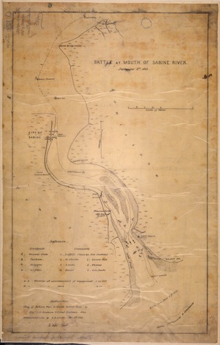
The Second Battle of Sabine Pass was a failed Union Army attempt to invade the Confederate state of Texas during the American Civil War. The Union Navy supported the effort and lost three gunboats during the battle, two captured and one destroyed.

State Highway 17 runs from Marfa to Pecos in west Texas. The road is maintained by the Texas Department of Transportation (TxDOT).
CJKR-FM is a Canadian radio station broadcasting on the assigned frequency of 97.5 MHz in Winnipeg, Manitoba. It airs an active rock format with the on-air brand name Power 97. The station is owned and operated by Corus Entertainment, which also owns sister stations CJOB and CFPG-FM. The studios and offices are located at 201 Portage Avenue in downtown Winnipeg, while its transmitter is located on Brady Road in south Winnipeg.

Chihuahuan Desert Nature Center and Botanical Gardens is a nonprofit nature center with botanical gardens on the grounds of the Chihuahuan Desert Research Institute, the parent organization. It is located off Texas State Highway 118 about 4 miles (6.4 km) south of Fort Davis, Texas, United States. The Center is open Monday through Saturday, except major holidays. An admission fee is charged.
CKRX-FM is a Canadian radio station that broadcasts an adult hits format at 102.3 FM in Fort Nelson, British Columbia. The station is branded as Bounce 102.3 and is owned by Bell Media.
Swiss Alp is an unincorporated community in southern Fayette County, Texas, United States.

Buchel County was a former Texas county. Its area is now completely contained in the present Brewster County.

Arthur Tracy Lee served as an officer in the regular army before and during the American Civil War. He was also an author, painter, musician, and an architect.

Wendy Russell Davis is an American lawyer and Democratic Party politician from Fort Worth, Texas. Davis represented the 10th district in the Texas Senate from 2009 to 2015. She previously served on the Fort Worth City Council.
Hualapai Valley is a valley in Mohave County, Arizona.
St. Andrew's Cathedral was the Anglican Pro-cathedral of the former Canadian Diocese of Mackenzie River: it was in Fort Chipewyan but reverted to parish church status in 1933 when the diocese was abolished: it is the oldest Anglican church in Alberta.
Limpia Canyon is a deep valley or canyon in the Davis Mountains of Jeff Davis County, Texas. It was cut by Limpia Creek and is its path southeastward from the northeastern slope of Mount Livermore at 30°46′39″N103°44′40″W, past Fort Davis and Wild Rose Pass, to its mouth at an elevation of 4,117 feet / 1,255 meters on the eastern edge of the Davis Mountains.
Limpia Creek, originally known as the Rio Limpia, is a stream that heads in Jeff Davis County, Texas and its mouth is in Pecos County, Texas. Limpa is the Spanish word for "clear or clean water". The creek has its head in the Davis Mountains at an elevation of 7,160 feet, at location 30°38′27″N104°09′42″W on the northeast slope of Mount Livermore. The creek flows 42 miles down Limpia Canyon past Fort Davis and Wild Rose Pass to the canyon mouth, where it turns eastward to its mouth at its confluence with Barrilla Draw, where it disappears into the ground at an elevation of 3,533 feet / 1,077 meters.
The James Lynaugh Unit is a state prison for men located in Fort Stockton, Pecos County, Texas, owned by operated by the Texas Department of Criminal Justice. It opened in September 1994, and has a maximum capacity of 1416 male inmates at various security levels.
Gore is an unincorporated community in southwest Warren County, in the U.S. state of Missouri. The community lies on the north edge of the Missouri River Valley. Missouri Route 94 passes just north of the community and the Katy Trail passes the location. The Loutre Slough joins the Missouri River just south of the community.
References
Coordinates: 30°42′52″N103°46′57″W / 30.71444°N 103.78250°W