Related Research Articles

Jeff Davis County is a county in the U.S. state of Texas. As of the 2020 census, its population was 1,996. Its county seat is Fort Davis. The county is named for Jefferson Davis, who served as the 23rd United States Secretary of War in the 1850s, and as President of the Confederate States of America.

The Grand Canyon of the Yellowstone is the first large canyon on the Yellowstone River downstream from Yellowstone Falls in Yellowstone National Park in Wyoming. The canyon is approximately 24 miles (39 km) long, between 800 and 1,200 ft deep and from .25 to .75 mi wide.

The Feather River is the principal tributary of the Sacramento River, in the Sacramento Valley of Northern California. The river's main stem is about 73 miles (117 km) long. Its length to its most distant headwater tributary is just over 210 miles (340 km). The main stem Feather River begins in Lake Oroville, where its four long tributary forks join—the South Fork, Middle Fork, North Fork, and West Branch Feather Rivers. These and other tributaries drain part of the northern Sierra Nevada, and the extreme southern Cascades, as well as a small portion of the Sacramento Valley. The total drainage basin is about 6,200 square miles (16,000 km2), with approximately 3,604 square miles (9,330 km2) above Lake Oroville.

State Highway 17 runs from Marfa to Pecos in west Texas. The road is maintained by the Texas Department of Transportation (TxDOT).

Wills Creek is a 38.6-mile-long (62.1 km) tributary of the North Branch Potomac River in Pennsylvania and Maryland in the United States.

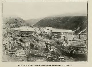
The Cook–Folsom–Peterson Expedition of 1869 was the first organized expedition to explore the region that became Yellowstone National Park. The privately financed expedition was carried out by David E. Folsom, Charles W. Cook and William Peterson of Diamond City, Montana, a gold camp in the Confederate Gulch area of the Big Belt Mountains east of Helena, Montana. The journals kept by Cook and Folsom, as well as their personal accounts to friends were of significant inspirational value to spur the organization of the Washburn-Langford-Doane Expedition which visited Yellowstone in 1870.
Crooksville High School is a public high school in Crooksville, Ohio. It is the only high school in the Crooksville Exempted Village School District. Their nickname is the Ceramics. The high school was built in 1988.

Spearfish Canyon is a deep but narrow gorge carved by Spearfish Creek located in Lawrence County, South Dakota, U.S., just south of Spearfish. The canyon is located within the Black Hills, located on the northern edge of the Black Hills National Forest. The Spearfish Canyon Scenic Byway travels through the Canyon from Spearfish to Cheyenne Crossing along U.S. Route 14A. The highway follows an old railroad grade that was abandoned after massive flooding in 1933.
The Ray Mountains is a mountain range in central Alaska named for the Ray River, itself named for United States Army Captain Patrick Henry Ray, who established a meteorological station in Barrow, Alaska, in 1881. The mountains are within the Yukon-Tanana Uplands, an area of low mountain ranges that also includes the White Mountains. The Ray Mountains cover an area of 10,600 square miles (27,454 km2) and are bordered on the east by the Yukon River, on the south by the Tozitna River, and on the north by Kanuti National Wildlife Refuge. The highest point in the Ray Mountains is Mount Tozi, which has a summit elevation of 5,519 feet (1,682 m). Other notable peaks include Wolf Mountain, Mount Henry Eakin, the Kokrines Hills, and Moran Dome.

Temescal Creek is an approximately 29-mile-long (47 km) watercourse in Riverside County, in the U.S. state of California. Flowing primarily in a northwestern direction, it connects Lake Elsinore with the Santa Ana River. It drains the eastern slopes of the Santa Ana Mountains on its left and on its right the western slopes of the Temescal Mountains along its length. With a drainage basin of about 1,000 square miles (2,600 km2), it is the largest tributary of the Santa Ana River, hydrologically connecting the 720-square-mile (1,900 km2) San Jacinto River and Lake Elsinore watersheds to the rest of the Santa Ana watershed. However, flowing through an arid rain shadow zone of the Santa Ana Mountains, and with diversion of ground water for human use, the creek today is ephemeral for most of its length, except for runoff from housing developments and agricultural return flows.

This is a list of the LGM-30 Minuteman missile, Missile Alert Facilities and Launch Facilities of the 44th Missile Wing, 20th Air Force, assigned to Ellsworth AFB, South Dakota.
Sheep Creek is a geographical place name. With variations, the name is given to hundreds of bodies of water, roads, canals, reservoirs and populated areas in the United States and other countries. It is the name of a tributary to Lockyear Creek in Queensland, Australia, and the name of at least three bodies of water in Canada. The U.S. state of Montana has 85 different locales that bear that name or a derivation. The U.S. state of Idaho has 92 natural and man-made areas that incorporate Sheep Creek into their names. Nature areas that include trails named Sheep Creek can be found in Canada's Yukon Territory, Colorado's Larimer County and in Utah's Bryce Canyon National Park.
Temescal Mountains, also known as the Sierra Temescal, are one of the northernmost mountain ranges of the Peninsular Ranges in western Riverside County, in Southern California in the United States. They extend for approximately 25 mi (40 km) southeast of the Santa Ana River east of the Elsinore Fault Zone to the Temecula Basin and form the western edge of the Perris Block.
Dadsville is an unincorporated community in Preble County, in the U.S. state of Ohio.
Wild Rose Pass is a gap in the Davis Mountains in Jeff Davis County, Texas. It lies at an elevation of 4,554 feet / 1,388 meters.

Carrizo Gorge is a valley in the Jacumba Mountains, in San Diego County, California. Its mouth is at an elevation of 1,411 feet (430 m), where it widens out to become Carrizo Canyon, 1 mi (1.6 km) northeast of Palm Grove. Its head is located in the Jacumba Mountains, 1.5 mi (2.4 km) north of Round Mountain, at an elevation of 2,600 ft (790 m) at 32°39′38″N116°11′28″W.
Limpia Creek, originally known as the Rio Limpia, is a stream that heads in Jeff Davis County, Texas and its mouth is in Pecos County, Texas. Limpa is the Spanish word for "clear or clean water". The creek has its head in the Davis Mountains at an elevation of 7,160 feet, at location 30°38′27″N104°09′42″W on the northeast slope of Mount Livermore. The creek flows 42 miles down Limpia Canyon past Fort Davis and Wild Rose Pass to the canyon mouth, where it turns eastward to its mouth at its confluence with Barrilla Draw, where it disappears into the ground at an elevation of 3,533 feet / 1,077 meters.
Lookout is an unincorporated area in Wayne County, Pennsylvania, United States.
Currant Creek is a stream in eastern Juab County and southern Utah County in northern Utah, United States.
Oakland is an unincorporated community in Plain Township, Franklin County, Ohio, United States. It is located southeast of New Albany at the intersection of Morse Road and Babbitt Road, at 40°03′05″N82°46′39″W.
References
Coordinates: 30°46′39″N103°44′40″W / 30.77750°N 103.74444°W
