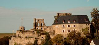
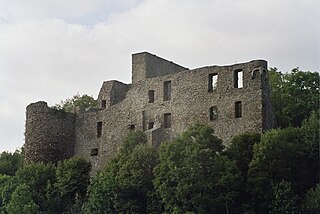
| Wildenburg Castle Burg Wildenburg | |
|---|---|
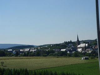
| Kempfeld | |
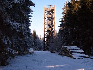
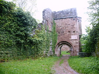
The viewing tower on the castle ruins | |
 Wildenburg Castle Burg Wildenburg | |
| Coordinates | 49°46′33″N7°15′23″E / 49.775944°N 7.256278°E Coordinates: 49°46′33″N7°15′23″E / 49.775944°N 7.256278°E |
| Type | motte-and-bailey castle |
| Code | DE-RP |
| Height | 630 m above sea level (NN) |
| Site information | |
| Condition | ruin |
| Garrison information | |
| Occupants | counts |

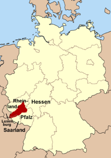
Wildenburg Castle (German : Burg Wildenburg) is a ruined castle near Kempfeld in the county of Birkenfeld in the German state of Rhineland-Palatinate.

German is a West Germanic language that is mainly spoken in Central Europe. It is the most widely spoken and official or co-official language in Germany, Austria, Switzerland, South Tyrol (Italy), the German-speaking Community of Belgium, and Liechtenstein. It is also one of the three official languages of Luxembourg and a co-official language in the Opole Voivodeship in Poland. The languages which are most similar to German are the other members of the West Germanic language branch: Afrikaans, Dutch, English, the Frisian languages, Low German/Low Saxon, Luxembourgish, and Yiddish. There are also strong similarities in vocabulary with Danish, Norwegian and Swedish, although those belong to the North Germanic group. German is the second most widely spoken Germanic language, after English.
A castle is a type of fortified structure built during the Middle Ages by predominantly the nobility or royalty and by military orders. Scholars debate the scope of the word castle, but usually consider it to be the private fortified residence of a lord or noble. This is distinct from a palace, which is not fortified; from a fortress, which was not always a residence for royalty or nobility; and from a fortified settlement, which was a public defence – though there are many similarities among these types of construction. Usage of the term has varied over time and has been applied to structures as diverse as hill forts and country houses. Over the approximately 900 years that castles were built, they took on a great many forms with many different features, although some, such as curtain walls and arrowslits, were commonplace.

Kempfeld is an Ortsgemeinde – a municipality belonging to a Verbandsgemeinde, a kind of collective municipality – in the Birkenfeld district in Rhineland-Palatinate, Germany. It belongs to the Verbandsgemeinde of Herrstein, whose seat is in the like-named municipality.