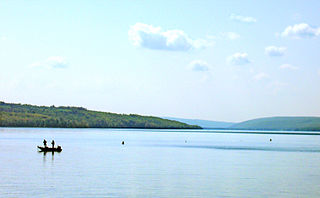
Owasco Lake is the sixth largest and third easternmost of the Finger Lakes of New York in the United States.
Conesus Lake is located in Livingston County, New York. Conesus Lake is the westernmost of New York's eleven Finger Lakes. It is located off Interstate 390 about 15 miles (24 km) south of Interstate 90.

Hemlock Lake is one of the minor Finger Lakes. It is mostly located in Livingston County, New York, south of Rochester, with a portion overlapping into Ontario County. Hemlock is a translation of the Seneca name for the lake, O-neh-da Te-car-ne-o-di. It is one of two Finger Lakes whose shorelines are virtually undeveloped.

Canadarago Lake is a 1,917-acre (7.76 km2) lake located in Otsego County, New York and is the source of Oaks Creek. The Village of Richfield Springs is located at the lake's northern end. It is the second largest lake in Otsego County, lying to the west of and parallel to the larger Otsego Lake. The lake's name is also spelled "Candajarago Lake" or "Caniadaraga Lake".

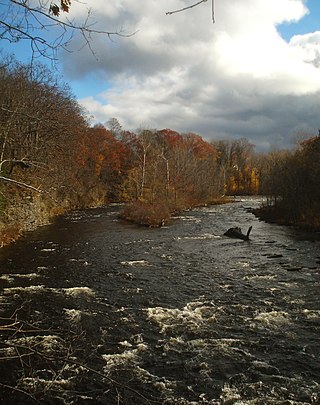
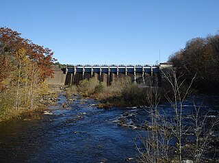
The Salmon River is a small river north of Syracuse in Upstate New York, the United States. It is a popular and economically important sportfishing destination, and the most heavily fished of New York's Lake Ontario tributaries. From its headwaters in the Tug Hill region of New York, it flows 44 miles (71 km) westward through two hydroelectric dams and over the 110-foot (34 m) Salmon River Falls before it empties into eastern Lake Ontario at Port Ontario in Oswego County. The Salmon River watershed drains approximately 280 square miles (730 km2).

Grafton Lakes State Park is a 2,545-acre (10.30 km2) state park located in Rensselaer County, New York, United States. The park is in the central part of the Town of Grafton and north of the hamlet of Grafton on NY Route 2, northeast of Albany. The park contains the Shaver Pond Nature Center.

Cranberry Lake is on the east branch of the Oswegatchie River in the Adirondack Park in New York in the United States. It is the third largest lake in the Adirondack Park. About 75 percent of the shoreline is owned by the State of New York. The 118,000-acre (480 km2) Five Ponds Wilderness Area abuts its south shore, and the Cranberry Lake Wild Forest covers much of its remaining shoreline.
Lake Pleasant is located in the Adirondack Park in New York in the United States. The lake is in the town of Lake Pleasant in Hamilton County.

The Saugatuck Reservoir is a reservoir in Fairfield County, Connecticut, United States, that straddles the border between the towns of Redding, Weston, and Easton. Its completion is marked by the creation of the Samuel P. Senior dam of the Saugatuck River in January 1942, and provides water to several of the nearby towns. The reservoir is surrounded by the Centennial Watershed State Forest and a small section of the Trout Brook Valley State Park Reserve on the southeast end of the reservoir. The Saugatuck Reservoir utilizes an uncontrolled spillway adjacent to the Samuel P. Senior dam that effectively limits the maximum water level. There is also a concrete levee positioned on the southeastern side of the reservoir that prevents water from flooding Trout Brook Valley.

Massawepie Lake is located in the town of Piercefield, in southern St. Lawrence County, New York, approximately 12 miles (19 km) southwest of the village of Tupper Lake, New York. The lake is also surrounded by the Massawepie Scout Camps. The name of the lake is of Iroquois origin, meaning "the beaver's lake". The outlet flows west into the South Branch Grass River.

Brown Tract Pond Campground is a campground run by the New York State Department of Environmental Conservation in Raquette Lake, New York. It is located on the shores of Browns Tract Pond in a remote area of the Adirondacks, approximately two miles (3.2 km) from Raquette Lake, near the town of Inlet in Hamilton County.
East Caroga Lake is located in the Town of Caroga by Caroga Lake, New York. The lake provides excellent warm water fishing and rainbow trout fishing. The lake is connected to West Caroga Lake by a small channel. Origin of the name, "Caroga" is derived from the once nearby Indian Village known as "Caroga".
West Caroga Lake is located in the Town of Caroga by Caroga Lake, New York. The lake is known for excellent warm water fishing, but it also offers the only location to fish for splake in the county. The lake is connected to East Caroga Lake by a small channel. Origin of the name, "Caroga" is derived from the once nearby Indian Village known as "Caroga".

Canada Lake is located in the Town of Caroga in Fulton County in the U.S. state of New York. Unlike the nearby Caroga lakes, Canada Lake is very deep which provides colder water for species such as trout to survive. There is an annual draw down on the lake by way of a control structure on the outlet of Stewart Landing. The impoundment of this water has created a lake complex of Lily Lake, Canada Lake, West Lake and Green Lake.
Butterfield Lake is located near Redwood, New York. Water from adjacent Mud Lake flows into Butterfield Lake. Fish species present in the lake are largemouth bass, smallmouth bass, northern pike, walleye, yellow perch, black bullhead, bluegill, and black crappie, bowfin (ling), and possibly still some gar.
Norwood Lake is a man-made lake located by Norwood, New York. Fish species present in the reservoir are smallmouth bass, northern pike, rock bass, yellow perch, and walleye. There is a carry down boat launch located on Riverside Road.
Fall Lake is located north of Piseco, New York. Fish species present in the lake are rock bass, white sucker, black bullhead, smallmouth bass, yellow perch, and pickerel. There is carry down access on Fall Stream off Old Piseco Road on land owned by the Irondequoit Club.
Garnet Lake is located south of the hamlet of Garnet Lake, New York. Fish species present in the lake are pickerel, largemouth bass, yellow perch, and brown bullhead. There is carry down on a trail off Maxam Road on the east shore.

Fourth Lake is located near Fourth Lake, New York. Fish species present in the lake are northern pike, smallmouth bass, largemouth bass, bluegill, yellow perch, pumpkinseed sunfish, and brown bullhead. There is a state owned carry down located north of the hamlet of Fourth Lake on the west shore.

Salmon River Reservoir, also known as the Redfield Reservoir, is a man-made lake located near the hamlet of Redfield, New York. The reservoir was created with the completion of a hydroelectric dam in 1912. It has the capacity to hold 56,000 acre-feet (69,000,000 m3) of water. It is the larger of the Salmon River's two reservoirs.


