Wilhelminadorp

Last updated
Wilhelminadorp
Village
Wilhelminadorp-Klappbrucke-2.jpg
Drawbridge in Wilhelminadorp
2010-NL-P09-Zeeland-positiekaart-gemnamen.jpg
Red pog.svg
Wilhelminadorp
Location in the province of Zeeland in the Netherlands
Netherlands location map.svg
Red pog.svg
Wilhelminadorp
Wilhelminadorp (Netherlands)
Coordinates: 51°31′40″N3°53′46″E / 51.52778°N 3.89611°E / 51.52778; 3.89611 Coordinates: 51°31′40″N3°53′46″E / 51.52778°N 3.89611°E / 51.52778; 3.89611
Country Netherlands
Province Zeeland
Municipality Goes
Established1812
Area
[1]
  Total10.66 km2 (4.12 sq mi)
Elevation
[2]
2.2 m (7.2 ft)
Population
 (2021) [1]
  Total800
  Density75/km2 (190/sq mi)
Time zone UTC+1 (CET)
  Summer (DST) UTC+2 (CEST)
Postal code
4474 & 4475 [1]
Dialing code 0113

Wilhelminadorp is a village in the Dutch province of Zeeland. It is located in the municipality of Goes. [3]

Contents

Wilhelminadorp was founded in 1812, when the Wilhelminapolder was diked. Originally the polder was named Lodewijkspolder, after then King of Holland Louis Bonaparte who had given the permit to start work. With the restoration of the House of Orange, the name was changed in 1815. The polder was now named after Wilhelmina of Prussia, wife of William I of the Netherlands. [4] [5]

Restaurant Katseveer (one Michelin star) is located in the village. [6]

History

The village was first mentioned in 1849 as "Wilhelminadorp, veelal het Nieuwedorp genoemd". [5] Wilhelminadorp is located on the canal from Goes to Goese Sas  [ nl ]. All the land in the polder is owned by De Koninklijke Maatschap de Wilhelminapolder. The company owns 1,700 hectares (4,200 acres) of land of which 1,300 hectares (3,200 acres) is used for agricultural. It is one of the largest landowners of the Netherlands. [7]

Wilhelminadorp was home to 501 people in 1840. [8] In 1841, a church was built by Rijkswaterstaat, but the company paid for the church. [7] It was originally part of the municipality of Kattendijke, however the town hall was located in Wilhelminadorp. In 1970, it was merged into the municipality of Goes. [8]

Related Research Articles

Wezep Town in Gelderland, Netherlands

Wezep is a town in the municipality of Oldebroek, Netherlands. Located in the province of Gelderland, it had about 13,500 inhabitants in 2012. The Wezep railway station, located on the Utrecht–Zwolle railway, is the town's main landmark. The municipality's TV station is called LOCO TV.

Daarlerveen Village in Overijssel, Netherlands

Daarlerveen is a village in the Dutch province of Overijssel. It is located in the municipality of Hellendoorn, about 2 km south of the town of Vroomshoop.

Fijnaart Town in North Brabant, Netherlands

Fijnaart is a town in the Dutch province of North Brabant. It is located in the municipality of Moerdijk, about 8 km west of the town of Zevenbergen.

Kropswolde Village in Groningen, Netherlands

Kropswolde is a village in the Dutch province of Groningen. It is located in the municipality of Midden-Groningen, about 3 km southwest of the town of Hoogezand and 5 km northeast of the town of Zuidlaren.

Doornsteeg Neighbourhood and Hamlet in Nijkerk, Gelderland, Netherlands

Doornsteeg is a neighbourhood of Nijkerk and a hamlet in the Dutch province of Gelderland. It is a part of the municipality of Nijkerk, and lies about 8 km northeast of Amersfoort.

Kattendijke Village in Zeeland, Netherlands

Kattendijke is a village in the Dutch province of Zeeland. It is located in the municipality of Goes on the Oosterschelde about 5 km northeast of the city of Goes.

Herveld Village in Gelderland, Netherlands

Herveld is a village in the Dutch province of Gelderland. It is located in the municipality of Overbetuwe.

Eerde Village in North Brabant, Netherlands

Eerde is a village in the Dutch province of North Brabant. It is part of the municipality of Meierijstad, located about 500 m west of the built-up area of Veghel and 3 km southwest of the town centre of Veghel. During Operation Market Garden, in September 1944, it changed hands several times between German and American forces but ended up in American hands; the village was severely damaged in the process.

Galder, Netherlands Village in North Brabant, Netherlands

Galder is a village in the Dutch province of North Brabant. It is located in the municipality of Alphen-Chaam 8 km south of the city of Breda.

Noordhoek, Moerdijk Village in North Brabant, Netherlands

Noordhoek is a village in the Dutch province of North Brabant. It is located in the municipality of Moerdijk, about 5 km west of Zevenbergen.

De Horst, Berg en Dal Village in Gelderland, Netherlands

De Horst is a village in the Dutch province of Gelderland. It is located in the municipality of Berg en Dal, about 2 km east of Groesbeek.

Dorkwerd Village in Groningen, Netherlands

Dorkwerd is a small village in Groningen, the Netherlands. It is located in the municipality of Groningen, about 4 km northwest of the city center. Recent construction of new residential areas have brought the city to less than 500 meters from the village of Dorkwerd, and the postal authorities have placed it under Groningen.

Bears, Friesland Village in Friesland, Netherlands

Bears or Beers is a small village in the Dutch province of Friesland. It is located in the municipality Leeuwarden, about 8 km southwest of Leeuwarden. Bears has a population of about 133 in January 2017.

Heikant is a hamlet in the Dutch province of North Brabant. It is located in the municipality of Cranendonck, about 1.5 km southeast of Budel.

Huis ter Heide, Utrecht Village in Utrecht, Netherlands

Huis ter Heide is a village in the central Netherlands. It is located in the municipality of Zeist, Utrecht, about 2 km northeast of the centre of the town Zeist.

Pesse Village in Drenthe, Netherlands

Pesse is a village in the Dutch province of Drenthe. It is located in the municipality of Hoogeveen.

Heelsum Village in Gelderland, Netherlands

Heelsum is a village in the Dutch province of Gelderland. It is located in the municipality of Renkum, west of Arnhem.

De Lutte Village in Overijssel, Netherlands

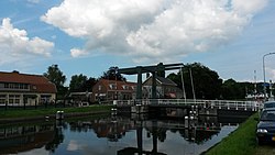
De Lutte is a village in the Dutch province of Overijssel. It is located in the municipality of Losser. It is located close to the border between the Netherlands and Germany. De Lutte is connected to Germany and Oldenzaal and Hengelo by the A1.

Heemse Neighbourhood and former village in Hardenberg, Overijssel, Netherlands

Heemse is a neighbourhood of Hardenberg and former village in the Dutch province of Overijssel. In 1966, it was annexed by Hardenberg.

Slijkplaat is a hamlet in the Dutch province of Zeeland. It is located in the municipality of Sluis. The hamlet exists of two streets and 28 houses.

References

  1. 1 2 3 "Kerncijfers wijken en buurten 2021". Central Bureau of Statistics. Retrieved 19 April 2022.
  2. "Postcodetool for 4475AA". Actueel Hoogtebestand Nederland (in Dutch). Het Waterschapshuis. Retrieved 19 April 2022.
  3. ANWB Topografische Atlas Nederland, Topografische Dienst and ANWB, 2005.
  4. (in Dutch) De Geschiedenis van Goes en omgeving
  5. 1 2 "Wilhelminadorp - (geografische naam)". Etymologiebank (in Dutch). Retrieved 19 April 2022.
  6. "Katseveer". Guide Michelin (in Dutch). Retrieved 19 April 2022.
  7. 1 2 "Wilhelminadorp". Zalig Zeeland (in Dutch). Retrieved 19 April 2022.
  8. 1 2 "Wilhelminadorp" (in Dutch). Retrieved 19 April 2022.