Related Research Articles

Willcox is a city in Cochise County, Arizona, United States. The city is located in the Sulphur Springs Valley, a flat and sparsely populated drainage basin dotted with seasonal lakes. The city is surrounded by Arizona's most prominent mountain ranges, including the Pinaleño Mountains and the Chiricahua Mountains.

The Chiricahua Mountains massif is a large mountain range in southeastern Arizona which is part of the Basin and Range province of the west and southwestern United States and northwest Mexico; the range is part of the Coronado National Forest. The highest point, Chiricahua Peak, rises 9,759 feet (2,975 m) above sea level, approximately 6,000 feet (1,800 m) above the surrounding valleys. The range takes its name from the Chiricahua Apaches native to the region.
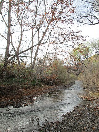
Sonoita Creek is a tributary stream of the Santa Cruz River in Santa Cruz County, Arizona. It originates near and takes its name from the abandoned Pima mission in the high valley near Sonoita. It flows steadily for the first 15 miles (24 km) of its westward course past Patagonia, its bird sanctuary and Patagonia Lake, but sinks beneath the sand seven to eight miles before joining the Santa Cruz River a few miles north of Nogales. This confluence provides water for Tumacácori and Tubac and collects in the marsh lands around San Xavier del Bac downstream, to the north. The Santa Rita Mountains lie to the north and the Canelo Hills, Red Mountain and the Patagonia Mountains lie to the south. Harshaw Creek is a southern tributary which joins the Sonoita near Patagonia. Harshaw Creek drains the area between the Patagonia Mountains to the west and the high San Rafael Valley grasslands to the east. The ghost town of Harshaw lies within its watershed.
The Ramona Valley AVA is an American Viticultural Area located 28 miles (45 km) northeast of the city of San Diego in San Diego County, California, centered on the community of Ramona. It was designated the 162nd American Viticultural Area in January, 2006 by the United States Department of the Treasury Alcohol and Tobacco Tax and Trade Bureau, which recognized the area for its distinctive microclimate, elevation, and soil attributes. Approximately 89,000 acres (360 km2) in area, it is 14.5 miles (23.3 km) long and 9.5 miles (15.3 km) wide. Geographically, the Ramona Valley is described as being a broad, flat valley ringed by hills and mountains that isolate it from the surrounding areas. The valley has an average vineyard elevation of 1,400 feet (430 m) and an annual average rainfall of 16.5 inches (41.9 cm).

The Willamette Valley AVA is an American Viticultural Area which lies in the Willamette Valley of Oregon. The AVA is the wine growing region which encompasses the drainage basin of the Willamette River. It stretches from the Columbia River in the north to just south of Eugene in the south, where the Willamette Valley ends; and from the Oregon Coast Range in the west to the Cascade Mountains in the east. At 5,360 square miles (13,900 km2), it is the largest AVA in the state, and contains most of the state's wineries; approximately 908 as of 2021.

The Southern Oregon AVA is an American Viticultural Area which lies in Southern Oregon, United States. The Southern Oregon AVA was established in 2005 and was created to include the land of two smaller AVAs: the Rogue Valley AVA and the Umpqua Valley AVA. Southern Oregon AVA was established to allow the two principal winegrowing regions in the southern part of the state to market themselves jointly. This creation of a "super-AVA" is a departure from the trend in the Willamette Valley AVA or northern Oregon of establishing smaller AVAs specific to a particular locale's climate or soil conditions.

The Dundee Hills AVA is an American Viticultural Area located in Yamhill County, Oregon. It is entirely contained within the Willamette Valley AVA, and is approximately 28 miles (45 km) southwest of Portland, near the towns of Dundee and Dayton. The area is 6,940 acres (2,809 ha) in total size, with 1,300 acres (526 ha) planted with grapes. The Dundee Hills are a north-south oriented line of hills on the western side of the Willamette River valley. The soil is red in color, rich in iron, relatively infertile, making it suitable for grape cultivation. The region gets 30 inches (76 cm) to 45 inches (114 cm) of rainfall per year. The Chehalem Mountains to the north protect the region from the cool breezes that enter Willamette Valley from the Columbia Gorge. Over 25 wineries and independent vineyards in this region produce over 44,000 cases of wine.
Napa Valley is an American Viticultural Area (AVA) located in Napa County in California's Wine Country. It was established by the Bureau of Alcohol, Tobacco and Firearms (ATF) on January 27, 1981. Napa Valley is considered one of the premier wine regions in the world. Records of commercial wine production in the region date back to the nineteenth century, but premium wine production dates back only to the 1960s.
The Santa Cruz Mountains AVA is an American Viticultural Area centered on the Santa Cruz Mountains. Its territory expands three California counties, Santa Clara, Santa Cruz and San Mateo. Established in 1981 by the Alcohol and Tobacco Tax and Trade Bureau (TTB), Santa Cruz Mountains AVA was among the first to be defined by its mountain topography. Based on elevation, it largely follows the fog line along the coast, extending down to 800 feet (240 m) on the eastern slope toward San Francisco Bay, 400 feet (120 m) on the western slope to the Pacific Ocean and extending toward the ridgecrests at 3000+ feet elevation.

Arizona wine refers to wine made from grapes grown in the U.S. state of Arizona. There are three major regions of vineyards and wineries in Arizona:
Leona Valley AVA is an American Viticulture Area (AVA) in northeastern Los Angeles County, California. It is located in Leona Valley within the Sierra Pelona Mountains of Southern California.

The Chehalem Mountains AVA is an American Viticultural Area (AVA) located in the Yamhill and Washington counties of northwestern Oregon. It contains two sub-regions, Laurelwood District AVA and Ribbon Ridge AVA.
The Sonoita AVA is an American Viticultural Area located in southeast Arizona, south of the city of Tucson. The Sonoita area is a basin surrounded by four mountain ranges, the Huachuca Mountains, the Santa Rita Mountains, the Mustang Mountains, and the Whetstone Mountains. The vineyard plantings are 4,500 to 5,000 feet above sea level, some of the highest in North America. The soil is alluvial fans of gravelly loam that retains scarce water well.

The Grand Valley AVA is an American Viticultural Area located in Mesa County, Colorado, primarily in Grand Junction and Palisade. It is located roughly 200 miles (320 km) southwest of Denver. The high-desert AVA - with an average elevation of between 4,000 and 5,000 feet above sea level - is defined by the irrigated agricultural area served via canals within the Grand Valley of the Colorado River. The AVA was established in 1991 as the first of two Colorado wine regions. The West Elks AVA is the second federally designated AVA in Colorado.
The Central Delaware Valley AVA is an American Viticultural Area located in southeastern Pennsylvania and New Jersey. The wine appellation includes 96,000 acres (38,850 ha) surrounding the Delaware River north of Philadelphia. Its southern boundary is near Titusville, New Jersey, just north of Trenton, and its northern border is near Musconetcong Mountain. A variety of Vitis vinifera and Vitis labrusca grape varieties can be grown in the area. It has a hot-summer humid continental climate (Dfa) and is in hardiness zones 6b and 7a.
Snipes Mountain AVA is an American Viticultural Area located in the Yakima Valley of Washington State. It was approved by the Bureau of Alcohol, Tobacco, Firearms and Explosives on January 21, 2009 making it Washington's 10th federally designated AVA. It is the second smallest AVA in the state, after the Red Mountain AVA, and has one of the state's longest viticultural histories. The 4,145 acres (1,677 ha) appellation is a sub-AVA of the Yakima Valley AVA and the Columbia Valley AVA. It is located above and between the towns of Sunnyside and Granger around Outlook, Washington, in the southeast corner of the Yakima Valley.

The Peloncillo Mountains of Cochise County is a mountain range in northeast Cochise County, Arizona. A northern north–south stretch of the range extends to the southern region of Greenlee County on the northeast, and a southeast region of Graham County on the northwest. The north stretch of the Peloncillo's forms the border between the two counties. It lies east and northeast of the Willcox Playa, and the San Simon Valley.

The Willcox Playa is a large endorheic dry lake or sink (playa) adjacent to Willcox, Arizona in Cochise County, in the southeast corner of the state. It is part of the Sonoran Desert ecoregion and is the remnant of a Pleistocene era pluvial Lake Cochise. Portions of the dry lake bed have been used as a bombing range by the US military. Most of this area is currently used by the Electronic Proving Ground, based at Fort Huachuca. It was designated a National Natural Landmark in 1966 for its fossil pollen captured underground, the thousands of sandhill cranes that roost in the area and the largest diversity of tiger beetles in the United States.
References
- 1 2 "Willcox AVA". University of Arizona. Retrieved December 19, 2020.
- ↑ Ruelas, Richard (September 13, 2016). "Willcox wins federal designation as a unique Arizona wine region". azcentral. Retrieved December 19, 2020.
- 1 2 3 "Establishment of the Willcox Viticultural Area" (TTB-2016-0002-0007). Federal Register. Alcohol and Tobacco Tax and Trade Bureau. September 12, 2016. Retrieved November 21, 2020.
- ↑ Burch, Cathelina (September 10, 2016). "Willcox takes big step up in wine world". Arizona Daily Star. Retrieved December 19, 2020.
- ↑ Selinger, Hannah (March 26, 2020). "Exploring the Diverse, Terroir-Driven Wines of the American Southwest". Wine Enthusiast. Retrieved December 19, 2020.