William Hewett (died 1840)

Last updated

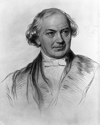
William Hewett was a Royal Navy officer noted for making the first comprehensive survey of the North Sea and for his work on tides.

Chart of the Coasts of Brazil incorporating Hewett's survey work Laurie's General Chart of the Coasts of Brasil commonwealth 5138jp45w, Published 1861.jpg
Chart of the Coasts of Brazil incorporating Hewett's survey work

Hewett went to sea in HMS Indefatigable first in the war with France, from 1805 to 1811, and in China in 1811. He then joined HMS Cornwall as midshipman. From 1813 he served in HMS Inconstant, and carried out a number of surveys on the coast of Brazil, including Maranhão, Ceará and Bahia. He was made an acting Lieutenant in 1814, which was confirmed in 1815. [1] [2] [3]

Part of Admiralty Chart No 1630 showing the Leman and Ower Shoals Admiralty Chart No 1630 England East Coast. Orford Ness to Blakeney with the off lying shoals between Smith's Knoll and the outer Dowsing, Published 1888 Leman and Ower Shoals.jpg
Part of Admiralty Chart No 1630 showing the Leman and Ower Shoals

Hewett's first command was the surveying vessel HMS Protector. From 1818 to 1830 he carried out surveys of the east coast of England, an area noted for dangerous and often shifting shoals. [1] [4] :104 Hewett's description of the Leman and Ower banks, off the coast of Norfolk is given in full in the North Sea Sailing Directions of 1846. [5] Other areas surveyed included Yarmouth Roads, [6] the entrance to the Humber estuary, Lynn and Boston Deeps, The Gabbards and the Dudgeon. He also made recommendations for improvement of navigation of the coast, in particular regarding positioning of lighthouses and light vessels. He tested nautical inventions and trial compasses, reporting results to the Admiralty's committees. [1] [2] [7]

In 1830, Hewett was promoted to Commander, and in 1831 took command of HMS Fairy. He began his great work of surveying the North Sea to the Dutch coast and including the Dogger Bank. Four chronometers were supplied for determining longitude. [4] :240–242 As well as normal surveying work, Hewett was engaged to test the theory of William Whewell who had suggested that between the Suffolk and Dutch coasts there should be a point at which there would be neither rise nor fall of the tide [8] - what is now known as an amphidromic point. This involved anchoring the ship and taking repeated soundings at the same location with lead and line, precautions being needed to allow for irregularities in the sea bed, and the effects of tidal flow. The data supported Whewell's prediction, with a rise of no more than 1 foot (0.30 m). [9] [10]

The North Sea survey was nearing completion, when, on 13 November 1840, sailing from near Orfordness to Yarmouth, Fairy was lost with all hands in a great gale. For several days there was doubt as to her fate. Francis Beaufort, the hydrographer who had initiated the survey knew the Fairy to be a sound ship, and Hewett to be a fine seaman. He thought she might have run for shelter to Norway. A search was started and a reward was offered for information. But eventually it became clear that the ship was lost. [4] :240–242 [11] A substantial fund was raised for the widows and children of those lost in the disaster. Hewett's widow had lost not only her husband, but a son and brother. [12]

Admiralty Chart No 2182 The North Sea sheet II, surveyed by Captains Hewett and Washington Admiralty Chart No 2182 The North Sea, sheet II from Orfordness to Flamborough and Scheveningen to the Texel. Surveyed by Captains Hewett and Washington R.N. in H.M. SS Fairy and Blazer. RMG L1211, Published 1853.tiff
Admiralty Chart No 2182 The North Sea sheet II, surveyed by Captains Hewett and Washington

The data from Hewett's ten years of work on the survey, including 30,000 soundings, were safe. [13] Captain John Washington in HMS Shearwater completed the survey, and confirmed Hewett's tidal findings. [14] The survey of the North Sea was published as three sheets, the first, of the southern part, as Admiralty Chart No. 1406 in 1842, [15] [4] :240–242 [16] and sheets II and III as Chart Nos. 2182 and 2248 in 1853–4. [17]

Related Research Articles

<span class="mw-page-title-main">William Whewell</span> 19th-century English scientist and theologian

William Whewell was an English polymath, scientist, Anglican priest, philosopher, theologian, and historian of science. He was Master at Trinity College, Cambridge. In his time as a student there, he achieved distinction in both poetry and mathematics.

<span class="mw-page-title-main">Francis Beaufort</span> Irish hydrographer

Sir Francis Beaufort was an Irish hydrographer, creator of the Beaufort cipher and the Beaufort scale, and naval officer.

<span class="mw-page-title-main">Thomas Abel Brimage Spratt</span> Royal Navy admiral

Thomas Abel Brimage Spratt was an English vice-admiral, hydrographer, and geologist.

<span class="mw-page-title-main">United Kingdom Hydrographic Office</span> UK government agency concerned with providing hydrographic and marine geospatial data

The United Kingdom Hydrographic Office (UKHO) is the UK's agency for providing hydrographic and marine geospatial data to mariners and maritime organisations across the world. The UKHO is a trading fund of the Ministry of Defence (MoD) and is located in Taunton, Somerset, with a workforce of approximately 900 staff.

<span class="mw-page-title-main">Admiralty chart</span> Nautical chart

Admiralty charts are nautical charts issued by the United Kingdom Hydrographic Office (UKHO) and subject to Crown Copyright. Over 3,500 Standard Nautical Charts (SNCs) and 14,000 Electronic Navigational Charts (ENCs) are available with the Admiralty portfolio offering the widest official coverage of international shipping routes and ports, in varying detail.

<span class="mw-page-title-main">Henry Mangles Denham</span> British Royal Navy officer

Vice Admiral Sir Henry Mangles Denham was a Royal Navy officer who went on to be Commander-in-Chief, Pacific Station.

<span class="mw-page-title-main">Sailing Directions</span> Details of routes for coastal navigation

Sailing Directions are written directions that describe the routes to be taken by boats and ships during coastal navigation and port approaches. There are also products known as Sailing Directions, which are books written by various Hydrographic Offices throughout the world. They are known as Pilot Books, because they provide local knowledge of routes and landmarks, which would typically be provided by a local marine pilot. As such, they are used frequently by naval and government vessels, who are exempted from 'Compulsory Pilotage' in many ports.

<span class="mw-page-title-main">Winterton Lighthouse</span> Lighthouse

Winterton Lighthouse is located in Winterton-on-Sea in the English county of Norfolk. In 1845 Winterton Ness was described as being 'well known to the mariner as the most fatal headland between Scotland and London'. As well as marking the headland, the lighthouse was intended to help guide vessels into the Cockle Gat, which provided the northern entry into the safe water of Yarmouth Roads. The lighthouse was known to Daniel Defoe and is mentioned in his novel Robinson Crusoe.

<span class="mw-page-title-main">F. W. L. Thomas</span>

Captain Frederick William Leopold Thomas, c.1812–1885, RN, FSA (Scot) was a naval officer, photographer, and historian, noted for his surveys of Scotland, and for taking the first photographs of St Kilda.

<i>The Nautical Magazine</i> Monthly seafaring magazine

The Nautical Magazine was a monthly magazine containing articles of general interest to seafarers. The magazine was first published in 1832 by Simpkin, Marshall, and Co. (London) as The Nautical Magazine: A Journal of Papers on Subjects Connected with Maritime Affairs in General and then as The Nautical Magazine And Naval Chronicle. From 1891 the title was modified to Nautical Magazine and Journal of the Royal Naval Reserve and it was published by Brown, Son and Ferguson, (Glasgow), who continued to produce it until it was acquired and merged into Sea Breezes in 2011.

HMS <i>Herald</i> (1824) Atholl-class corvette launched in 1822

HMS Herald was an Atholl-class 28-gun sixth-rate corvette of the Royal Navy. She was launched in 1822 as HMS Termagant, commissioned in 1824 as HMS Herald and converted to a survey ship in 1845. After serving as a chapel ship from 1861, she was sold for breaking in 1862.

<span class="mw-page-title-main">John Washington (Royal Navy officer)</span> English naval officer and hydrographer

John Washington was an officer of the Royal Navy, Hydrographer of the Navy, and a founding member of the Royal Geographical Society of London.

HMS <i>Porcupine</i> (1844) British survey ship

HMS Porcupine was a Royal Navy 3-gun wooden paddle steamer. It was built in Deptford Dockyard in 1844 and served as a survey ship. It was first employed in the survey of the Thames Estuary by Captain Frederick Bullock.

<span class="mw-page-title-main">Henry Charles Otter</span>

Henry Charles Otter was a Royal Navy officer and hydrographic surveyor, noted for his work in charting Scotland in the mid-19th century. He was active in surveying in the Baltic Sea during the war with Russia (1853-6) and in supporting the laying of the first transatlantic telegraph cable in 1858.

<span class="mw-page-title-main">HMS Shearwater (1837)</span>

HMS Shearwater was a wooden paddle steamer which became the main surveying vessel in the UK in the 1840s. Shearwater was built in Harwich in 1826 for the Post Office, transferred to the Royal Navy in 1837, and equipped for surveying at Woolwich in 1841. Her length was 137', beam 23'.

<span class="mw-page-title-main">George Thomas (surveyor)</span>

George Thomas was a Master in the Royal Navy who was one of the early surveyors of the coasts of Great Britain

<span class="mw-page-title-main">Frederick Bullock (Royal Navy officer)</span>

Admiral Frederick Bullock was a Royal Navy officer noted for his work as a surveyor, particularly in the Thames Estuary.

<span class="mw-page-title-main">Michael Atwell Slater</span>

Michael Atwell Slater was a Royal Navy Officer and hydrographic surveyor particularly noted for his survey work in the north-east of England and the east of Scotland.

<span class="mw-page-title-main">Edward Killwick Calver</span>

Edward Killwick Calver was a Captain in the Royal Navy, and hydrographic surveyor. He is particularly noted for his surveying work in the east of Britain, and as the captain of HMS Porcupine, in oceanographic voyages in 1869 and 1870.

<span class="mw-page-title-main">Richard Hoskyn</span>

Richard Hoskyn (1811-1873) was a Royal Navy officer and hydrographic surveyor. He discovered the site of Ancient Kaunos in what is now southern Turkey, surveyed much of the coast of Ireland, carried out deep-sea sounding in preparation for the laying of telegraphic cables, and became superintendent of charts for the UK Admiralty.

References

  1. 1 2 3 "Loss of the Fairy". The Nautical Magazine: 116–130. 1841.
  2. 1 2 Dawson, Llewellyn Styles (1885). Memoirs of hydrography, including brief biographies of the principal officers who have served in H.M. Naval Surveying Service between the years 1750 and 1885. Part 1 - 1750-1830. Eastbourne: Henry W. Keay. pp. 56–57.
  3. Purdy, J. (1822). Memoir, Descriptive and Explanatory, to Accompany the New Chart of the Ethiopic Or Southern Atlantic Ocean, with the Western Coasts of South-America, from Cape Horn to Panama. London: R.H. Laurie. pp. 9–10.
  4. 1 2 3 4 Ritchie, G.S. (1967). The Admiralty Chart. London: Hollis & Carter.
  5. Norie, John William (1846). New and extensive sailing directions for the navigation of the North sea. London: Charles Wilson. pp. 34–35.
  6. Hewett, William (1837). "Yarmouth Roads". The Nautical Magazine: 105–108.
  7. Hewett, William (1854). "Becher's mercurial marine artificial horizon (Letter dated 1834)". The Nautical Magazine: 203–208.
  8. Whewell, William (1836). "Researches on the tides, sixth series. On the results of an extensive system of tide observations made on the coasts of Europe and America in June 1835". Philosophical Transactions of the Royal Society of London. 126: 289–341.
  9. Hewett, William (1841). "Tide observations in the North Sea". The Nautical Magazine: 180–183.
  10. Cartwright, David Edgar (17 August 2000). Tides: A Scientific History. Cambridge University Press. ISBN   978-0-521-79746-7. OCLC   1001932580.
  11. Rice, Tony (1986). British Oceanographic Vessels 1800-1950. London: The Ray Society. p. 70. ISBN   0903874199.
  12. "Memorial of Mrs. Hewett". The Nautical Journal: 425–427. 1841.
  13. "Loss of the Fairy". The Nautical Journal: 7. 1841.
  14. Washington, John (1842). "Tide Observations - North Sea - Professor Whewell's Theory". The Nautical Magazine: 566–569.
  15. "The North Sea - Sheet 1 - From Dover and Calais to Orfordness and Scheveningen". The Nautical Magazine: 289–291. 1845.
  16. Day, Sir Archibald. The Admiralty Hydrographic Service, 1795-1919. H.M. Stationery Office. p. 50. OCLC   1082894797.
  17. Dunsterville, Edward (1860). Admiralty Catalogue of Charts, Plans, Views, and Sailing Directions, &c (PDF). London: Her Majesty's Stationery Office. p. 20.