
Umbriel is a moon of Uranus discovered on October 24, 1851, by William Lassell. It was discovered at the same time as Ariel and named after a character in Alexander Pope's 1712 poem The Rape of the Lock. Umbriel consists mainly of ice with a substantial fraction of rock, and may be differentiated into a rocky core and an icy mantle. The surface is the darkest among Uranian moons, and appears to have been shaped primarily by impacts. However, the presence of canyons suggests early endogenic processes, and the moon may have undergone an early endogenically driven resurfacing event that obliterated its older surface.
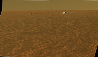
The Meridiani Planum (alternately Meridiani plain, Meridiani plains, Terra Meridiani, or Terra Meridiani plains) is either a large plain straddling the equator of Mars and covered with a vast number of spherules containing a lot of iron oxide or a region centered on this plain that includes some adjoining land. The plain sits on top of an enormous body of sediments that contains a lot of bound water. The iron oxide in the spherules is crystalline (grey) hematite (Fe203).

The geology of Venus is the scientific study of the surface, crust, and interior of the planet Venus. Of all the other planets in the Solar System, it is the one nearest to Earth and most like it in terms of mass, but has no magnetic field or recognizable plate tectonic system. Much of the ground surface is exposed volcanic bedrock, some with thin and patchy layers of soil covering, in marked contrast with Earth, the Moon, and Mars. Some impact craters are present, but Venus is similar to Earth in that there are fewer craters than on the other rocky planets that are largely covered by them. This is due in part to the thickness of the Venusian atmosphere disrupting small impactors before they strike the ground, but the paucity of large craters may be due to volcanic re-surfacing, possibly of a catastrophic nature. Volcanism appears to be the dominant agent of geological change on Venus. Some of the volcanic landforms appear to be unique to the planet. There are shield and composite volcanoes similar to those found on Earth. Given that Venus has approximately the same size, density, and composition as Earth, it is plausible that volcanism may be continuing on the planet today, as demonstrated by recent studies.

Elysium, located in the Elysium and Cebrenia quadrangles, is the second largest volcanic region on Mars, after Tharsis. The region includes the volcanoes Hecates Tholus, Elysium Mons and Albor Tholus. The province is centered roughly on Elysium Mons at 24.7°N 150°E. Elysium Planitia is a broad plain to the south of Elysium, centered at 3.0°N 154.7°E. Another large volcano, Apollinaris Mons, lies south of Elysium Planitia and is not part of the province. Besides having large volcanoes, Elysium has several areas with long trenches, called fossa or fossae (plural) on Mars. They include the Cerberus Fossae, Elysium Fossae, Galaxias Fossae, Hephaestus Fossae, Hyblaeus Fossae, Stygis Fossae and Zephyrus Fossae.
The classical albedo features of Mars are the light and dark features that can be seen on the planet Mars through an Earth-based telescope. Before the age of space probes, several astronomers created maps of Mars on which they gave names to the features they could see. The most popular system of nomenclature was devised by Giovanni Schiaparelli, who used names from classical antiquity. Today, the improved understanding of Mars enabled by space probes has rendered many of the classical names obsolete for the purposes of cartography; however, some of the old names are still used to describe geographical features on the planet.

The atmosphere of Mars is the layer of gases surrounding Mars. It is primarily composed of carbon dioxide (95%), molecular nitrogen (2.8%), and argon (2%). It also contains trace levels of water vapor, oxygen, carbon monoxide, hydrogen, and noble gases. The atmosphere of Mars is much thinner than Earth's. The average surface pressure is only about 610 pascals (0.088 psi) which is less than 1% of the Earth's value. The currently thin Martian atmosphere prohibits the existence of liquid water on the surface of Mars, but many studies suggest that the Martian atmosphere was much thicker in the past. The higher density during spring and fall is reduced by 25% during the winter when carbon dioxide partly freezes at the pole caps. The highest atmospheric density on Mars is equal to the density found 35 km (22 mi) above the Earth's surface and is ≈0.020 kg/m3. The atmosphere of Mars has been losing mass to space since the planet's core slowed down, and the leakage of gases still continues today. The atmosphere of Mars is colder than Earth's. Owing to the larger distance from the Sun, Mars receives less solar energy and has a lower effective temperature, which is about 210 K. The average surface emission temperature of Mars is just 215 K, which is comparable to inland Antarctica. Although Mars' atmosphere consists primarily of carbon dioxide, the greenhouse effect in the Martian atmosphere is much weaker than Earth's: 5 °C (9.0 °F) on Mars, versus 33 °C (59 °F) on Earth. This is because the total atmosphere is so thin that the partial pressure of carbon dioxide is very weak, leading to less warming. The daily range of temperature in the lower atmosphere is huge due to the low thermal inertia; it can range from −75 °C (−103 °F) to near 0 °C (32 °F) near the surface in some regions. The temperature of the upper part of the Martian atmosphere is also significantly lower than Earth's because of the absence of stratospheric ozone and the radiative cooling effect of carbon dioxide at higher altitudes.

An ejecta blanket is a generally symmetrical apron of ejecta that surrounds an impact crater; it is layered thickly at the crater's rim and thin to discontinuous at the blanket's outer edge. The impact cratering is one of the basic surface formation mechanisms of the solar system bodies and the formation and emplacement of ejecta blankets are the fundamental characteristics associated with impact cratering event. The ejecta materials are considered as the transported materials beyond the transient cavity formed during impact cratering regardless of the state of the target materials.

The geology of Mars is the scientific study of the surface, crust, and interior of the planet Mars. It emphasizes the composition, structure, history, and physical processes that shape the planet. It is analogous to the field of terrestrial geology. In planetary science, the term geology is used in its broadest sense to mean the study of the solid parts of planets and moons. The term incorporates aspects of geophysics, geochemistry, mineralogy, geodesy, and cartography. A neologism, areology, from the Greek word Arēs (Mars), sometimes appears as a synonym for Mars's geology in the popular media and works of science fiction. The term areology is also used by the Areological Society.

Kuiper is a moderate-size crater with a central peak cluster located at 11.35°S 31.23°W on Mercury. It is 62 kilometers in diameter and was named after Dutch-American astronomer Gerard Kuiper in 1976. It is one of only 2 Mercurian craters which are named not after artists, and one of very few cases when the same name is used for 3 craters. Gerard Kuiper, being a leader of American planetary science, died shortly before the first images of Mercurian surface were made.
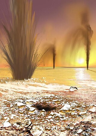
Martian geysers are putative sites of small gas and dust eruptions that occur in the south polar region of Mars during the spring thaw. "Dark dune spots" and "spiders" – or araneiforms – are the two most visible types of features ascribed to these eruptions.

The Arcadia quadrangle is one of a series of 30 quadrangle maps of Mars used by the United States Geological Survey (USGS) Astrogeology Research Program. The quadrangle is located in the north-central portion of Mars’ western hemisphere and covers 240° to 300° east longitude and 30° to 65° north latitude. The quadrangle uses a Lambert conformal conic projection at a nominal scale of 1:5,000,000 (1:5M). The Arcadia quadrangle is also referred to as MC-3.

Dark slope streaks are narrow, avalanche-like features common on dust-covered slopes in the equatorial regions of Mars. They form in relatively steep terrain, such as along escarpments and crater walls. Although first recognized in Viking Orbiter images from the late 1970s, dark slope streaks were not studied in detail until higher-resolution images from the Mars Global Surveyor (MGS) and Mars Reconnaissance Orbiter (MRO) spacecraft became available in the late 1990s and 2000s.

Lobate debris aprons (LDAs) are geological features on Mars, first seen by the Viking Orbiters, consisting of piles of rock debris below cliffs. These features have a convex topography and a gentle slope from cliffs or escarpments, which suggest flow away from the steep source cliff. In addition, lobate debris aprons can show surface lineations as do rock glaciers on the Earth.

Astapus Colles is a group of hills in the Casius quadrangle of Mars, located at 35.5 North and 272.3 West. It is 580 km across and was named after an albedo feature at 35N, 269W. The term "Colles" is used for small hills or knobs.

During past ages, there was rain and snow on Mars; especially in the Noachian and early Hesperian epochs. Some moisture entered the ground and formed aquifers. That is, the water went into the ground, seeped down until it reached a formation that would not allow it to penetrate further. Water then accumulated forming a saturated layer. Deep aquifers may still exist.

The Amazonian is a geologic system and time period on the planet Mars characterized by low rates of meteorite and asteroid impacts and by cold, hyperarid conditions broadly similar to those on Mars today. The transition from the preceding Hesperian period is somewhat poorly defined. The Amazonian is thought to have begun around 3 billion years ago, although error bars on this date are extremely large. The period is sometimes subdivided into the Early, Middle, and Late Amazonian. The Amazonian continues to the present day.
Transverse aeolian ridges (TARs) are visually bright features commonly found in topographic depressions on Mars. These small-scale and relict bedforms were first seen in narrow-angle images from the Mars Orbiter Camera (MOC) and were called “ridges” to preserve both dunes and ripples as formative mechanisms. While TARs are widespread on Mars, their formation, age, composition, and role in past Martian sediment cycles remain poorly constrained.

Louth is an impact crater on Mars located at 70.19°N 103.24°E in the Mare Boreum quadrangle. Located within Vastitas Borealis, the crater has a diameter of 36.29 kilometres and is named after Louth, a town in Ireland.
