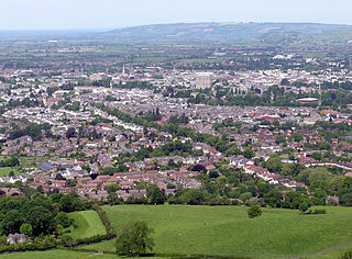
Wingmoor Farm Meadow

Last updated
Wingmoor Farm Meadow

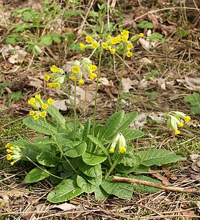
Cowslips. - geograph.org.uk - 162051.jpg

Example - Cowslips (Primula veris)
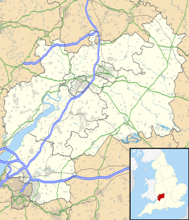
Gloucestershire UK location map.svg
Red pog.svg
Wingmoor Farm Meadow shown within Gloucestershire
Type Gloucestershire Wildlife Trust nature reserve
Location Severn Vale north of Cheltenham
Coordinates 51°56′40.6″N2°5′32.4″W / 51.944611°N 2.092333°W / 51.944611; -2.092333 Coordinates: 51°56′40.6″N2°5′32.4″W / 51.944611°N 2.092333°W / 51.944611; -2.092333
Area 7.4 acres (3.0 ha)
Created 1990
Operated by Gloucestershire Wildlife Trust
Status Access by permit

Wingmoor Farm Meadow (grid reference SO937273 ) is a 3-hectare (7.4-acre) nature reserve in Gloucestershire. [1] The site is listed in the ‘Tewkesbury Borough Local Plan to 2011’, adopted March 2006, Appendix 3 'Nature Conservation',' as a Key Wildlife Site (KWS). [2]

Ordnance Survey National Grid System of geographic grid references used in Great Britain

The Ordnance Survey National Grid reference system is a system of geographic grid references used in Great Britain, distinct from latitude and longitude. It is often called British National Grid (BNG).

Gloucestershire County of England

Gloucestershire is a county in South West England. The county comprises part of the Cotswold Hills, part of the flat fertile valley of the River Severn, and the entire Forest of Dean.

Contents

The site is managed by the Gloucestershire Wildlife Trust under lease agreement from the Grundon Group.

Gloucestershire Wildlife Trust organization

The Gloucestershire Wildlife Trust is the Gloucestershire local partner in a conservation network of 47 Wildlife Trusts. The Wildlife Trusts are local charities with the specific aim of protecting the United Kingdom's natural heritage. The Gloucestershire Wildlife Trust is managed by a Board of Trustees elected from its membership who provide overall direction for the development of the Trust and there are Advisory Committees. The work of the trust is carried out through staff and volunteers.

Location and habitat

The meadow is about three miles north of Cheltenham near Stoke Orchard and Bishop's Cleeve. It is in the Severn Vale. It is a single meadow within an area of gravel extraction and reclamation. [1]

Cheltenham Place in England

Cheltenham is a regency spa town and borough on the edge of the Cotswolds in Gloucestershire, England. Cheltenham has been a health and holiday spa town resort since the discovery of mineral springs in 1716 and has a number of internationally renowned and historic schools.

Stoke Orchard village in United Kingdom

Stoke Orchard is a village or hamlet north-west of Cheltenham in Gloucestershire, England.

Bishops Cleeve village in United Kingdom

Bishop's Cleeve is a village in the Borough of Tewkesbury, Gloucestershire, North of Cheltenham. The village lies at the foot of Cleeve Hill, the highest point in the Cotswolds and borders Woodmancote on the East side of the Gloucestershire Warwickshire railway line that splits the two parishes. Bishop's Cleeve has a population of 10,612 (2011), which today is estimated to be over 17,000 (2018), the village saw rapid growth during the 20th century as a result of the construction of Smiths Aerospace factory near the village after the Second World War.

The field is narrow ridge-and-furrow. This is created by the way it has been ploughed. Views on the purpose of ridge-and-furrow range from the wish to increase the surface area of the field to improving the drainage systems. The soils of the Severn Vale are clay so this kind of management would help to achieve improved drainage. Many fields in the Vale of Gloucester and the Midlands were traditionally ridge-and-furrow meadows, but are now rare. [1]

Ridge and furrow Archaeological pattern of ridges and troughs created by a system of ploughing used in Europe during the Middle Ages, typical of the open field system

Ridge and furrow is an archaeological pattern of ridges and troughs created by a system of ploughing used in Europe during the Middle Ages, typical of the open field system. It is also known as rigand furrow, mostly in the North East of England and in Scotland.

There is a field pond site in the north-west corner. [1]

Flora

The meadow is unimproved grassland and supports a variety of plants. There is a mixture of plants which flourish on neutral and calcareous soils. The ridges support a diverse flora and these include Cowslip, Burnet-saxifrage, Common Restharrow, Pepper-saxifrage (Silaum silaus) and Field Scabious. Lady's Bedstraw and Meadow Barley are also recorded. The furrows being damper support Tufted Hair-grass, Cock's-foot and Hard Rush (Juncus inflexus). [1]

<i>Primula veris</i> species of plant

Primula veris is a herbaceous perennial flowering plant in the primrose family Primulaceae. The species is native throughout most of temperate Europe and western Asia, and although absent from more northerly areas including much of northwest Scotland, it reappears in northernmost Sutherland and Orkney and in Scandinavia. This species frequently hybridizes with other Primulas such as Primula vulgaris to form false oxlip which is often confused with true oxlip, a much rarer plant.

<i>Juncus</i> genus of plants

Juncus is a genus of monocotyledonous flowering plants, commonly known as rushes. It is the largest genus in the family Juncaceae, containing around 300 species.

The pond is surrounded by Willow and Hawthorn. There is a line of Crack Willow on the western edge of the meadow. There are mixed hedges on the remaining sides. [1]

Conservation

Meadow management to preserve and to increase species of flowers requires hay-cutting followed by grazing by sheep. [1]

Publications

Related Research Articles

Coombe Hill Canal

Coombe Hill Canal lies in the Vale of Gloucester, south west England, north of Leigh and runs west 2.75 miles (4.43 km) from Coombe Hill Basin to the River Severn near Wainlode Hill. It opened in 1796 and closed 80 years later in 1876, after the only lock was damaged by flooding. The Gloucestershire Wildlife Trust purchased the Coombe Hill Canal nature reserve in 1985 and the area is managed by the trust. Adjacent to the Coombe Hill Canal is a large area of wet meadowland situated midway between Gloucester and Tewkesbury to the west of the A38, which was purchased by the trust in 1999. There is a north and a south meadow. This land and the Canal itself often flood in winter, which attracts hundreds of wildfowl.
Lower Woods

Lower Woods is a 280.1-hectare (692-acre) biological and geological Site of Special Scientific Interest near the village of Wickwar, South Gloucestershire, notified in 1966 and renotified in 1985. The site area has increased at last revision in 1974 to a 284.1-hectare (702-acre) site. The site is a nature reserve managed by the Gloucestershire Wildlife Trust.

Midger

Midger is a 65.7-hectare (162-acre) biological Site of Special Scientific Interest straddling the border of Gloucestershire and South Gloucestershire, notified in 1966 and renotified in 1984. Since the last revision in 1974, the size has been reduced to a 56-hectare (140-acre) site. It lies east of Hillesley, Gloucestershire and north of Hawkesbury Upton, South Gloucestershire. It is at the head of the Kilcott Valley.

Ashleworth Ham

Ashleworth Ham is a 104.73-hectare (258.8-acre) biological Site of Special Scientific Interest. It is a large area of grassland on the Severn floodplain, north of Ashleworth in Gloucestershire, England. It is registered as a Site of Special Scientific Interest and was notified in 1974 and renotified in 1985. Ashleworth Ham received this designation because it is one of three sites in the Severn Vale where migratory waterfowl winter.
Dowdeswell Reservoir

Dowdeswell Reservoir and former water treatment works lie below the parish of Dowdeswell in Gloucestershire. They were originally built by Cheltenham Corporation to supply the town of Cheltenham with drinking water and subsequently became part of the Severn Trent network.

Chaceley Meadow SSSI

Chaceley Meadow is a 1.8-hectare (4.4-acre) biological Site of Special Scientific Interest in Gloucestershire, notified in 1954 and renotified in 1993. It lies on the eastern edge of Chaceley village and is about half a mile west of the River Severn.

Box Farm Meadows SSSI

Box Farm Meadows is a 8.3-hectare (21-acre) biological Site of Special Scientific Interest in Gloucestershire, notified in 1985. This was formerly known as Balls Green Pastures. The reserve is situated at the southern edge of Box village and one mile east of Nailsworth.

Clarkes Pool Meadow SSSI

Clarke's Pool Meadow is a 1.8-hectare (4.4-acre) biological Site of Special Scientific Interest in Gloucestershire, notified in 1997. It lies on the flat top of 'Old Hill' about half a mile south of Blakeney. The site consists of two fields which were purchased by the Gloucestershire Wildlife Trust in 1997. The site was designated an SSSI in the same year and it is one of the finest surviving traditional hay meadows in Gloucestershire.

Salmonsbury Meadows SSSI

Salmonsbury Meadows is an 18-hectare (44-acre) biological and geological Site of Special Scientific Interest in Gloucestershire, notified in 1985. The site is listed in the 'Cotswold District' Local Plan 2001-2011 as a Key Wildlife Site (KWS).

Laymoor Quag

Laymoor Quag is a 3.5-hectare (8.6-acre) nature reserve within the Forest of Dean in Gloucestershire. The site is listed in the 'Forest of Dean Local Plan Review' as a Key Wildlife Site (KWS).

Ridley Bottom, Tidenham human settlement in United Kingdom

Ridley Bottom is a 1.1-hectare (2.7-acre) nature reserve in Gloucestershire. The site is listed in the 'Forest of Dean Local Plan Review' as a Key Wildlife Site (KWS).

Vell Mill Daffodil Meadow

Vell Mill Daffodil Meadow is a 2.1-hectare (5.2-acre) nature reserve in Gloucestershire.

Gwen and Veras Fields human settlement in United Kingdom

Gwen and Vera's Fields is a 0.28-hectare (0.69-acre) nature reserve in Gloucestershire.

Plump Hill Dolomite Quarry

Plump Hill Dolomite Quarry is a 4.5-hectare (11-acre) nature reserve in Gloucestershire in the Forest of Dean.
Wigpool human settlement in United Kingdom

Wigpool is a 7.5-hectare (19-acre) nature reserve in Gloucestershire in the Forest of Dean.

Mitcheldean Meend Marsh

Mitcheldean Meend Marsh is a 0.7-hectare (1.7-acre) nature reserve in Gloucestershire in the Forest of Dean. The site is listed in the 'Forest of Dean Local Plan Review' as a Key Wildlife Site (KWS).

Mythe Railway Nature Reserve

Mythe Railway Nature Reserve is a 2.8-hectare (6.9-acre) nature reserve in Gloucestershire. The site is listed in the ‘Tewkesbury Borough Local Plan to 2011’, adopted March 2006, Appendix 3 'Nature Conservation',' as a Key Wildlife Site (KWS).

Neu-Lindsey Nature Reserve

Neu-Lindsey Nature Reserve is a 0.4-hectare (0.99-acre) nature reserve in Gloucestershire. The site is listed in the ‘Stroud District’ Local Plan, adopted November 2005, Appendix 6 as a Key Wildlife Site (KWS).
Snows Farm Nature Reserve

Snows Farm Nature Reserve is a 21.3-hectare (53-acre) nature reserve in Gloucestershire. The site is listed in the ‘Stroud District’ Local Plan, adopted November 2005, Appendix 6 as a Key Wildlife Site (KWS).

Three Groves Wood

Three Groves Wood is a 3.3-hectare (8.2-acre) nature reserve in Gloucestershire. The site is listed in the ‘Stroud District’ Local Plan, adopted November 2005, Appendix 6 as a Key Wildlife Site (KWS).

References

  1. 1 2 3 4 5 6 7 Kelham, A, Sanderson, J, Doe, J, Edgeley-Smith, M, et al., 1979, 1990, 2002 editions, 'Nature Reserves of the Gloucestershire Trust for Nature Conservation/Gloucestershire Wildlife Trust'
  2. Tewkesbury Borough Local Plan to 2011, adopted March 2006, Appendix 3 'Nature Conservation', Key Wildlife Sites