
West Dorset was a local government district in Dorset, England. Its council was based in Dorchester. The district was formed on 1 April 1974, under the Local Government Act 1972, and was a merger of the boroughs of Bridport, Dorchester and Lyme Regis, along with Sherborne urban district, and the rural districts of Beaminster, Bridport, Dorchester and Sherborne.
Winterbourne may refer to:

Milborne St Andrew is a village and civil parish in the county of Dorset in southern England. It is situated on the A354 road, 9 miles northeast of the county town Dorchester, in a winterbourne valley on the dip slope of the Dorset Downs. In the 2011 census the parish had 472 dwellings, 453 households and a population of 1,062.

Winterborne St Martin, commonly known as Martinstown, is a village and civil parish in southwest Dorset, England, situated 4 miles (6.4 km) south-west of Dorchester, beside Maiden Castle. In 2013 the estimated population of the civil parish was 780.

Winterborne Monkton is a small village and civil parish in the county of Dorset in southern England. It lies close to the A354 road between the county town Dorchester, 1.5 miles (2.4 km) to the north, and the coastal resort Weymouth, 5 miles (8.0 km) to the south. Dorset County Council's 2013 mid-year estimate of the parish population was 50.

Winterborne Whitechurch, also Winterborne Whitchurch, is a village and civil parish in central Dorset, England, situated in a winterbourne valley on the A354 road on the Dorset Downs five miles southwest of Blandford Forum. In the 2011 census the civil parish had 354 dwellings, 331 households and a population of 757.

Winterborne Zelston is a village and civil parish in north Dorset, England. It is situated in a winterbourne valley on the A31 road eight miles south of Blandford Forum and 10 mi (16 km) northwest of Poole. The parish had a population of 141 in 2001. In 2013 the estimated population of the civil parish was 90.

Winterbourne Steepleton is a village and civil parish in south west Dorset, England, situated in a winterbourne valley 5 miles (8.0 km) west of Dorchester, next to the village of Winterbourne Abbas. The name of the village derives from its site next to a seasonal winterbourne stream and from having a stone church steeple - one of only three medieval stone spires in the county. In the 2011 census the parish had a population of 297.
A winterbourne is a stream or river that is dry through the summer months. A winterbourne is sometimes simply called a bourne, from the Anglo-Saxon word for a stream flowing from a spring, although this term can also be used for all-year water courses.

South Dorset is a constituency represented in the House of Commons of the UK Parliament since 2010 by Richard Drax, a Conservative. The constituency was created as a consequence of the Redistribution of Seats Act 1885, although the area covered has changed since then.
Culliford Tree Hundred was a hundred in the county of Dorset, England, containing the following parishes:
St George's Hundred, later often George Hundred, was a hundred in the county of Dorset, England, containing the following parishes:

The Church of St Mary Magdalene is the Anglican church in the village of Winterbourne Monkton, Wiltshire, England. It is a 19th-century rebuilding of a structure dating from the 14th century.

Winterborne Came is a small dispersed settlement and civil parish in the county of Dorset in England, situated in the west of the county, approximately 1 mile (1.6 km) south-east of the county town Dorchester. Dorset County Council's 2013 mid-year estimate of the parish population was 40.
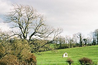
Winterborne Farringdon is a deserted village in Dorset, England, 1.5 miles south of Dorchester. Its lands are now incorporated into the adjacent settlements of Winterborne Came and Winterborne Herringston. There are substantial ground traces, and a remaining wall of St German's Church.

Winterborne Clenston is a small village and civil parish in Dorset, England, around 3+1⁄2 miles southwest of Blandford Forum. In 2013 the civil parish had an estimated population of 40.

Winterborne Tomson is a village in the district of North Dorset, Dorset, England.
