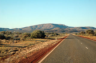
Karijini National Park is an Australian national park centred in the Hamersley Ranges of the Pilbara region in the northwestern section of Western Australia. The park is located north of the Tropic of Capricorn, 1,055 kilometres (656 mi) from the state's capital city, Perth. Formerly known as Hamersley Range National Park, the park was officially renamed in 1991.

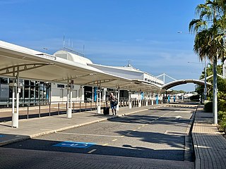
Perth Airport is an international, domestic and general aviation airport serving Perth, the capital city of Western Australia.

Canberra Airport is an international airport situated in the district of Majura, Australian Capital Territory. It serves Australia's capital city, Canberra, as well as the nearby city of Queanbeyan and regional areas of the Australian Capital Territory and southeastern New South Wales. Located approximately 8 km (5.0 mi) from the city centre, within the North Canberra district, it is the ninth-busiest airport in Australia.

Billings Logan International Airport is in the western United States, two miles northwest of downtown Billings, in Yellowstone County, Montana. It is the fourth busiest airport in Montana, having been surpassed in recent years by Bozeman, Missoula, and Flathead County (Kalispell) in number of annual enplanements. Owned by the city of Billings, the airport is on top of the Rims, a 500-foot (150 m) cliff overlooking the downtown core, and covers 2,500 acres of land.

Wittenoom is a former town and a declared contaminated site, 1,420 kilometres (880 mi) north-north-east of Perth, in the Hamersley Range in the Pilbara region of Western Australia. The declared contaminated site comprises 50,000 hectares, making it the largest contaminated site in the southern hemisphere.

MacRobertson Miller Airlines (MMA) was a Western Australian airline that operated between 1927 and 1993. It served a changing roster of destinations in Western Australia and the Northern Territory, concentrated on services between Perth and Darwin via towns in the Pilbara and Kimberley regions. After being purchased by Ansett Transport Industries in 1968, MMA grew to become Australia's third-largest airline. It gradually lost its independent identity under Ansett ownership, being eventually rebranded Ansett WA before being entirely subsumed into Ansett Australia in the early 1990s.

Darwin International Airport is a domestic and international airport, and the only airport serving Darwin, Australia. It is the eleventh busiest airport in Australia measured by passenger movements.

The Hamersley Range is a mountainous region of the Pilbara region of Western Australia. The range was named on 12 June 1861 by explorer Francis Thomas Gregory after Edward Hamersley, a prominent promoter of his exploration expedition to the northwest. The range is the second oldest mountain range in the world, having formed 3.4 billion years ago. Karijini National Park lies within the range.

Busselton Margaret River Airport, formerly known as Busselton Regional Airport, is located in the Busselton suburb of Yalyalup, 6.5 km (4.0 mi) from the town centre. Busselton is a major regional centre in the South West of Western Australia, 220 km (140 mi) south of Perth and at the edge of the Margaret River wine region.

Pago Pago International Airport, also known as Tafuna Airport, is a public airport located 7 miles (11.3 km) southwest of the central business district of Pago Pago, in the village and plains of Tafuna on the island of Tutuila in American Samoa, an unincorporated territory of the United States.

Puerto Princesa International Airport is an airport serving the general area of Puerto Princesa, located in the province of Palawan in the Philippines. It is classified as an international airport by the Civil Aviation Authority of the Philippines.

Ceduna Airport is a public airport in Ceduna, South Australia. The airport, which is owned by the District Council of Ceduna is located adjacent to the Eyre Highway, approximately 2 km (1.2 mi) east of the town. It is the westernmost airport that receives regular passenger service in South Australia and is critical infrastructure for the surrounding remote and sparsely populated region. In addition to scheduled flights to Adelaide, the airport caters to charters in support of the mining industry, general aviation, the Royal Flying Doctor Service, aerial firefighting and occasional military use.

Geraldton Airport is an airport located 6 nautical miles east of Geraldton, Western Australia, in Moonyoonooka along the Geraldton – Mount Magnet Road.
Karratha Airport is an airport in Karratha, in the Pilbara region of Western Australia. The airport is 14 km (8.7 mi) from Karratha and 5 nautical miles south of Dampier.

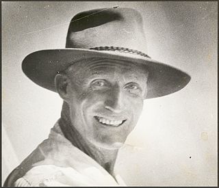
Horace Clive Miller OBE was a pioneering Australian aviator and co-founder of MacRobertson Miller Airlines (MMA).
The Daly Waters Airfield, also RAAF Base Daly Waters, is a former commercial and sporadically-used military airfield located at Daly Waters, Northern Territory, Australia. As an airfield on Australia's earliest international routes, Daly Waters was used throughout the 1920s and 1930s as a stop over for commercial airlines operating on the domestic route to Western Australia and international carriers flying from Australia into south-east Asia via Darwin. During World War II, the airbase was used by the Royal Australian Air Force (RAAF) and the United States Army Air Force to undertake combat operations against the Japanese in New Guinea, the Dutch East Indies and the islands to Australia's north. Following the war, the airbase was used commercially again up until the 1970s when the airfield was sporadically-used by the RAAF.

Rottnest Island Airport is a small airport for light aircraft, situated about 800 m (2,600 ft) from the main settlement at Thomson Bay, Rottnest Island and 10 nautical miles northwest of Fremantle. Daily air services operate to the island. In the past these have been from Perth Airport, but in recent years have been mainly from Jandakot.

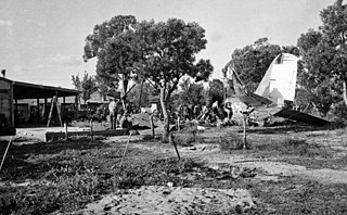
On 2 July 1949 a Douglas DC-3 aircraft departed from Perth, Western Australia for a night flight of 441 nautical miles (817 km) to Carnarvon. The aircraft climbed to a height of about 500 feet (150 m) and then spiralled almost vertically to the ground, killing all 18 people on board. It crashed about a mile north of Perth airport and burned for over an hour. At the time, it was the worst civil aviation accident in Western Australia.

Maylands Airport on the Maylands Peninsula, in Maylands, Western Australia, was the main landing place of a significant number of record breaking flights in the early stages of flight in Australia. It was Perth's first official airport and was the birthplace of commercial aviation in Western Australia.
Cunderdin Airport is located at Cunderdin, Western Australia.


