Gmina Skórzec is a rural gmina in Siedlce County, Masovian Voivodeship, in east-central Poland. Its seat is the village of Skórzec, which lies approximately 13 kilometres (8 mi) south-west of Siedlce and 77 km (48 mi) south-east of Warsaw.
Gmina Wiśniew is a rural gmina in Siedlce County, Masovian Voivodeship, in east-central Poland. Its seat is the village of Wiśniew, which lies approximately 11 kilometres (7 mi) south of Siedlce and 90 km (56 mi) east of Warsaw.

Borki-Kosiorki is a village in the administrative district of Gmina Wiśniew, within Siedlce County, Masovian Voivodeship, in east-central Poland. It lies approximately 4 kilometres (2 mi) north-east of Wiśniew, 8 km (5 mi) south-east of Siedlce, and 92 km (57 mi) east of Warsaw.
Borki-Paduchy is a village in the administrative district of Gmina Wiśniew, within Siedlce County, Masovian Voivodeship, in east-central Poland. It lies approximately 5 kilometres (3 mi) north-east of Wiśniew, 11 km (7 mi) south-east of Siedlce, and 94 km (58 mi) east of Warsaw.
Borki-Sołdy is a village in the administrative district of Gmina Wiśniew, within Siedlce County, Masovian Voivodeship, in east-central Poland.
Ciosny is a village in the administrative district of Gmina Wiśniew, within Siedlce County, Masovian Voivodeship, in east-central Poland. It lies approximately 3 kilometres (2 mi) east of Wiśniew, 12 km (7 mi) south of Siedlce, and 93 km (58 mi) east of Warsaw.

Daćbogi is a village in the administrative district of Gmina Wiśniew, within Siedlce County, Masovian Voivodeship, in east-central Poland. It lies approximately 6 kilometres (4 mi) south-west of Wiśniew, 16 km (10 mi) south of Siedlce, and 89 km (55 mi) east of Warsaw.
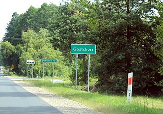
Gostchorz is a village in the administrative district of Gmina Wiśniew, within Siedlce County, Masovian Voivodeship, in east-central Poland. It lies approximately 3 kilometres (2 mi) south of Wiśniew, 13 km (8 mi) south of Siedlce, and 91 km (57 mi) east of Warsaw.
Kaczory is a village in the administrative district of Gmina Wiśniew, within Siedlce County, Masovian Voivodeship, in east-central Poland. It lies approximately 3 kilometres (2 mi) south of Wiśniew, 13 km (8 mi) south of Siedlce, and 90 km (56 mi) east of Warsaw.
Lipniak is a village in the administrative district of Gmina Wiśniew, within Siedlce County, Masovian Voivodeship, in east-central Poland. It lies approximately 7 kilometres (4 mi) west of Wiśniew, 11 km (7 mi) south-west of Siedlce, and 84 km (52 mi) east of Warsaw.
Łupiny is a village in the administrative district of Gmina Wiśniew, within Siedlce County, Masovian Voivodeship, in east-central Poland. It lies approximately 5 kilometres (3 mi) south-west of Wiśniew, 13 km (8 mi) south of Siedlce, and 87 km (54 mi) east of Warsaw.
Mościbrody is a village in the administrative district of Gmina Wiśniew, within Siedlce County, Masovian Voivodeship, in east-central Poland. It lies approximately 4 kilometres (2 mi) north of Wiśniew, 8 km (5 mi) south of Siedlce, and 91 km (57 mi) east of Warsaw.
Mościbrody-Kolonia is a village in the administrative district of Gmina Wiśniew, within Siedlce County, Masovian Voivodeship, in east-central Poland. It lies approximately 4 kilometres (2 mi) north of Wiśniew, 8 km (5 mi) south of Siedlce, and 91 km (57 mi) east of Warsaw.

Myrcha is a village in the administrative district of Gmina Wiśniew, within Siedlce County, Masovian Voivodeship, in east-central Poland. It lies approximately 6 kilometres (4 mi) north-west of Wiśniew, 7 km (4 mi) south of Siedlce, and 86 km (53 mi) east of Warsaw.
Radomyśl is a village in the administrative district of Gmina Wiśniew, within Siedlce County, Masovian Voivodeship, in east-central Poland. It lies approximately 7 kilometres (4 mi) south-east of Wiśniew, 16 km (10 mi) south-east of Siedlce, and 96 km (60 mi) east of Warsaw.
Śmiary is a village in the administrative district of Gmina Wiśniew, within Siedlce County, Masovian Voivodeship, in east-central Poland. It lies approximately 5 kilometres (3 mi) south-west of Wiśniew, 15 km (9 mi) south of Siedlce, and 88 km (55 mi) east of Warsaw.
Stok Wiśniewski is a village in the administrative district of Gmina Wiśniew, within Siedlce County, Masovian Voivodeship, in east-central Poland. It lies approximately 5 kilometres (3 mi) north-west of Wiśniew, 8 km (5 mi) south of Siedlce, and 86 km (53 mi) east of Warsaw.

Wiśniew-Kolonia is a village in the administrative district of Gmina Wiśniew, within Siedlce County, Masovian Voivodeship, in east-central Poland.
Wólka Wiśniewska is a village in the administrative district of Gmina Wiśniew, within Siedlce County, Masovian Voivodeship, in east-central Poland.
Zabłocie is a village in the administrative district of Gmina Wiśniew, within Siedlce County, Masovian Voivodeship, in east-central Poland. It lies approximately 7 kilometres (4 mi) south-east of Wiśniew, 16 km (10 mi) south-east of Siedlce, and 96 km (60 mi) east of Warsaw.


