Gmina Dobryszyce is a rural gmina in Radomsko County, Łódź Voivodeship, in central Poland. Its seat is the village of Dobryszyce, which lies approximately 10 kilometres (6 mi) north of Radomsko and 71 km (44 mi) south of the regional capital Łódź.
Gmina Lgota Wielka is a rural gmina in Radomsko County, Łódź Voivodeship, in central Poland. Its seat is the village of Lgota Wielka, which lies approximately 13 kilometres (8 mi) north-west of Radomsko and 72 km (45 mi) south of the regional capital Łódź.

Biestrzyków Wielki is a village in the administrative district of Gmina Kobiele Wielkie, within Radomsko County, Łódź Voivodeship, in central Poland. It lies approximately 7 kilometres (4 mi) north-east of Kobiele Wielkie, 17 km (11 mi) east of Radomsko, and 80 km (50 mi) south of the regional capital Łódź.
Łowicz is a village in the administrative district of Gmina Kobiele Wielkie, within Radomsko County, Łódź Voivodeship, in central Poland. It lies approximately 6 kilometres (4 mi) west of Kobiele Wielkie, 9 km (6 mi) south-east of Radomsko, and 86 km (53 mi) south of the regional capital Łódź.
Wola Blakowa is a village in the administrative district of Gmina Lgota Wielka, within Radomsko County, Łódź Voivodeship, in central Poland. It lies approximately 3 kilometres (2 mi) south-west of Lgota Wielka, 13 km (8 mi) north-west of Radomsko, and 74 km (46 mi) south of the regional capital Łódź.
Adamów is a village in the administrative district of Gmina Ładzice, within Radomsko County, Łódź Voivodeship, in central Poland. It lies approximately 30 kilometres (19 mi) east of Ładzice, 24 km (15 mi) north-east of Radomsko, and 72 km (45 mi) south of the regional capital Łódź.
Brodowe is a village in the administrative district of Gmina Ładzice, within Radomsko County, Łódź Voivodeship, in central Poland. It lies approximately 4 kilometres (2 mi) south of Ładzice, 7 km (4 mi) west of Radomsko, and 82 km (51 mi) south of the regional capital Łódź.
Jankowice is a village in the administrative district of Gmina Ładzice, within Radomsko County, Łódź Voivodeship, in central Poland. It lies approximately 8 kilometres (5 mi) south-west of Ładzice, 14 km (9 mi) west of Radomsko, and 85 km (53 mi) south of the regional capital Łódź.
Jedlno Drugie is a village in the administrative district of Gmina Ładzice, within Radomsko County, Łódź Voivodeship, in central Poland. It lies approximately 8 kilometres (5 mi) west of Ładzice, 15 km (9 mi) west of Radomsko, and 81 km (50 mi) south of the regional capital Łódź.
Jedlno Pierwsze is a village in the administrative district of Gmina Ładzice, within Radomsko County, Łódź Voivodeship, in central Poland. It lies approximately 8 kilometres (5 mi) west of Ładzice, 15 km (9 mi) west of Radomsko, and 80 km (50 mi) south of the regional capital Łódź.
Kozia Woda is a village in the administrative district of Gmina Ładzice, within Radomsko County, Łódź Voivodeship, in central Poland. It lies approximately 3 kilometres (2 mi) north-west of Ładzice, 10 km (6 mi) west of Radomsko, and 77 km (48 mi) south of the regional capital Łódź.
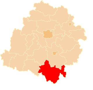
Ładzice is a village in Radomsko County, Łódź Voivodeship, in central Poland. It is the seat of the gmina called Gmina Ładzice. It lies approximately 8 kilometres (5 mi) west of Radomsko and 79 km (49 mi) south of the regional capital Łódź.
Radziechowice Drugie is a village in the administrative district of Gmina Ładzice, within Radomsko County, Łódź Voivodeship, in central Poland. It lies approximately 2 kilometres (1 mi) south of Ładzice, 7 km (4 mi) west of Radomsko, and 80 km (50 mi) south of the regional capital Łódź.
Radziechowice Pierwsze is a village in the administrative district of Gmina Ładzice, within Radomsko County, Łódź Voivodeship, in central Poland. It lies approximately 3 kilometres (2 mi) south-west of Ładzice, 10 km (6 mi) west of Radomsko, and 80 km (50 mi) south of the regional capital Łódź.
Stobiecko Szlacheckie is a village in the administrative district of Gmina Ładzice, within Radomsko County, Łódź Voivodeship, in central Poland. It lies approximately 5 kilometres (3 mi) north-east of Ładzice, 6 km (4 mi) north-west of Radomsko, and 76 km (47 mi) south of the regional capital Łódź.
Wierzbica is a village in the administrative district of Gmina Ładzice, within Radomsko County, Łódź Voivodeship, in central Poland. It lies approximately 4 kilometres (2 mi) north of Ładzice, 8 km (5 mi) north-west of Radomsko, and 75 km (47 mi) south of the regional capital Łódź.
Zakrzówek Szlachecki is a village in the administrative district of Gmina Ładzice, within Radomsko County, Łódź Voivodeship, in central Poland. It lies approximately 11 kilometres (7 mi) west of Ładzice, 17 km (11 mi) west of Radomsko, and 84 km (52 mi) south of the regional capital Łódź.
Dębowiec is a village in the administrative district of Gmina Wielgomłyny, within Radomsko County, Łódź Voivodeship, in central Poland. It lies approximately 6 kilometres (4 mi) north-west of Wielgomłyny, 19 km (12 mi) east of Radomsko, and 83 km (52 mi) south of the regional capital Łódź.
Wólka Bankowa is a village in the administrative district of Gmina Wielgomłyny, within Radomsko County, Łódź Voivodeship, in central Poland. It lies approximately 5 kilometres (3 mi) north-west of Wielgomłyny, 19 km (12 mi) east of Radomsko, and 85 km (53 mi) south of the regional capital Łódź.