Veselí is a village in the Pardubice Region of the Czech Republic. It has around 300 inhabitants.
Gmina Olsztyn is a rural gmina in Częstochowa County, Silesian Voivodeship, in southern Poland. Its seat is the village of Olsztyn, which lies approximately 12 kilometres (7 mi) south-east of Częstochowa and 59 km (37 mi) north of the regional capital Katowice.

Hai Bà Trưng District is an urban district (quận) of Hanoi, the capital city of Vietnam.

Kutakan, is a village in the Gegharkunik Province of Armenia. It has been known as Sultan Ali Kishlak and Gyunashli, and until 1968 as Janahmed. The Kutakan community also includes the nearby village of Zariver.

Brzezinki is a village in the administrative district of Gmina Wodzisław, within Jędrzejów County, Świętokrzyskie Voivodeship, in south-central Poland. It lies approximately 7 kilometres (4 mi) south-east of Wodzisław, 17 km (11 mi) south of Jędrzejów, and 51 km (32 mi) south-west of the regional capital Kielce.
Słonowice is a village in the administrative district of Gmina Kazimierza Wielka, within Kazimierza County, Świętokrzyskie Voivodeship, in south-central Poland. It lies approximately 3 kilometres (2 mi) west of Kazimierza Wielka and 70 km (43 mi) south of the regional capital Kielce.
Podłozy is a settlement in the administrative district of Gmina Wielkie Oczy, within Lubaczów County, Subcarpathian Voivodeship, in south-eastern Poland, close to the border with Ukraine. It lies approximately 5 kilometres (3 mi) west of Wielkie Oczy, 18 km (11 mi) south of Lubaczów, and 79 km (49 mi) east of the regional capital Rzeszów.
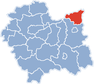
Stara Wieś is a village located in Poland, in the Opole Voivodeship, Głubczyce County and Gmina Głubczyce.
Tworylne is a former village in the administrative district of Gmina Czarna, within Bieszczady County, Subcarpathian Voivodeship, in south-eastern Poland, close to the border with Ukraine. It lies approximately 16 kilometres (10 mi) south-west of Czarna, 21 km (13 mi) south-west of Ustrzyki Dolne, and 92 km (57 mi) south of the regional capital Rzeszów.

Kaleń-Towarzystwo is a village in the administrative district of Gmina Żabia Wola, within Grodzisk Mazowiecki County, Masovian Voivodeship, in east-central Poland.
Osiny is a village in the administrative district of Gmina Jasieniec, within Grójec County, Masovian Voivodeship, in east-central Poland. It lies approximately 13 kilometres (8 mi) south-east of Grójec and 47 km (29 mi) south of Warsaw.
Kaliska is a settlement in the administrative district of Gmina Międzychód, within Międzychód County, Greater Poland Voivodeship, in west-central Poland.
Przęsin is a village in Gmina Miastko, Bytów County, Pomeranian Voivodeship, in northern Poland, on the border with West Pomeranian Voivodeship. It lies approximately 21 kilometres (13 mi) south-west of Bytów and 69 km (43 mi) south-west of Gdańsk.
Goszyce is a village in the administrative district of Gmina Bierawa, within Kędzierzyn-Koźle County, Opole Voivodeship, in south-western Poland. It lies approximately 13 kilometres (8 mi) east of Bierawa, 18 km (11 mi) south-east of Kędzierzyn-Koźle, and 56 km (35 mi) south-east of the regional capital Opole.

Sukowice is a village in the administrative district of Gmina Cisek, within Kędzierzyn-Koźle County, Opole Voivodeship, in south-western Poland. It lies approximately 3 kilometres (2 mi) south-west of Cisek, 10 km (6 mi) south of Kędzierzyn-Koźle, and 48 km (30 mi) south of the regional capital Opole.
Lisie Kąty is a village in the administrative district of Gmina Paczków, within Nysa County, Opole Voivodeship, in south-western Poland, close to the Czech border. It lies approximately 3 kilometres (2 mi) south of Paczków, 24 km (15 mi) west of Nysa, and 71 km (44 mi) west of the regional capital Opole.
Nowy Folwark is a settlement in the administrative district of Gmina Parchowo, within Bytów County, Pomeranian Voivodeship, in northern Poland. It lies approximately 8 kilometres (5 mi) north of Parchowo, 21 km (13 mi) north-east of Bytów, and 61 km (38 mi) west of the regional capital Gdańsk.
Ostowo is a settlement in the administrative district of Gmina Kartuzy, within Kartuzy County, Pomeranian Voivodeship, in northern Poland. It lies approximately 10 kilometres (6 mi) south-west of Kartuzy and 36 km (22 mi) west of the regional capital Gdańsk.
Perwilty is a settlement in the administrative district of Gmina Lelkowo, within Braniewo County, Warmian-Masurian Voivodeship, in northern Poland, close to the border with the Kaliningrad Oblast of Russia.

Zatoń Dolna is a village in the administrative district of Gmina Chojna, within Gryfino County, West Pomeranian Voivodeship, in north-western Poland, close to the German border. It lies approximately 11 kilometres (7 mi) north-west of Chojna, 30 km (19 mi) south-west of Gryfino, and 50 km (31 mi) south-west of the regional capital Szczecin.