Żydowo is a village in the administrative district of Gmina Czerniejewo, within Gniezno County, Greater Poland Voivodeship, in west-central Poland. It lies approximately 8 kilometres (5 mi) east of Czerniejewo, 10 km (6 mi) south of Gniezno, and 47 km (29 mi) east of the regional capital Poznań.
Braciszewo is a village in the administrative district of Gmina Gniezno, within Gniezno County, Greater Poland Voivodeship, in west-central Poland. It lies approximately 6 kilometres (4 mi) west of Gniezno and 44 km (27 mi) east of the regional capital Poznań.
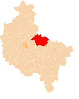
Dalki is a village in the administrative district of Gmina Gniezno, within Gniezno County, Greater Poland Voivodeship, in west-central Poland. It lies approximately 3 kilometres (2 mi) south-west of Gniezno and 48 km (30 mi) east of the regional capital Poznań.
Dębówiec is a village in the administrative district of Gmina Gniezno, within Gniezno County, Greater Poland Voivodeship, in west-central Poland. It lies approximately 9 kilometres (6 mi) north-east of Gniezno and 55 km (34 mi) north-east of the regional capital Poznań.

Ganina is a village in the administrative district of Gmina Gniezno, within Gniezno County, Greater Poland Voivodeship, in west-central Poland. It lies approximately 11 kilometres (7 mi) north-east of Gniezno and 58 km (36 mi) north-east of the regional capital Poznań.
Kalina is a village in the administrative district of Gmina Gniezno, within Gniezno County, Greater Poland Voivodeship, in west-central Poland. It lies approximately 10 kilometres (6 mi) east of Gniezno and 58 km (36 mi) east of the regional capital Poznań.
Strzyżewo Smykowe is a village in the administrative district of Gmina Gniezno, within Gniezno County, Greater Poland Voivodeship, in west-central Poland. It lies approximately 9 kilometres (6 mi) north-east of Gniezno and 57 km (35 mi) east of the regional capital Poznań.
Szczytniki Duchowne is a village in the administrative district of Gmina Gniezno, within Gniezno County, Greater Poland Voivodeship, in west-central Poland. It lies approximately 5 kilometres (3 mi) east of Gniezno and 53 km (33 mi) east of the regional capital Poznań.
Wełnica is a village in the administrative district of Gmina Gniezno, within Gniezno County, Greater Poland Voivodeship, in west-central Poland. It lies approximately 6 kilometres (4 mi) north-east of Gniezno and 54 km (34 mi) east of the regional capital Poznań.
Pierzyska is a village in the administrative district of Gmina Łubowo, within Gniezno County, Greater Poland Voivodeship, in west-central Poland. It lies approximately 3 kilometres (2 mi) east of Łubowo, 9 km (6 mi) west of Gniezno, and 41 km (25 mi) east of the regional capital Poznań.
Rybitwy is a village in the administrative district of Gmina Łubowo, within Gniezno County, Greater Poland Voivodeship, in west-central Poland. It lies approximately 8 kilometres (5 mi) west of Łubowo, 18 km (11 mi) west of Gniezno, and 33 km (21 mi) north-east of the regional capital Poznań.
Arcugowo is a village in the administrative district of Gmina Niechanowo, within Gniezno County, Greater Poland Voivodeship, in west-central Poland. It lies approximately 3 kilometres (2 mi) south-east of Niechanowo, 12 km (7 mi) south-east of Gniezno, and 54 km (34 mi) east of the regional capital Poznań.
Bieślin is a village in the administrative district of Gmina Trzemeszno, within Gniezno County, Greater Poland Voivodeship, in west-central Poland. It lies approximately 6 kilometres (4 mi) south of Trzemeszno, 18 km (11 mi) east of Gniezno, and 65 km (40 mi) east of the regional capital Poznań.
Bystrzyca is a village in the administrative district of Gmina Trzemeszno, within Gniezno County, Greater Poland Voivodeship, in west-central Poland. It lies approximately 2 kilometres (1 mi) east of Trzemeszno, 17 km (11 mi) east of Gniezno, and 66 km (41 mi) east of the regional capital Poznań.
Miaty is a village in the administrative district of Gmina Trzemeszno, within Gniezno County, Greater Poland Voivodeship, in west-central Poland. It lies approximately 4 kilometres (2 mi) south of Trzemeszno, 14 km (9 mi) east of Gniezno, and 62 km (39 mi) east of the regional capital Poznań.
Mijanowo is a village in the administrative district of Gmina Trzemeszno, within Gniezno County, Greater Poland Voivodeship, in west-central Poland. It lies approximately 6 kilometres (4 mi) east of Trzemeszno, 21 km (13 mi) east of Gniezno, and 70 km (43 mi) east of the regional capital Poznań.
Miława is a village in the administrative district of Gmina Trzemeszno, within Gniezno County, Greater Poland Voivodeship, in west-central Poland. It lies approximately 8 kilometres (5 mi) south-east of Trzemeszno, 22 km (14 mi) east of Gniezno, and 70 km (43 mi) east of the regional capital Poznań.
Ostrowite is a village in the administrative district of Gmina Trzemeszno, within Gniezno County, Greater Poland Voivodeship, in west-central Poland. It lies approximately 6 kilometres (4 mi) south-east of Trzemeszno, 19 km (12 mi) east of Gniezno, and 67 km (42 mi) east of the regional capital Poznań.
Popielewo is a village in the administrative district of Gmina Trzemeszno, within Gniezno County, Greater Poland Voivodeship, in west-central Poland. It lies approximately 4 kilometres (2 mi) east of Trzemeszno, 19 km (12 mi) east of Gniezno, and 68 km (42 mi) east of the regional capital Poznań.
Ostrowite Prymasowskie is a village in the administrative district of Gmina Witkowo, within Gniezno County, Greater Poland Voivodeship, in west-central Poland. It lies approximately 11 kilometres (7 mi) north-east of Witkowo, 19 km (12 mi) east of Gniezno, and 66 km (41 mi) east of the regional capital Poznań.