The Austrian Alpine Club has about 700,000 members in 194 sections and is the largest mountaineering organisation in Austria. It is responsible for the upkeep of over 234 alpine huts in Austria and neighbouring countries. It also maintains over 26,000 kilometres of footpaths, and produces detailed maps of key mountain areas within Austria. Much of this work is done by the association's 22,000 volunteers. The association has a museum in Innsbruck dedicated to the history of alpinism. It also has sections in Belgium and the United Kingdom, and a group in Poland.

The South Tyrol Alpine Club, abbreviated AVS, is an association of German and Ladin-speaking mountain climbers in South Tyrol, northern Italy. Founded in 1946, it is subdivided into 32 sections and 58 local divisions. The AVS is based in Bolzano and has more than 60,000 members.

The Hoher Weißzint is a mountain in the Zillertal Alps on the border between Tyrol, Austria, and South Tyrol, Italy.
The Dürrenstein is a mountain in the Dolomites in South Tyrol, Italy.

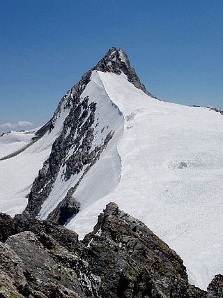
The Fineilspitze is a peak in the Schnalskamm group of the Ötztal Alps on the border between Tyrol, Austria, and South Tyrol, Italy. It is known for being the discovery site of Ötzi.

The Tribulauns are three peaks of the Stubai Alps on the border between Tyrol, Austria, and South Tyrol, Italy.
Im Hinteren Eis is a mountain in the Ötztal Alps on the border between Tyrol, Austria, and South Tyrol, Italy.
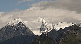
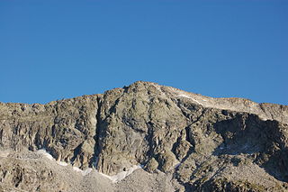
The Hochfeiler is a mountain, 3,510 metres high, and the highest peak in the Zillertal Alps on the border between Tyrol, Austria, and South Tyrol, Italy.
The Hochwilde or Hohe Wilde is a mountain in the Ötztal Alps on the border between Tyrol, Austria, and South Tyrol, Italy.

The III. Hornspitze is a mountain in the Zillertal Alps on the border between Tyrol, Austria, and South Tyrol, Italy.
The Patscher Spitze is a mountain of the Rieserferner group on the border between Tyrol, Austria, and South Tyrol, Italy.

The Wilder Pfaff is a mountain in the Stubai Alps on the border between Tyrol, Austria, and South Tyrol, Italy.

The Rötspitze is a mountain in the Hohe Tauern on the border between Tyrol, Austria, and South Tyrol, Italy.

The Zwölferkofel or Zwölfer is a peak of the Sexten Dolomites on the border between the provinces of South Tyrol and Belluno, in Italy.

The Pfitscherjoch is a mountain pass in the Zillertal Alps on the border between Tyrol, Austria, and South Tyrol, Italy.

The Hochpustertal is the easternmost part of the Puster Valley, stretching from the watershed of the Rienz and Drava rivers at Niederdorf in South Tyrol down the Drava to Lienz in East Tyrol, Austria. The area includes the Sexten and Prags side valleys.

The German and Austrian Alpine Club was a merger of the German, Austrian and German Bohemian Alpine Club that existed from 1873 to 1938.

The Alpine Club classification of the Eastern Alps is a common division of the Eastern Alps into 75 mountain ranges, based on the Moriggl Classification (ME) first published in 1924 by the German and Austrian Alpine Club. The present-day division established for the German-speaking world was compiled by the German, Austrian and South Tyrol Alpine Clubs and published in 1984 and is also used for the basic numbering of Alpine Club maps for mountaineering.
Bergverlag Rother is a German publisher with its headquarters in Oberhaching, Upper Bavaria. Since 1950 the company, that formerly went under the name of Bergverlag Rudolf Rother, had published the Alpine Club Guides in cooperation with the German Alpine Club (DAV), the Austrian Alpine Club (ÖAV) and the South Tyrol Alpine Club.

