Woodcock Hill Village Green

Last updated
Woodcock Hill Woodcock Hill 1.JPG
Woodcock Hill
View north from the top of Woodcock Hill Woodcock Hill view north 2.JPG
View north from the top of Woodcock Hill

Woodcock Hill Village Green or Woodcock Hill Open Space is an area of grass and woodland in Borehamwood in Hertfordshire in England. It was designated a Village Green in 2008 to prevent development of the site.

Borehamwood town in southern Hertfordshire, England

Borehamwood is a town in southern Hertfordshire. It is a commuter town near St Albans and London, situated 12 miles (19 km) from Charing Cross. Borehamwood has a population of 31,074, and is within the civil parish of Elstree and Borehamwood and the London commuter belt. The town is perhaps most well known for its multiple film and TV studios, commonly known as Elstree Studios, hence the association with Elstree.

Hertfordshire County of England

Hertfordshire is one of the home counties in England. It is bordered by Bedfordshire to the north, Cambridgeshire to the north-east, Essex to the east, Buckinghamshire to the west and Greater London to the south. For government statistical purposes, it is placed in the East of England region.

Contents

History

Woodcock Hill was first recorded as land donated by Offa, king of Mercia in the late eighth century, to St Albans Abbey. During the Dissolution of the Monasteries in 1539 the leading courtier Sir Anthony Denny acquired the land from King Henry VIII. In 1588 it was the location of one of the chain of beacons used to warn of the approach of the Spanish Armada, and during the Napoleonic Wars it was one of the Admiralty's chain of telegraph stations, sending messages to Hampstead Heath to the south and St Albans to the north. In the 1860s two railway tunnels were built at Woodcock Hill, and clay from the tunnels was used to make brick for local houses. [1]

Offa of Mercia 8th-century Anglo-Saxon King of Mercia

Offa was King of Mercia, a kingdom of Anglo-Saxon England, from 757 until his death in July 796. The son of Thingfrith and a descendant of Eowa, Offa came to the throne after a period of civil war following the assassination of Æthelbald. Offa defeated the other claimant, Beornred. In the early years of Offa's reign, it is likely that he consolidated his control of Midland peoples such as the Hwicce and the Magonsæte. Taking advantage of instability in the kingdom of Kent to establish himself as overlord, Offa also controlled Sussex by 771, though his authority did not remain unchallenged in either territory. In the 780s he extended Mercian supremacy over most of southern England, allying with Beorhtric of Wessex, who married Offa's daughter Eadburh, and regained complete control of the southeast. He also became the overlord of East Anglia and had King Æthelberht II of East Anglia beheaded in 794, perhaps for rebelling against him.

Mercia One of the kingdoms of the Anglo-Saxon Heptarchy

Mercia was one of the kingdoms of the Anglo-Saxon Heptarchy. The name is a Latinisation of the Old English Mierce or Myrce, meaning "border people". Mercia dominated what would later become England for three centuries, subsequently going into a gradual decline while Wessex eventually conquered and united all the kingdoms into Kingdom of England.

St Albans Cathedral Church in Hertfordshire, United Kingdom

St Albans Cathedral, sometimes called the Cathedral and Abbey Church of St Alban, and referred to locally as "the Abbey", is a Church of England cathedral in St Albans, England. Much of its architecture dates from Norman times. It ceased to be an abbey in the 16th century and became a cathedral in 1877. Although legally a cathedral church, it differs in certain particulars from most other cathedrals in England: it is also used as a parish church, of which the dean is rector with the same powers, responsibilities and duties as that of any other parish.

Battle against development

In 1959 the Woodcock Hill Society was formed to fight against development of the site, and it later merged with the Elstree & Borehamwood Green Belt Society. [2] In 1996 the land was identified as possible for development and a new organisation, Woodcock Hill Open Space Forever (WHOSE), was formed to protect it. In 2004 Hertsmere councillor and WHOSE chair Patricia Strack applied to Hertfordshire County Council to have the area declared a Village Green under the Commons Registration Act 1965, which would permanently protect it against development. A public enquiry in November 2007 found in favour of the application, and the County Council ratified Woodcock Hill as a Village Green on 9 July 2008. In December of the same year the committee of WHOSE formed the Woodcock Hill Village Green Trust. [1] [3]

Hertsmere Place in England

Hertsmere is a local government district and borough in Hertfordshire, England. Its council is based in Borehamwood. Other towns in the borough include Bushey, Elstree, Radlett and Potters Bar. The borough borders the three north London boroughs of Harrow, Barnet and Enfield, and is located mainly within the M25 Motorway.

Hertfordshire County Council British administrative body

Hertfordshire County Council is the upper-tier local authority for the non-metropolitan county of Hertfordshire, in England, the United Kingdom. After the elections in 2017, it consists of 78 councillors, and is controlled by the Conservative Party, which has 50 councillors, versus 19 Liberal Democrats and 9 Labour councillors. It is a member of the East of England Local Government Association.

Commons Registration Act 1965

The Commons Registration Act 1965 is an Act of Parliament in the United Kingdom enacted in 1965 that concerns the registration of rights to common land, town greens, and village greens in England and Wales. The legislation under the Harold Wilson government made reference to the Land Registration Act 1925 and Land Registration Act 1936.

Boundaries

The site is bounded by Barnet Lane to the south, the railway line to the west, and Vale Avenue and Carrington Avenue to the north.

Related Research Articles

St Albans City and District Place in England

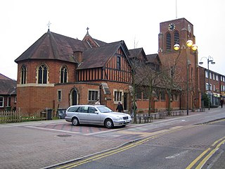
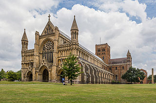
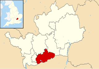
St Albans City and District is a local authority district in Hertfordshire in the East of England region. The main urban settlements are St Albans and Harpenden. The council offices are in St Albans.

Elstree Studios film studios based in or around the towns of Borehamwood and Elstree in Hertfordshire, England

Elstree Studios is a generic term which can refer to several current and defunct British film studios and television studios based in or around the towns of Borehamwood and Elstree in Hertfordshire. Studios have been located here since film production began in the area during 1914.

Bushey town in Hertfordshire, England, UK

Bushey is a town in the Hertsmere borough of Hertfordshire in the East of England. It has a population of 24,000. Bushey Heath is a large neighbourhood south east of Bushey on the boundary with the London Borough of Harrow reaching elevations of 165 metres (541 ft) above sea level.

Elstree village in the Hertsmere borough of Hertfordshire, England

Elstree is a village in the Hertsmere borough of Hertfordshire, England. It is about 13 miles northwest of central London on the former A5 road, that follows the course of Watling Street. In 2011, its population was 5,110. It forms part of the civil parish of Elstree and Borehamwood, originally known simply as Elstree.

Sandridge village in the United Kingdom

Sandridge is a village and civil parish between St Albans and Wheathampstead in Hertfordshire, England.

Radlett town in Hertfordshire, England

Radlett is an affluent settlement in the county of Hertfordshire between St Albans and Elstree on Watling Street, with a population of 8,042. It is located in the council district of Hertsmere and is covered by two wards; Aldenham East and Aldenham West. It is located inside the M25 motorway.

Elstree & Borehamwood railway station station in Hertsmere district of Hertfordshire, England

Elstree & Borehamwood railway station is a railway station in the town of Borehamwood, Hertfordshire, England. It primarily serves Borehamwood as well as the nearby village of Elstree, 1.3 miles (2.1 km) to the south-west. The station is situated on the Midland Main Line, 12 miles 35 chains (20.0 km) down the line from London St Pancras and is situated between Mill Hill Broadway to the south and Radlett to the north. Its three-letter station code is ELS.

Hertsmere (UK Parliament constituency) Parliamentary constituency in the United Kingdom

Hertsmere is a constituency in Hertfordshire, England, represented in the House of Commons since 2015 by Oliver Dowden of the Conservative Party.

Elstree and Borehamwood

Elstree and Borehamwood is a civil parish in the Borough of Hertsmere in Hertfordshire, England. Located approximately 12 miles (19 km) northwest of central London and adjacent to the Greater London boundary, it is an urbanised parish with suburban residential development, some open land and light industry. Elstree and Borehamwood is a recent renaming of the ancient parish of Elstree, covering the settlements of Elstree and Borehamwood. Formed in 1894 as the Elstree Parish Council, the local council is Elstree and Borehamwood Town Council. One of the most populous civil parishes in England, at the 2011 census it had a population of 37,065.

Elstree South tube station Unbuilt London Underground station

Elstree South was a proposed London Underground station in Elstree, Hertfordshire. It was designed by Charles Holden. The planned location of the station was adjacent to the A5183, north of the junction with the A41 and where junction 4 of the M1 motorway was subsequently built.

Elstree Rural District

Elstree Rural District was a rural district in Hertfordshire, England from 1894 to 1974.

Oaklands College

Oaklands College is a further education college in Hertfordshire, England, established in 1991. The college has campuses in St Albans and Welwyn Garden City, with a further training provision in Borehamwood.

Deacon's Hill is an area of Elstree, Hertfordshire, England. It is the part of the town which lies to the immediate west of the railway line and is informally known as being part of Elstree by its residents, even though it is geographically separate from the village of that name. Deacon's Hill includes a residential area and the Deacon's Hill open space.

This page provides brief details of primary schools in the borough of Hertsmere in Hertfordshire, England, United Kingdom.

BBC Elstree Centre Television production facility in Hertfordshire, England

BBC Elstree Centre, sometimes referred to as BBC Elstree Studios, is a television production facility located on Eldon Avenue in Borehamwood, Hertfordshire.

References

Coordinates: 51°38′46″N0°16′23″W / 51.646°N 0.273°W / 51.646; -0.273

Geographic coordinate system Coordinate system

A geographic coordinate system is a coordinate system that enables every location on Earth to be specified by a set of numbers, letters or symbols. The coordinates are often chosen such that one of the numbers represents a vertical position and two or three of the numbers represent a horizontal position; alternatively, a geographic position may be expressed in a combined three-dimensional Cartesian vector. A common choice of coordinates is latitude, longitude and elevation. To specify a location on a plane requires a map projection.