Woodsdale, Kansas | |
|---|---|
 | |
 Woodsdale  Woodsdale | |
| Coordinates: 37°16′21″N101°18′34″W / 37.27250°N 101.30944°W [1] | |
| Country | United States |
| State | Kansas |
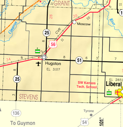
| County | Stevens |
| Founded | 1886 |
| Named after | Samuel Wood |
| Elevation | 3,113 ft (949 m) |
| Population | |
• Total | 0 |
| Time zone | UTC-6 (CST) |
| • Summer (DST) | UTC-5 (CDT) |
| Area code | 620 |
| GNIS ID | 482630 [1] |

Woodsdale is a ghost town in Stevens County, Kansas, United States. [1] It was involved in a county seat war with Hugoton during the 19th century.
