See also
| This disambiguation page lists articles associated with the title Woolmer. If an internal link led you here, you may wish to change the link to point directly to the intended article. |
Woolmer is a locality in East Hampshire, in South East England, the main feature of which is Woolmer Forest.
The name Woolmer (or Woolmers) may also refer to:
| This disambiguation page lists articles associated with the title Woolmer. If an internal link led you here, you may wish to change the link to point directly to the intended article. |

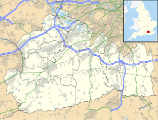
Surrey is a county in South East England which borders Kent to the east, East Sussex to the southeast, West Sussex to the south, Hampshire to the west, Berkshire to the northwest, and Greater London to the northeast. With about 1.2 million people, Surrey is the 12th-most populous English county, the third-most populous home county, after Kent and Essex, and the third-most populous in the Southeast, after Hampshire and Kent.

Godalming is a historic market town, civil parish and administrative centre of the Borough of Waverley in Surrey, England, 4 miles SSW of Guildford. The town traverses the banks of the River Wey in the Greensand Ridge – a hilly, heavily wooded part of the outer London commuter belt and Green Belt. In 1881, it became the first place in the world to have a public electricity supply and electric street lighting.

The home counties are the counties of England that surround Greater London. The counties generally included are Berkshire, Buckinghamshire, Essex, Hertfordshire, Kent, Surrey, and Sussex. Other counties more distant from London—such as Bedfordshire, Cambridgeshire, Hampshire and Oxfordshire—are also sometimes regarded as home counties due to their proximity to London and their connection to the London regional economy.

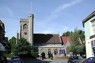
Haslemere is a town in the borough of Waverley in Surrey, England. It is north-east of the tripoint with Hampshire and West Sussex. Centred 12 miles (19 km) southwest of Guildford, it is the most southerly town in Surrey. All parts of the town are east of the A3, the main road between London and Portsmouth which passes underneath Hindhead, adjoining the many small, wooded, hillside or hilltop neighbourhoods closely associated with the largely Victorian town itself. The town has a newer Shottermill part, west of its station so has two hubs of services, retail and high street leisure.
Welwyn is a village and civil parish in Hertfordshire, England. The parish also includes the villages of Digswell and Oaklands. It is sometimes called Old Welwyn to distinguish it from the much newer settlement of Welwyn Garden City, about a mile to the south, though some residents dislike the suggestion of inferiority or irrelevance that tends to be implied by the moniker "Old" and prefer Welwyn Village. When saying where they live, locals will often be asked, "Welwyn or Welwyn Garden City?", as the latter's title is often shortened to simply Welwyn. To avoid confusion, there were plans to change Welwyn’s name to ‘Welwyn Minster’ in 1990 but this met with local resistance and the idea was abandoned.

Redhill is a town in the borough of Reigate and Banstead within the county of Surrey, England. The town, which adjoins the town of Reigate to the west, is due south of Croydon in Greater London, and is part of the London commuter belt. The town is also the post town, entertainment and commercial area of three adjoining communities: Merstham, Earlswood and Whitebushes, as well as of two small rural villages to the east in the Tandridge District, Bletchingley and Nutfield.

Tring is a market town and civil parish in the Borough of Dacorum, Hertfordshire, England. It is situated in a gap passing through the Chiltern Hills, classed as an Area of Outstanding Natural Beauty, 30 miles (48 km) from Central London. Tring is linked to London by the Roman road of Akeman Street, by the modern A41 road, by the Grand Union Canal and by the West Coast Main Line to London Euston. Settlements in Tring date back to prehistoric times and it was mentioned in the Domesday Book; the town received its market charter in 1315. Tring is now largely a commuter town within the London commuter belt. As of 2013, Tring has a population of 11,731.

Longford is a town in the northern midlands of Tasmania, Australia. It lies 145 m above sea level at the convergence of the Macquarie River and the South Esk River, 21 km south of Launceston and a 15-minute drive from the airport. It is just south of the Illawarra Road, a road connecting the Bass and Midland Highways. It has a population of 3,863 and is part of the Northern Midlands Council area. The region is predominantly agricultural, noted for wool, dairy produce and stock breeding.

Coombe is a historic neighbourhood in the Royal Borough of Kingston upon Thames in south west London, England. It sits on high ground, east of Norbiton. Most of the area was part of the former Municipal Borough of Malden and Coombe before local government re-organisation in 1965. It now shares borders with the boroughs of Merton and Sutton with, to the north, the small, inter-related neighbourhoods of Kingston Hill and Kingston Vale, beyond which is Richmond Park in Richmond; and Roehampton/Putney Vale in Wandsworth. To the east are public playing fields and Wimbledon Common.
Mickleham is a village in south east England, between the towns of Dorking and Leatherhead in Surrey. The civil parish covers 7.31 square kilometres and includes the hamlet of Fredley. The larger ecclesiastical parish includes the majority of the neighbouring village of Westhumble, from which Mickleham is separated by the River Mole.

Woolmer Green is a small village and civil parish in Hertfordshire, England. The 2011 census figure for the population is 661 people.
The 1975 English cricket season was the 76th in which the County Championship had been an official competition. The inaugural Cricket World Cup was won by West Indies, who defeated Australia in an exciting final. Australia toured England to compete for the Ashes and won the series 1-0. Leicestershire won their first County Championship title.
Woolmer Hill is an area of high ground in the south-west corner of Surrey, England in the Borough of Waverley abutting Hampshire to the west and West Sussex to the south. It is in the circa 1900-founded parish of Shottermill. In the north it is covered by woodland, and a higher land to the south has its residential neighbourhood on streets Hatchett's Drive and Lower Hanger. The hill reaches 185.5 metres above sea level, its foot being about 60 metres below. The area is bounded to the west by Sandy Lane and to the east by Woolmer Hill Road. To the east is Woolmer Hill School and to its south semi-rural houses and St Mary's Abbey. Most of its buildings are 20th century and the locality or neighbourhood owes this expansion to the enlargement of the A3 trunk road nearby and growth of Haslemere which is a semi-major stop on the Portsmouth Direct Line (railway).
Woolmer Hill School, formerly Woolmer Hill Technology College, is the main secondary school in the area of Haslemere, Surrey.

Brickendon Estate is a farm estate located in Longford, Tasmania. It is one of the two main ancestral homes of the Archer family, prominent local pioneers and politicians. Founded in 1824, it consists of a village and manor house, as well as 465ha working farm. The main manor was built in 1829-1830 in a Georgian style.

Woolmers Estate is a farming estate located in Longford, Tasmania, founded in 1817 by prominent grazier and member of parliament Thomas Archer. It consists of an 82ha property, including a two-part manor house, coach house, the National Rose Garden, extensive outbuildings and convict cottages and formal gardens. The main house consists of a brick nog weatherboard homestead, built in 1819, with an attached extensive addition in Italiate style, designed by William Archer and built in 1842-1843.
Apsley may refer to:
William Archer (1820–1874) was an Australian architect, naturalist, grazier, politician and member of the prominent Archer family. He was the second son of Thomas Archer, a prominent pastoralist and politician himself. A keen interest in architecture led to him going to London to study architecture when he finished school, where he studied under William Rogers and Robert Stephenson. During his life he built many colonial buildings across Tasmania, served as a member of both the Tasmanian House of Assembly and Tasmanian Legislative Council and made significant contributions to botany, with several native Tasmanian plants named after him. Despite this he died penniless at his brothers house Fairfield on 15 October 1874.
The Archer family are a notable family in Tasmania, Australia, prominent in society, business and politics of Tasmania for the last two centuries. They are best known today for their now world-heritage listed farm estates, Brickendon Estate and Woolmers Estate, but have contributed to many areas of Tasmania throughout their history. Other members of the family have been Mayors of Hertfordshire in England and influential in the American Civil War.

Letty Green is a village in the parish of Hertingfordbury, Hertfordshire, England.