Related Research Articles

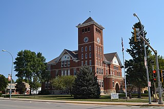
Wright County is a county in the U.S. state of Iowa. As of the 2010 census, the population was 13,229. The county seat is Clarion. The county organization became effective in January 1851, and is believed to be named either after Silas Wright, a governor of New York, or Joseph Albert Wright, a governor of Indiana.

Thor is a town in Norway Township, Humboldt County, Iowa, United States. The population was 186 at the 2010 census.

Woolstock is a city in Wright County, Iowa, United States. The population was 168 at the 2010 census.

Magor Township is one of sixteen townships in Hancock County, Iowa, USA. As of the 2000 census, its population was 450.
Wright Township is a township in Wayne County, Iowa, USA.
Pleasant Township is a township of Wright County, Iowa, United States.
Belmond Township is a township in Wright County, Iowa, USA.
Boone Township is a township in Wright County, Iowa, USA.
Dayton Township is a township in Wright County, Iowa, USA.
Eagle Grove Township is a township in Wright County, Iowa, USA.
Grant Township is a township in Wright County, Iowa, USA.
Iowa Township is a township in Wright County, Iowa, USA.
Lake Township is a township in Wright County, Iowa, USA.
Liberty Township is a township in Wright County, Iowa, USA.
Lincoln Township is a township in Wright County, Iowa, USA.
Norway Township is a township in Wright County, Iowa, USA.
Troy Township is a township in Wright County, Iowa, USA.
Vernon Township is a township in Wright County, Iowa, USA.
Wall Lake Township is a township in Wright County, Iowa, USA.
The Eagle Grove Community School District is a rural public school district headquartered in Eagle Grove, Iowa.
References
Coordinates: 42°36′00″N93°47′35″W / 42.6001°N 93.7931°W
| This article about the geography of Wright County, Iowa is a stub. You can help Wikipedia by expanding it. |
