Goldfield, Iowa

Last updated
Goldfield, Iowa
Wright County Iowa Incorporated and Unincorporated areas Goldfield Highlighted.svg
Location of Goldfield, Iowa
Coordinates: 42°44′5″N93°55′13″W / 42.73472°N 93.92028°W / 42.73472; -93.92028 Coordinates: 42°44′5″N93°55′13″W / 42.73472°N 93.92028°W / 42.73472; -93.92028
Country Flag of the United States.svg  United States
State Flag of Iowa.svg  Iowa
County Wright
Area
[1]
  Total1.18 sq mi (3.04 km2)
  Land1.18 sq mi (3.04 km2)
  Water0.00 sq mi (0.00 km2)
Elevation
1,129 ft (344 m)
Population
 (2020)
  Total634
  Density539.57/sq mi (208.25/km2)
Time zone UTC-6 (Central (CST))
  Summer (DST) UTC-5 (CDT)
ZIP code
50542
Area code 515
FIPS code 19-31530
GNIS feature ID0463548

Goldfield is a city in Wright County, Iowa, United States. The population was 634 at the time of the 2020 census. [2]

Contents

History

A post office called Goldfield has been in operation since 1856. [3] Brassfield was the name of a pioneer settler, but it was decided that Goldfield sounded like a more suitable placename. [4]

Geography

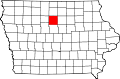
Goldfield's longitude and latitude coordinates in decimal form are 42.734708, -93.920163. [5] The city is located along the Boone River. [6]

According to the United States Census Bureau, the city has a total area of 1.19 square miles (3.08 km2), all land. [7]

Demographics

Historical populations
YearPop.±%
1880 99    
1890 343+246.5%
1900 628+83.1%
1910 618−1.6%
1920 749+21.2%
1930 700−6.5%
1940 715+2.1%
1950 665−7.0%
1960 682+2.6%
1970 722+5.9%
1980 789+9.3%
1990 710−10.0%
2000 680−4.2%
2010 635−6.6%
2020 634−0.2%
Source: "U.S. Census website". United States Census Bureau . Retrieved 2020-03-28. and Iowa Data Center
Source:
U.S. Decennial Census [8] [2]
The population of Goldfield, Iowa from US census data GoldfieldIowaPopPlot.png
The population of Goldfield, Iowa from US census data

2010 census

As of the census [9] of 2010, there were 635 people, 290 households, and 187 families living in the city. The population density was 533.6 inhabitants per square mile (206.0/km2). There were 313 housing units at an average density of 263.0 per square mile (101.5/km2). The racial makeup of the city was 95.4% White, 0.3% African American, 0.5% Native American, 0.9% from other races, and 2.8% from two or more races. Hispanic or Latino of any race were 3.0% of the population.

There were 290 households, of which 23.8% had children under the age of 18 living with them, 50.7% were married couples living together, 8.3% had a female householder with no husband present, 5.5% had a male householder with no wife present, and 35.5% were non-families. 31.0% of all households were made up of individuals, and 13.8% had someone living alone who was 65 years of age or older. The average household size was 2.19 and the average family size was 2.67.

The median age in the city was 46.6 years. 19.2% of residents were under the age of 18; 7.6% were between the ages of 18 and 24; 21.2% were from 25 to 44; 31% were from 45 to 64; and 21.1% were 65 years of age or older. The gender makeup of the city was 50.7% male and 49.3% female.

2000 census

As of the census [10] of 2000, there were 680 people, 295 households, and 194 families living in the city. The population density was 666.0 inhabitants per square mile (257.1/km2). There were 315 housing units at an average density of 308.5 per square mile (119.1/km2). The racial makeup of the city was 99.26% White, 0.15% Native American, 0.44% from other races, and 0.15% from two or more races. Hispanic or Latino of any race were 1.62% of the population.

There were 295 households, out of which 27.5% had children under the age of 18 living with them, 56.9% were married couples living together, 5.1% had a female householder with no husband present, and 34.2% were non-families. 29.5% of all households were made up of individuals, and 18.0% had someone living alone who was 65 years of age or older. The average household size was 2.31 and the average family size was 2.81.

Age spread: 22.6% under the age of 18, 7.9% from 18 to 24, 24.1% from 25 to 44, 22.4% from 45 to 64, and 22.9% who were 65 years of age or older. The median age was 42 years. For every 100 females, there were 104.8 males. For every 100 females age 18 and over, there were 102.3 males.

The median income for a household in the city was $32,411, and the median income for a family was $41,250. Males had a median income of $28,409 versus $19,886 for females. The per capita income for the city was $16,983. About 4.2% of families and 7.2% of the population were below the poverty line, including 5.6% of those under age 18 and 9.9% of those age 65 or over.

Economy

In 2006, a 50 million-gallons-per-year ethanol plant was built in Goldfield by Central Iowa Renewable Energy LLC. The $86 million project brought approximately 40 new jobs to the community. There were plans to double the annual production capacity of the plant in 2009. Future Energy LLC is planning to build a biodiesel plant near Goldfield. That project will bring 30 new jobs to the area. Goldfield Industrial Park is a 10-acre (40,000 m2) industrial development site east of Goldfield on Highway 3.

Education

The community is within the Clarion–Goldfield–Dows Community School District. It was in the Goldfield Community School District until July 1, 1993, when it merged into the Clarion–Goldfield Community School District. That in turn merged with the Dows Community School District on July 1, 2014. [11]

Clarion–Goldfield–Dows Community Schools serve the educational needs of the Goldfield community. The Goldfield Community School provided K–12 education from 1912 to 1981. In 1956 the present Goldfield school building was built. In 1981 Goldfield Community School began whole grade sharing with Clarion Community Schools, the first such arrangement in the state. Clarion is located 8 miles (13 km) East of Goldfield on Highway 3. At that time Goldfield students in grades 9–12 attended Clarion High School during the morning and returned to Goldfield later for a class and extracurricular activities. In 1986 middle school students joined the high school students in Clarion. In 1993 the Clarion and Goldfield districts passed a merger and reorganized into the Clarion–Goldfield Community School District. The merger was passed by 89% and 99% in each district respectively. An elementary school program was maintained in Goldfield. In 2002 3rd grade for the entire district was combined in the Goldfield Elementary to greater utilize the building. The Goldfield building was closed in 2008, with all students attending all classes in Clarion. The Clarion–Goldfield and Dows community school districts merged into the Clarion–Goldfield–Dows Community School District in 2014 after 9 years of whole grade sharing. The Clarion–Goldfield–Dows School District had a certified enrollment (K–12) of 943 students in 2018–19.

Related Research Articles

<span class="mw-page-title-main">Wright County, Iowa</span> County in Iowa, United States

Wright County is a county in the U.S. state of Iowa. As of the 2020 census, the population was 12,943. The county seat is Clarion. The county organization became effective in January 1851, and is believed to be named either after Silas Wright, a governor of New York, or Joseph Albert Wright, a governor of Indiana.

<span class="mw-page-title-main">Rembrandt, Iowa</span> City in Iowa, United States

Rembrandt is a city in Buena Vista County, Iowa, United States. The population was 209 at the time of the 2020 census.

<span class="mw-page-title-main">Yetter, Iowa</span> City in Iowa, United States

Yetter is a city in Calhoun County, Iowa, United States. The population was 19 at the time of the 2020 census.

<span class="mw-page-title-main">Rockwell, Iowa</span> City in Iowa, United States

Rockwell is a city in Cerro Gordo County, Iowa, United States. The population was 1,071 at the time of the 2020 census. It is part of the Mason City Micropolitan Statistical Area.

<span class="mw-page-title-main">Dickens, Iowa</span> City in Iowa, United States

Dickens is a city in Clay County, Iowa, United States. The population was 146 in the 2020 census, a decline from 202 in 2000.

<span class="mw-page-title-main">Osterdock, Iowa</span> City in Iowa, United States

Osterdock is a city located in Clayton County, Iowa, United States. As of the 2020 census, the city had a total population of 43, down from 50 in 2000.

<span class="mw-page-title-main">Arion, Iowa</span> City in Iowa, United States

Arion is a city in Crawford County, Iowa, United States, along the Boyer River. The population was 97 at the 2020 census.

<span class="mw-page-title-main">Aspinwall, Iowa</span> City in Iowa, United States

Aspinwall is a city in Crawford County, Iowa, United States. The population was 33 at the 2020 census.

<span class="mw-page-title-main">Dow City, Iowa</span> City in Iowa, United States

Dow City is a city in Crawford County, Iowa, United States, along the Boyer River. The population was 485 at the time of the 2020 census.

<span class="mw-page-title-main">Imogene, Iowa</span> City in Iowa, United States

Imogene is a city in Fremont County, Iowa, United States. The population was 39 at the time of the 2020 census.

<span class="mw-page-title-main">St. Donatus, Iowa</span> City in Iowa, United States

St. Donatus is a city in Jackson County, Iowa, United States. The population was 120 at the time of the 2020 census. St. Donatus is known for its status as a Luxembourger village, with historic architecture and views along U.S. Route 52. It is the home of a historic Catholic church, which is dedicated to Saint Donatus of Muenstereifel, the town's namesake. It was formerly named Tete Des Morts, which is the name of a creek that flows through the village.

<span class="mw-page-title-main">Reasnor, Iowa</span> City in Iowa, United States

Reasnor is a city in Jasper County, Iowa, United States. The population was 152 at the time of the 2020 census.

<span class="mw-page-title-main">Ely, Iowa</span> City in Iowa, United States

Ely is a city in Linn County, Iowa. The population was 2,328 at the time of the 2020 census. It is part of the Cedar Rapids metropolitan area

<span class="mw-page-title-main">Robins, Iowa</span> City in Iowa, United States

Robins is a city in Linn County, Iowa, United States. The population was 3,353 at the time of the 2020 census. It is a suburb of Cedar Rapids and part of the Cedar Rapids Metropolitan Statistical Area.

<span class="mw-page-title-main">Belmond, Iowa</span> City in Iowa, United States

Belmond is a city in Wright County, Iowa, United States. It is located along U.S. Route 69, 14 miles (23 km) by road from Clarion, the county seat. The population was 2,463 in the 2020 census, a decline from 2,560 in 2000.

<span class="mw-page-title-main">Clarion, Iowa</span> City in Iowa, United States

Clarion is a city in and the county seat of Wright County, Iowa, United States. The population was 2,810 at the time of the 2020 census.

<span class="mw-page-title-main">Galt, Iowa</span> City in Iowa, United States

Galt is a city in Wright County, Iowa, United States. The population was 26 at the time of the 2020 census.

<span class="mw-page-title-main">Rowan, Iowa</span> City in Iowa, United States

Rowan is a city in Wright County, Iowa, United States. The population was 123 at the time of the 2020 census.

<span class="mw-page-title-main">Dows, Iowa</span> City in Iowa, United States

Dows is a city in Franklin and Wright counties of the U.S. state of Iowa. The population was 521 at the time of the 2020 census. The town was incorporated on May 3, 1892.

<span class="mw-page-title-main">Clearfield, Iowa</span> City in Iowa, United States

Clearfield is a city in Taylor and Ringgold counties in the U.S. state of Iowa. The population was 278 at the time of the 2020 census.

References

  1. "2020 U.S. Gazetteer Files". United States Census Bureau. Retrieved March 16, 2022.
  2. 1 2 "2020 Census State Redistricting Data". census.gov. United states Census Bureau. Retrieved 12 August 2021.
  3. "Wright County". Jim Forte Postal History. Retrieved 19 March 2015.
  4. Chicago and North Western Railway Company (1908). A History of the Origin of the Place Names Connected with the Chicago & North Western and Chicago, St. Paul, Minneapolis & Omaha Railways. p. 78.
  5. "US Gazetteer files: 2010, 2000, and 1990". United States Census Bureau. 2011-02-12. Retrieved 2011-04-23.
  6. DeLorme (1998). Iowa Atlas & Gazetteer. Yarmouth, Maine: DeLorme. ISBN   0-89933-214-5.
  7. "US Gazetteer files 2010". United States Census Bureau. Archived from the original on 2012-01-25. Retrieved 2012-05-11.
  8. "Census of Population and Housing". Census.gov. Retrieved June 4, 2015.
  9. "U.S. Census website". United States Census Bureau . Retrieved 2012-05-11.
  10. "U.S. Census website". United States Census Bureau . Retrieved 2008-01-31.
  11. "REORGANIZATION & DISSOLUTION ACTIONS SINCE 1965-66 Archived 2019-02-09 at the Wayback Machine ." Iowa Department of Education. Retrieved on August 14, 2018.