Wrangler Lake

Last updated
Wrangler Lake
USA Wyoming location map.svg
Red pog.svg
Wrangler Lake
Usa edcp relief location map.png
Red pog.svg
Wrangler Lake
Location Yellowstone National Park, Park County, Wyoming, US
Coordinates 44°41′0″N110°26′5″W / 44.68333°N 110.43472°W / 44.68333; -110.43472 Coordinates: 44°41′0″N110°26′5″W / 44.68333°N 110.43472°W / 44.68333; -110.43472
Basin  countriesUnited States
Surface elevation7,850 feet (2,390 m)

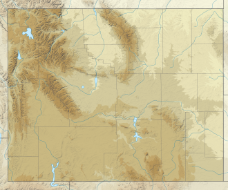
Wrangler Lake is a lake located in Yellowstone National Park in the U.S. state of Wyoming. It is a few miles from the Wapiti Lake Trailhead.
Contents

Description

The Yellowstone Fly-Fishing Guide describes the lake as fishless. [1] There is a 10.2 mi (16.4 km) roundtrip trail which starts at Sour Creek in Yellowstone National Park and ends at Wrangler Lake. [2]

Bill Schneider notes that Wrangler Lake has many mosquitos in June and July, and so recommends hiking later in the season. [3]

Related Research Articles

<span class="mw-page-title-main">Madison River</span> River in Wyoming and Montana, United States

The Madison River is a headwater tributary of the Missouri River, approximately 183 miles (295 km) long, in Wyoming and Montana. Its confluence with the Jefferson and Gallatin rivers near Three Forks, Montana forms the Missouri River.

<span class="mw-page-title-main">Lamar River</span> River in Wyoming, United States

The Lamar River is a tributary of the Yellowstone River, approximately 40 miles (64 km) long, in northwestern Wyoming in the United States. The river is located entirely within Yellowstone National Park.

<span class="mw-page-title-main">Slough Creek (Wyoming)</span> River in Montana and Wyoming, United States

Slough Creek is a tributary of the Lamar River, approximately 25 mi (40 km) long, in Montana and Wyoming in the United States.

<span class="mw-page-title-main">Shoshone National Forest</span> National Forest in Wyoming, US

Shoshone National Forest is the first federally protected National Forest in the United States and covers nearly 2,500,000 acres (1,000,000 ha) in the state of Wyoming. Originally a part of the Yellowstone Timberland Reserve, the forest is managed by the United States Forest Service and was created by an act of Congress and signed into law by U.S. President Benjamin Harrison in 1891. Shoshone National Forest is one of the first nationally protected land areas anywhere. Native Americans have lived in the region for at least 10,000 years, and when the region was first explored by European adventurers, forestlands were occupied by several different tribes. Never heavily settled or exploited, the forest has retained most of its wildness. Shoshone National Forest is a part of the Greater Yellowstone Ecosystem, a nearly unbroken expanse of federally protected lands encompassing an estimated 20,000,000 acres (8,100,000 ha).

Height of the Rockies Provincial Park is a provincial park in the Canadian Rockies of south eastern British Columbia, Canada. It is located west of the Continental Divide, adjacent to Elk Lakes Provincial Park.

<span class="mw-page-title-main">Trails of Yellowstone National Park</span>

Yellowstone National Park has over 1,100 miles (1,800 km) of blazed and mapped hiking trails, including some that have been in use for hundreds of years. Several of these trails were the sites of historical events. Yellowstone's trails are noted for various geysers, hot springs, and other geothermal features, and for viewing of bald eagles, ospreys, grizzly bears, black bears, wolves, coyotes, bighorn sheep, pronghorns, and free-ranging herds of bison and elk.

<span class="mw-page-title-main">Gibbon River</span> River in Wyoming, United States

The Gibbon River flows east of the Continental Divide in Yellowstone National Park, in northwestern Wyoming, the Northwestern United States. Along with the Firehole River, it is a major tributary of the Madison River, which itself is a tributary of the Missouri River.

<span class="mw-page-title-main">Angling in Yellowstone National Park</span>

Angling in Yellowstone National Park is a major reason many visitors come to the park each year and since it was created in 1872, the park has drawn anglers from around the world to fish its waters. In 2006, over 50,000 park fishing permits were issued to visitors. The park contains hundreds of miles of accessible, high-quality trout rivers containing wild trout populations—over 200 creeks, streams and rivers are fishable. There are 45 fishable lakes and several large lakes are easily accessible to visitors. Additionally, the park's remote sections provide anglers ample opportunity to visit rivers, streams, creeks and lakes that receive little angling pressure. With the exception of one specially designated drainage, all the park's waters are restricted to artificial lures and fly fishing. The Madison, Firehole and a section of the Gibbon rivers are restricted to fly fishing only.

<span class="mw-page-title-main">Mount Holmes</span>

Mount Holmes is a prominent mountain peak in Yellowstone National Park. It is the tallest mountain in the Wyoming portion of the Gallatin Range. Mount Holmes is located in the northwestern part of the park and marks the southern terminus of the Gallatin Range. It is the source of Indian Creek, a tributary of the Gardner River.

<span class="mw-page-title-main">Hayden Valley</span>

Hayden Valley is a large, sub-alpine valley in Yellowstone National Park straddling the Yellowstone River between Yellowstone Falls and Yellowstone Lake. The valley floor along the river is an ancient lake bed from a time when Yellowstone Lake was much larger. The valley is well known as one of the best locations to view wildlife in Yellowstone.

<span class="mw-page-title-main">Grebe Lake</span> Body of water

Grebe Lake is a 156 acres (0.63 km2) backcountry lake in Yellowstone National Park most noted for its population of Arctic grayling. Grebe Lake comprises the headwaters of the Gibbon River. Grebe Lake is located approximately 3.1 miles (5.0 km) north of the Norris-Canyon section of the Grand Loop Road. The trail to the lake passes through mostly level Lodgepole Pine forest and open meadows. The lake was named by J.P. Iddings, a geologist with the Arnold Hague geologic surveys. There are four backcountry campsites located on the lake.

<span class="mw-page-title-main">Trout Lake (Wyoming)</span> Body of water

Trout Lake, formerly known as Fish Lake and Soda Butte Lake, is a 12 acres (0.049 km2) popular backcountry lake for hikers and anglers in Yellowstone National Park. The lake is located approximately .33 miles (0.53 km) north of the Northeast Entrance Road near the confluence of Pebble Creek and Soda Butte Creek. The lake sits in a depression on a high bench above the Soda Butte Creek Canyon. A steep trail through a Douglas fir forest leads to the lake. The trailhead is located at: 44°53′57″N110°7′21″W.

<span class="mw-page-title-main">Lone Star Geyser</span> Geyser in the Lone Star Geyser Basin of Yellowstone National Park

Lone Star Geyser is a cone type geyser located in the Lone Star Geyser Basin of Yellowstone National Park. The basin is a backcountry geyser basin located 3 miles (4.8 km) southeast of Old Faithful Geyser and the Upper Geyser Basin. The geyser is reached via an old service road open to hikers and biking with the trailhead near Kepler Cascades on the Grand Loop Road.

<span class="mw-page-title-main">Bunsen Peak</span>

Bunsen Peak el. 8,564 feet (2,610 m) is a prominent peak due south of Mammoth Hot Springs in Yellowstone National Park, Wyoming. The peak lies on the east flank of Kingman Pass on the Mammoth to Norris section of the Grand Loop Road. The peak was first ascended by Ferdinand V. Hayden and Captain John W. Barlow in 1871, Bunsen Peak was not named until 1872 during the second Hayden Geologic Survey. E. S. Topping named the peak Observation Mountain in 1872 as well, but that name did not stick. The Bunsen Peak Trail with its trailhead just south of Mammoth is a steep 2.1 miles (3.4 km) to the summit. Bunsen Peak was named for the German chemist Robert Bunsen, the inventor of the Bunsen Burner and responsible for early work on volcanic geyser theories.

<span class="mw-page-title-main">Shoshone Lake</span> Lake in Yellowstone National Park, Wyoming

Shoshone Lake is a U.S. backcountry lake with an area of 8,050 acres with an elevation of 7,795 feet (2,376 m) in the southwest section of Yellowstone National Park, Wyoming. It lies at the headwaters of the Lewis River, a tributary of the Snake River. The U.S. Fish and Wildlife Service believes that Shoshone Lake is the largest backcountry lake in the lower 48 states that cannot be reached by a road. The Yellowstone Caldera is located within the lake.

<span class="mw-page-title-main">The Thunderer (Wyoming)</span> Mountain in Wyoming, United States

The Thunderer el. 10,558 feet (3,218 m) is a mountain peak in the northeast section of Yellowstone National Park, in the Absaroka Range of the U.S. state of Wyoming. Named by members of the Arnold Hague Geological Survey of 1885 for its propensity to attract thunderstorms, the mountain is a long high ridge just north of Mount Norris. Prior to 1885, the peak was merely considered a high ridge extending north from Mount Norris rather than a separately named peak. The Thunderer is easily visible from the northeast entrance road as it passes up the Soda Butte Creek canyon.

<span class="mw-page-title-main">Bearpaw Lake (Teton County, Wyoming)</span> Body of water

Bearpaw Lake is located in Grand Teton National Park, in the U. S. state of Wyoming. Bearpaw Lake is south of Trapper Lake and north of Leigh Lake. Bearpaw Lake is an easy to moderate 9.2-mile (14.8 km) round trip hike along the Leigh Lake Trail. The trail starts at the String Lake trailhead and wanders north along the east shores of Leigh Lake with a 460 feet (140 m) elevation gain. Bearpaw Lake is nestled at the eastern base of Mount Moran and snow and glacier meltwaters off Skillet Glacier eventually feed into the lake. There are three backcountry camping sites with designated tent pads at the lake and a backcountry permit is required to use these sites.

<span class="mw-page-title-main">Bierstadt Lake</span> Lake in Colorado, United States

Bierstadt Lake is located in Larimer County, Colorado and within the Rocky Mountain National Park. Near McHenrys Peak and Longs Peak, there are "spectacular views" of the Continental Divide at the lake. The Bierstadt Lake Trailhead is located about 6.5 miles (10.5 km) from the turn-off at U.S. Route 36 into the Rocky Mountain National Park. During the summer, shuttle buses provide transportation to the trailhead.

<span class="mw-page-title-main">Lakes of Grand Teton National Park</span> Lakes of United States Grand Teton National Park in northwestern Wyoming

There are 44 named and countless unnamed lakes in Grand Teton National Park. The largest of these is Jackson Lake, a natural glacial lake that has been enlarged with the construction of the Jackson Lake Dam. The lakes range in size as well as ease of access. In addition to mountain tarns, there are several large peidmont lakes. Nearly all the lakes are glacial in origin, formed by glacial action that carved out the valleys and left moraine behind that acted as dams to lock in water.

References

  1. Mathews, Craig (2019). The Yellowstone fly-fishing guide : an authoritative guide to the waters of Yellowstone National Park (New and revised ed.). Guilford, Connecticut: Lyons Press. p. 128. ISBN   978-1493042241 . Retrieved 28 August 2022.
  2. "Wapiti Lake Trailhead (4K7)". National Park Service. Retrieved 29 August 2022.
  3. Schneider, Bill (2012). Hiking Yellowstone National Park: A Guide to More than 100 Great Hikes. Rowman & Littlefield. p. 195. ISBN   9780762786145 . Retrieved 1 September 2022.