
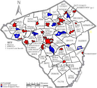
Lancaster County, sometimes nicknamed the Garden Spot of America or Pennsylvania Dutch Country, is a county in the Commonwealth of Pennsylvania, United States. As of the 2020 census, the population was 552,984, making it Pennsylvania's sixth-most populous county. Its county seat is also Lancaster. Lancaster County comprises the Lancaster metropolitan statistical area. The county is part of the South Central region of the state.. Lancaster County is a tourist destination with its Amish community being a major attraction. The ancestors of the Amish began to immigrate to colonial Pennsylvania in the early 18th century to take advantage of the religious freedom offered by William Penn, as well as the area's rich soil and mild climate. They were joined by French Huguenots fleeing the religious persecution of Louis XIV. There were also significant numbers of English, Welsh and Ulster Scots.

Columbia, formerly Wright's Ferry, is a borough (town) in Lancaster County, Pennsylvania, United States. As of the 2020 census, it had a population of 10,222. It is 28 miles (45 km) southeast of Harrisburg, on the east (left) bank of the Susquehanna River, across from Wrightsville and York County and just south of U.S. Route 30.

Manor Township is a second-class township in west-central Lancaster County, Pennsylvania, United States. As of the 2020 census, it had a population of 21,920.

The Susquehanna River is a major river located in the Mid-Atlantic region of the United States, crossing three lower Northeast states. At 444 miles (715 km) long, it is the longest river on the East Coast of the United States. By watershed area, it is the 16th-largest river in the United States, and also the longest river in the early 21st-century continental United States without commercial boat traffic.

The Conestoga wagon, also simply known as the Conestoga, is an obsolete transport vehicle that was used exclusively in North America, primarily the United States, mainly from the early 18th to mid-19th centuries. It is a heavy and large horse-drawn vehicle which, while largely elusive in origin, originated most likely from German immigrants of Pennsylvanian Dutch culture in the Province of Pennsylvania in the early 18th century. The name "Conestoga Wagon" probably derived from the Conestoga River Valley settlement area in the province and saw usage as early as 1717, although it is not known whether the first wagons referred as such had similar builds as later Conestoga wagons.

The Susquehannock, also known as the Conestoga, Minquas, and Andaste, were an Iroquoian people who lived in the lower Susquehanna River watershed in what is now Pennsylvania. Their name means “people of the muddy river.”

The Paxton Boys, also known as the Paxtang Boys or the Paxton Rangers, were a mob of settlers that murdered 20 unarmed Conestoga in Lancaster County, Pennsylvania, in December 1763. This group of vigilantes from Lancaster and Cumberland counties formed in 1763 to defend themselves from Indigenous attacks during Pontiac's War. The Paxton Boys justified their actions by claiming that the Conestoga were colluding with the Lenape and Shawnee who were attacking Pennsylvania's frontier settlements. According to historian Kevin Kenny, the Paxton Boys were Pennsylvania's most aggressive colonists.

The Conestoga River, also referred to as Conestoga Creek, is a 61.6-mile-long (99.1 km) tributary of the Susquehanna River flowing through the center of Lancaster County, Pennsylvania, United States.
The Columbia–Wrightsville Bridge, officially the Veterans Memorial Bridge, spans the Susquehanna River between Columbia and Wrightsville, Pennsylvania, and carries Pennsylvania Route 462 and BicyclePA Route S. Built originally as the Lancaster-York Intercounty Bridge, construction began in 1929, and the bridge opened September 30, 1930. On November 11, 1980, it was officially dedicated as Veterans Memorial Bridge, though it is still referenced locally as the Columbia–Wrightsville Bridge.
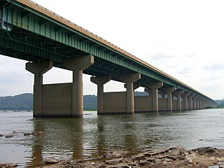
The Wright's Ferry Bridge carries U.S. Route 30 (US 30) over the Susquehanna River between Columbia and Wrightsville, Pennsylvania. The "Wright's Ferry" in its name commemorates the first ferry across the Susquehanna River.

The Pennsylvania Railroad Bridge once carried the York Branch of the Pennsylvania Railroad across the Susquehanna River between Columbia and Wrightsville, Pennsylvania and is therefore considered a Columbia-Wrightsville Bridge. It and its predecessors were a vital commercial and passenger linkage between Philadelphia and Baltimore for over 100 years.

Cresap's War was a border conflict between Pennsylvania and Maryland fought in the 1730s. Hostilities erupted in 1730 with a series of violent incidents prompted by disputes over property rights and law enforcement. The conflict escalated through the first half of the decade, culminating in the deployment of military forces by Maryland in 1736 and by Pennsylvania in 1737. The armed phase of the conflict ended in May 1738 with the intervention of King George II, who compelled the negotiation of a ceasefire. A final settlement was not achieved until 1767 when the Mason–Dixon line was recognized as the permanent boundary between the two colonies.

Conestoga is an unincorporated community and census-designated place (CDP) in Conestoga Township, Lancaster County, Pennsylvania, United States. At the 2020 census, the population was 1,163. The Conestoga post office serves ZIP code 17516.
Transportation in Lancaster County, Pennsylvania has a long and variegated history. An early-settled part of the United States, and lying on the route between Philadelphia and Harrisburg, it has been the site of early experiments in canals, railroads, and highways. Before all these, at least ten Native American paths crossed parts of the county, many connecting with the Susquehannock village of Conestoga.

Washington Boro is a census-designated place (CDP) in Manor Township, Lancaster County, Pennsylvania, United States, along the Susquehanna River. The ZIP code is 17582. It is served by the Penn Manor School District and is the terminus of Pennsylvania Routes 441 and 999. The population was 729 at the 2010 census.
Colonel Thomas Cresap was an English-born settler and trader in the states of Maryland and Pennsylvania. Cresap served Lord Baltimore as an agent in the Maryland–Pennsylvania boundary dispute that became known as Cresap's War. Later, together with the Native American chief Nemacolin, Cresap improved a Native American path to the Ohio Valley, and ultimately settled and became a large landowner near Cumberland, Maryland, where he was involved in further disputes near Brownsville, Pennsylvania, including in the French and Indian War and Lord Dunmore's War.

Strasburg Road was an early road in Pennsylvania connecting Philadelphia to Strasburg in Lancaster County. The route was surveyed by John Sellers and others in 1772-3 under the colonial administration of Governor Richard Penn and completed under the new administration of the independent state of Pennsylvania. The route started at the "second ferry" on the Schuylkill River, today's Market Street in Philadelphia, and went through West Chester, East Fallowfield Township, and Gap, before ending in Strasburg. Earlier roads travelled much the same route, including a Native American path in use as early as 1620.
Thomas Brown, was an American colonial era husbandman, businessman, and land speculator. Along with his brother Basil, he acquired the bulk of the (Brownsville) lands towards the end of the American Revolution from Thomas Cresap(Cresap's War, Lord Dunmore's War), early enough to sell plots to Jacob Bowman in 1780 and Jacob Yoder who respectively made business firsts in 1780 and 1782; Jacob Bowman founded a trading post and tavern. Yoder got in a crop big enough to ship to New Orleans and invented the flat boat on Redstone Creek, inaugurating the water craft construction businesses which made the town an industrial powerhouse for the next seventy years.
John Wright was an emigrant English pioneer, colonial period businessman who established Wright's Ferry. The resulting increase in settlement triggered nine years of armed conflict during the Maryland-Pennsylvania boundary dispute known as Cresap's War. The animal powered ferry was the very first means of crossing the broad unfriendly Susquehanna River in a region known as Conejohela Valley nearly halfway between what became Lancaster County, Pennsylvania, and York County, Pennsylvania.
The Conejohela Flats are a group of islands in the flooded Conejohela Valley, a large floodplain along the southernmost 30 miles (50 km) of the Susquehanna River in Pennsylvania and Maryland in the United States. The valley was flooded primarily during the early 1900s by the construction of the Holtwood, Conowingo, and Safe Harbor dams from 1910 to 1931.

