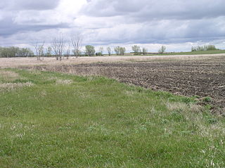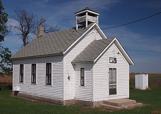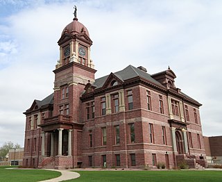
Clay County is a county in the U.S. state of Minnesota. As of the 2020 census, the population was 65,318. Its county seat is Moorhead. Clay County is part of the Fargo, ND-MN Metropolitan Statistical Area.

Campbell County is a county in the U.S. state of South Dakota. As of the 2020 census, the population was 1,377, making it the fourth-least populous county in South Dakota. Its county seat is Mound City. The county was created in 1873 and organized in 1884. It was named for Norman B. Campbell, a Dakota Territory legislator in 1873 and son of General Charles T. Campbell.

Aurora County is a county in the U.S. state of South Dakota. As of the 2020 census, the population was 2,747. The county was created in 1879, and was organized in 1881.

Stark County is a county in the U.S. state of North Dakota. As of the 2020 census, the population was 33,646, making it the 7th most populous county in North Dakota. Its county seat is Dickinson.

McIntosh County is a county in the U.S. state of North Dakota. As of the 2020 census, the population was 2,530. Its county seat is Ashley. The county is notable for being the county with the highest percentage of German-Americans in the United States, with over 76% of the county's residents being of German descent as of 2010.

Divide County is a county in the U.S. state of North Dakota. As of the 2020 census, the population was 2,195. Its county seat is Crosby.

Traverse County is a county in the U.S. state of Minnesota. As of the 2020 census, the population was 3,360, making it the least-populous county in Minnesota. Its county seat is Wheaton. The county was founded in 1862 and organized in 1881.

Scott County is a county in the U.S. state of Minnesota. As of the 2020 census, the population was 150,928. Its county seat is Shakopee. Shakopee is also the largest city in Scott County, the twenty-first-largest city in Minnesota, and the sixteenth-largest Twin Cities suburb. The county was organized in 1853 and named in honor of General Winfield Scott. Scott County is part of the Minneapolis-St. Paul-Bloomington, MN-WI Metropolitan Statistical Area. It is a member of the Metropolitan Council, and shares many of the council's concerns about responsible growth management, advocating for progressive development concepts such as clustering, open-space design, and the preservation of open space and rural/agricultural land.

Rock County is a county located in the southwestern corner of the U.S. state of Minnesota. According to the 2020 census, its population was 9,704. The county seat is Luverne. It is located within the Sioux Falls MSA.

Polk County is a county in the northwestern part of the U.S. state of Minnesota. The population was 31,192 at the 2020 census. Its county seat is Crookston, and the largest community is East Grand Forks.

Pipestone County is a county in the U.S. state of Minnesota. As of the 2020 census, the population was 9,424. Its county seat is Pipestone.

Pennington County is a county in the northwestern part of the U.S. state of Minnesota. As of the 2020 census, the population was 13,992. Its county seat is Thief River Falls.

Nobles County is a county in the U.S. state of Minnesota. As of the 2020 census, the population was 22,290. Its county seat is Worthington. Nobles County comprises the Worthington, MN Micropolitan Statistical Area.

Mower County is a county in the U.S. state of Minnesota. As of the 2020 census, the population was 40,029. The county seat is Austin. Mower County comprises the Austin Micropolitan Statistical Area and is included in the Rochester-Austin Combined Statistical Area. Lake Louise State Park is in southeastern Mower County, near Le Roy.

Meeker County is a county in the U.S. state of Minnesota. As of the 2020 census, the population was 23,400. Its county seat is Litchfield.

Kittson County is a county in the northwestern corner of the U.S. state of Minnesota along the Canada–US border, south of the Canadian province of Manitoba. As of the 2020 census, the population was 4,207. Its county seat is Hallock.

Douglas Township is a township in Dakota County, Minnesota, United States. The population was 748 at the 2020 census. Douglas Township was organized in 1858, and named for Stephen A. Douglas, a United States Senator from Illinois. Its town hall is located at the intersection of U.S. Route 61 and state highways 20 and 50.
Eureka Township is an urban township in Dakota County, Minnesota, United States. The population was 1,373 at the 2020 census.
A civil township is a widely used unit of local government in the United States that is subordinate to a county, most often in the northern and midwestern parts of the country. The term town is used in New England, New York, as well as Wisconsin to refer to the equivalent of the civil township in these states; Minnesota uses "town" officially but often uses it and "township" interchangeably. Specific responsibilities and the degree of autonomy vary in each state. Civil townships are distinct from survey townships, but in states that have both, the boundaries often coincide, especially in Indiana, Ohio, and Illinois, and may completely geographically subdivide a county. The U.S. Census Bureau classifies civil townships as minor civil divisions. Currently, there are 20 states with civil townships, including Indiana, Ohio, Illinois, Michigan, Iowa, Minnesota, Wisconsin, Missouri, Kansas, Nebraska, South Dakota, North Dakota, Pennsylvania, and West Virginia.

Pickering Township is a civil township in Bottineau County in the U.S. state of North Dakota. Its population was 193 as of the 2010 census, down from 213 at the 2000 census.


