
Kosianka Leśna is a village in the administrative district of Gmina Grodzisk, within Siemiatycze County, Podlaskie Voivodeship, in north-eastern Poland. It lies approximately 2 kilometres (1 mi) west of Grodzisk, 20 km (12 mi) north-west of Siemiatycze, and 67 km (42 mi) south-west of the regional capital Białystok.
Nienaszów is a village in the administrative district of Gmina Nowy Żmigród, within Jasło County, Subcarpathian Voivodeship, in south-eastern Poland. It lies approximately 5 kilometres (3 mi) north-east of Nowy Żmigród, 16 km (10 mi) south-east of Jasło, and 54 km (34 mi) south-west of the regional capital Rzeszów.
Harklowa is a village in the administrative district of Gmina Skołyszyn, within Jasło County, Subcarpathian Voivodeship, in south-eastern Poland. It lies approximately 4 kilometres (2 mi) south of Skołyszyn, 10 km (6 mi) west of Jasło, and 59 km (37 mi) south-west of the regional capital Rzeszów.
Brzezówka is a village in the administrative district of Gmina Tarnowiec, within Jasło County, Subcarpathian Voivodeship, in south-eastern Poland. It lies approximately 4 kilometres (2 mi) south-east of Tarnowiec, 11 km (7 mi) east of Jasło, and 44 km (27 mi) south-west of the regional capital Rzeszów.
Czeluśnica is a village in the administrative district of Gmina Tarnowiec, within Jasło County, Subcarpathian Voivodeship, in south-eastern Poland. It lies approximately 4 kilometres (2 mi) south-west of Tarnowiec, 6 km (4 mi) east of Jasło, and 47 km (29 mi) south-west of the regional capital Rzeszów.
Dobrucowa is a village in the administrative district of Gmina Tarnowiec, within Jasło County, Subcarpathian Voivodeship, in south-eastern Poland. It lies approximately 9 km (6 mi) east of Jasło and 44 km (27 mi) south-west of the regional capital Rzeszów.
Gliniczek is a village in the administrative district of Gmina Tarnowiec, within Jasło County, Subcarpathian Voivodeship, in south-eastern Poland. It lies approximately 5 kilometres (3 mi) south-west of Tarnowiec, 5 km (3 mi) east of Jasło, and 48 km (30 mi) south-west of the regional capital Rzeszów.
Glinik Polski is a village in the administrative district of Gmina Tarnowiec, within Jasło County, Subcarpathian Voivodeship, in south-eastern Poland. It lies approximately 8 kilometres (5 mi) south of Tarnowiec, 10 km (6 mi) south-east of Jasło, and 51 km (32 mi) south-west of the regional capital Rzeszów.
Łajsce is a village in the administrative district of Gmina Tarnowiec, within Jasło County, Subcarpathian Voivodeship, in south-eastern Poland. It lies approximately 10 kilometres (6 mi) south of Tarnowiec, 11 km (7 mi) south-east of Jasło, and 53 km (33 mi) south-west of the regional capital Rzeszów.
Łubienko is a village in the administrative district of Gmina Tarnowiec, within Jasło County, Subcarpathian Voivodeship, in south-eastern Poland. It lies approximately 10 kilometres (6 mi) south of Tarnowiec, 13 km (8 mi) south-east of Jasło, and 51 km (32 mi) south-west of the regional capital Rzeszów.
Łubno Opace is a village in the administrative district of Gmina Tarnowiec, within Jasło County, Subcarpathian Voivodeship, in south-eastern Poland. It lies approximately 10 kilometres (6 mi) south of Tarnowiec, 13 km (8 mi) south-east of Jasło, and 51 km (32 mi) south-west of the regional capital Rzeszów.
Łubno Szlacheckie is a village in the administrative district of Gmina Tarnowiec, within Jasło County, Subcarpathian Voivodeship, in south-eastern Poland. It lies approximately 10 kilometres (6 mi) south of Tarnowiec, 13 km (8 mi) south-east of Jasło, and 51 km (32 mi) south-west of the regional capital Rzeszów.
Potakówka is a village in the administrative district of Gmina Tarnowiec, within Jasło County, Subcarpathian Voivodeship, in south-eastern Poland. It lies approximately 4 kilometres (2 mi) south of Tarnowiec, 10 km (6 mi) east of Jasło, and 46 km (29 mi) south-west of the regional capital Rzeszów.
Roztoki is a village in the administrative district of Gmina Tarnowiec, within Jasło County, Subcarpathian Voivodeship, in south-eastern Poland. It lies approximately 3 kilometres (2 mi) west of Tarnowiec, 6 km (4 mi) east of Jasło, and 46 km (29 mi) south-west of the regional capital Rzeszów.
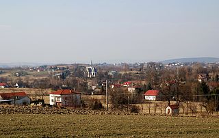
Tarnowiec is a village in Jasło County, Subcarpathian Voivodeship, in south-eastern Poland. It is the seat of the gmina called Gmina Tarnowiec. It lies approximately 9 kilometres (6 mi) east of Jasło and 44 km (27 mi) south-west of the regional capital Rzeszów.
Umieszcz is a village in the administrative district of Gmina Tarnowiec, within Jasło County, Subcarpathian Voivodeship, in south-eastern Poland. It lies approximately 5 kilometres (3 mi) south-west of Tarnowiec, 7 km (4 mi) south-east of Jasło, and 48 km (30 mi) south-west of the regional capital Rzeszów.
Majscowa is a village in the administrative district of Gmina Dębowiec, within Jasło County, Subcarpathian Voivodeship, in south-eastern Poland. It lies approximately 5 kilometres (3 mi) north-east of Dębowiec, 4 km (2 mi) south of Jasło, and 52 km (32 mi) south-west of the regional capital Rzeszów.
Kalinowo is a village in the administrative district of Gmina Długosiodło, within Wyszków County, Masovian Voivodeship, in east-central Poland. It lies approximately 6 kilometres (4 mi) south of Długosiodło, 17 km (11 mi) north-east of Wyszków, and 69 km (43 mi) north-east of Warsaw.
Lulin is a village in the administrative district of Gmina Oborniki, within Oborniki County, Greater Poland Voivodeship, in west-central Poland. It lies approximately 11 kilometres (7 mi) south-west of Oborniki and 25 km (16 mi) north-west of the regional capital Poznań.


