
Koksijde is a town and a municipality in Belgium. It is located on the North Sea coast in the southwest of the Flemish province of West Flanders.
Machelen, or in full Machelen-aan-de-Leie, is a village in the municipality of Zulte in the province of East Flanders of Belgium. It was the hometown of the painter Roger Raveel.
Houtem is a village in the municipality of Veurne in the Belgian province of West Flanders. The village is located near the French border. Until 1977, Houtem was an independent municipality. During World War I, it was home to the Headquarters of the Belgian Army.

Beerlegem is a village belonging to the municipality of Zwalm. It is located in the Flemish Ardennes, the hilly southern part of the province of East Flanders, Belgium. Until 1970, it was an independent municipality.
Leeuwergem is a village belonging to the municipality of Zottegem. It is located on the Molenbeek, in the Denderstreek and Flemish Ardennes, which is part of the hilly southern part of the East Flanders province, Belgium.

Erwetegem is a village and deelgemeente (sub-municipality) belonging to the municipality of Zottegem. It is located in the Denderstreek and in the Flemish Ardennes, the hilly southern part of the province of East Flanders, Belgium. Erwetegem used to an independent municipality until 1970.
Oelegem is a village and deelgemeente (sub-municipality) of the municipality of Ranst in the province of Antwerp, Belgium. The village is located about 14 kilometres (8.7 mi) east of the city of Antwerp.

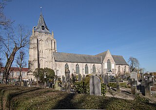
Oud-Rekem is a village in the Lanaken municipality of the Limburg province of Belgium. The village is considered one of the most authentic villages of Belgium. Since 1994, it is protected as a monument.

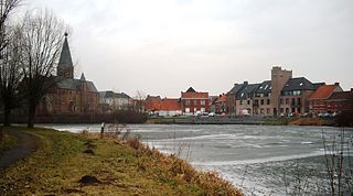
Kieldrecht is a village and deelgemeente (sub-municipality) of Beveren in East Flanders, Belgium. Kieldrecht was an independent municipality until 1977, when it merged with Beveren as part of the fusion of municipalities in Belgium. The village is located on the border with the Netherlands, and forms a single urban area with the Dutch village of Nieuw-Namen.
Vrasene is a village in the municipality of Beveren in the Belgian province of East Flanders. It is located about 15 kilometres (9.3 mi) east of Antwerp.

Haasdonk is a village and deelgemeente (sub-municipality) of Beveren in East Flanders, Belgium. Haasdonk was an independent municipality until 1 January 1977, when it merged with Beveren as part of the fusion of municipalities in Belgium. It is located about 12 kilometres (7.5 mi) west of Antwerp.

Waarloos is a village and deelgemeente (sub-municipality) of the municipality of Kontich in the province of Antwerp, Belgium. The village is located about 13 kilometres (8.1 mi) south of the city of Antwerp.

Kluizen is a village in the municipalities of Evergem and Ghent in the province of East Flanders, Belgium. Large parts of the original municipality have become part of the Port of Ghent.

Liezele is a village and deelgemeente (sub-municipality) of the municipality of Puurs-Sint-Amands in the province of Antwerp, Belgium. The village is located about 20 kilometres (12 mi) south-south-west of the city of Antwerp. On the night of 4 to 5 September 1914, the entire village was destroyed by the Belgian Army to deny the Germany Army cover.
Hoogstade is a village in the municipality of Alveringem in the Belgian province of West Flanders. The village is located on the N8. Until 1971, Hoogstade was an independent municipality.
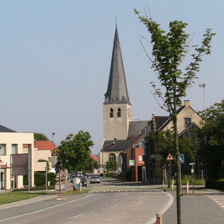
Huise is a village on a hill within the municipality of Zingem, part of the province of East Flanders in Belgium.

Kallo is a village and deelgemeente (sub-municipality) of Beveren in East Flanders, Belgium. Kallo was an independent municipality until 1 January 1977, when it merged with Beveren as part of the fusion of municipalities in Belgium. Most of the deelgemeente consists of harbours and industrial zones.
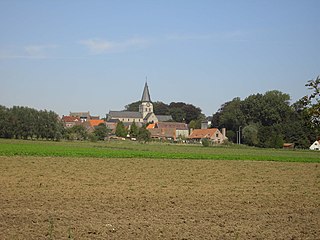
Petegem-aan-de-Schelde is a village and former municipality in the Wortegem-Petegem municipality in the Belgian province of East Flanders. The village officially changed its name from Petegem into Petegem-aan-de-Schelde in order to distinguish itself from Petegem-aan-de-Leie. In 1971, the municipality merged into Wortegem-Petegem.

Beveren-aan-de-IJzer is a village in the municipality of Alveringem in the Belgian province of West Flanders. The village is located near the border with France, and was therefore called Beveren aan de Franse grens during the 19th century. Until 1971, Beveren-aan-de-IJzer was an independent municipality.

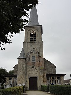
Wortegem is a village and seat of the municipality of Wortegem-Petegem in the Belgian province of East Flanders. It is located about 17 kilometres (11 mi) east of Kortrijk.

