Zgorzelec(listen) is a town in south-western Poland with 32,322 inhabitants (2012). It lies in Lower Silesian Voivodeship. It is the seat of Zgorzelec County, and also of the smaller district of Gmina Zgorzelec. Zgorzelec is located on the Lusatian Neisse river, on the post-1945 Polish-German Neisse border adjoining the German town of Görlitz, of which it constituted the eastern part up to 1945.
This is a list of the extreme points of Estonia: the points that are farther north, south, east or west than any other location.

Gaworzyce is a village in Polkowice County, Lower Silesian Voivodeship, in south-western Poland. It is the seat of the administrative district (gmina) called Gmina Gaworzyce. It lies approximately 20 kilometres (12 mi) north-west of Polkowice, and 98 kilometres (61 mi) north-west of the regional capital Wrocław.

Wierzbica is a village in the administrative district of Gmina Urzędów, within Kraśnik County, Lublin Voivodeship, in eastern Poland. It lies approximately 6 kilometres (4 mi) north-west of Urzędów, 15 km (9 mi) north-west of Kraśnik, and 41 km (25 mi) south-west of the regional capital Lublin.

Wielka Wola is a village in the administrative district of Gmina Czerniewice, within Tomaszów Mazowiecki County, Łódź Voivodeship, in central Poland. It lies approximately 4 kilometres (2 mi) south of Czerniewice, 17 km (11 mi) north-east of Tomaszów Mazowiecki, and 52 km (32 mi) east of the regional capital Łódź.
Nowy Bazanów is a village in the administrative district of Gmina Ryki, within Ryki County, Lublin Voivodeship, in eastern Poland.

Friedrichstadt is a neighborhood in central Dresden, Germany. A factory district in the late 19th and early 20th centuries, it is known as the home of the founders of the artistic association known as Die Brücke.

Konstantynowo is a village in the administrative district of Gmina Chodzież, within Chodzież County, Greater Poland Voivodeship, in west-central Poland. It lies approximately 9 kilometres (6 mi) east of Chodzież and 69 km (43 mi) north of the regional capital Poznań.
Blizanówek is a village in the administrative district of Gmina Blizanów, within Kalisz County, Greater Poland Voivodeship, in west-central Poland.
Laski is a village in the administrative district of Gmina Trzcinica, within Kępno County, Greater Poland Voivodeship, in west-central Poland.
Kuczków is a village in the administrative district of Gmina Pleszew, within Pleszew County, Greater Poland Voivodeship, in west-central Poland.
Retno is a village in the administrative district of Gmina Krosno Odrzańskie, within Krosno Odrzańskie County, Lubusz Voivodeship, in western Poland.

Radomyśl is a village in the administrative district of Gmina Wierzchowo, within Drawsko County, West Pomeranian Voivodeship, in north-western Poland. It lies approximately 6 kilometres (4 mi) west of Wierzchowo, 17 km (11 mi) south-east of Drawsko Pomorskie, and 96 km (60 mi) east of the regional capital Szczecin.

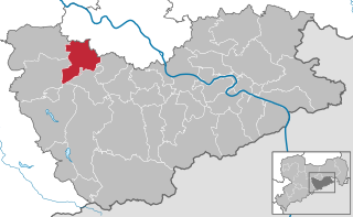
Weißig is a municipal subdivision of Freital in Sächsische Schweiz-Osterzgebirge district. It consists of two other villages, Oberweißig and Unterweißig.

Deuben is a municipal subdivision of Freital in Sächsische Schweiz-Osterzgebirge district.

Somsdorf is a municipal subdivision of Freital in Sächsische Schweiz-Osterzgebirge district. It lies in the west of Freital, between the Rote Weißeritz and the Wilde Weißeritz.
The Dresden–Werdau railway is an electrified, double-track main line in the German state of Saxony. It runs from Dresden via Freiberg, Chemnitz and Zwickau to Werdau wye, where it joins the Leipzig-Hof railway.
Dashteh is a village in Bask-e Kuleseh Rural District, in the Central District of Sardasht County, West Azerbaijan Province, Iran. At the 2006 census, its population was 37, in 8 families.

Roggenmarkt is a city square and marketplace in the city of Münster in the German state of North Rhine-Westphalia. It lies to the northeast of the Münster Cathedral at the city center. The Roggenmarkt is located north of the city's main Prinzipalmarkt and extends in an arc to the west away from St. Lambert's Church. The two markets flow into each other.


