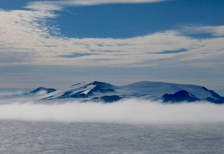
Joinville Island is the largest island of the Joinville Island group, about 40 nautical miles long in an east–west direction and 12 nautical miles wide, lying off the northeastern tip of the Antarctic Peninsula, from which it is separated by the Antarctic Sound.
The Behrendt Mountains is a group of mountains, 20 nautical miles long, aligned in the form of a horseshoe with the opening to the southwest, standing 7 nautical miles southwest of the Merrick Mountains in Ellsworth Land, Antarctica.
The Scaife Mountains is a group of mountains rising west of Prehn Peninsula and between the Ketchum Glacier and Ueda Glacier, at the base of the Antarctic Peninsula.

Bear Peninsula is a peninsula about 50 nautical miles long and 25 nautical miles wide which is ice-covered except for several isolated rock bluffs and outcrops along its margins, lying 3 nautical miles east of Martin Peninsula on Walgreen Coast, Marie Byrd Land, Antarctica.
Martin Peninsula is a peninsula about 60 nautical miles long and 20 nautical miles wide that is ice-covered except for a few rock outcrops along its margins, located between Getz Ice Shelf and Dotson Ice Shelf on the coast of Marie Byrd Land, Antarctica. The farthest point of the peninsula is Jacobsen Head.
Mikkelsen Bay is a bay, 15 nautical miles wide at its mouth and indenting 10 nautical miles, entered between Bertrand Ice Piedmont and Cape Berteaux along the west coast of Graham Land, Antarctica.
Northeast Glacier is a steep, heavily crevassed glacier, 13 nautical miles long and 5 nautical miles wide at its mouth, which flows from McLeod Hill westward and then south-westwards into Marguerite Bay between the Debenham Islands and Roman Four Promontory, on the west coast of Graham Land, Antarctica.
Neny Fjord is a bay, 10 nautical miles long in an east–west direction and 5 nautical miles wide, between Red Rock Ridge and Roman Four Promontory on the west coast of Graham Land, Antarctica.
Rymill Bay is a bay, 9 nautical miles wide at its mouth and indenting 5 nautical miles between Red Rock Ridge and Bertrand Ice Piedmont along the west coast of Graham Land, Antarctica.

Joinville Island group is a group of antarctic islands, lying off the northeastern tip of the Antarctic Peninsula, from which Joinville Island group is separated by the Antarctic Sound.

The Prince Charles Mountains are a major group of mountains in Mac. Robertson Land in Antarctica, including the Athos Range, the Porthos Range, and the Aramis Range. The highest peak is Mount Menzies, with a height of 3,228 m (10,591 ft). Other prominent peaks are Mount Izabelle and Mount Stinear. These mountains, together with other scattered peaks, form an arc about 420 km (260 mi) long, extending from the vicinity of Mount Starlight in the north to Goodspeed Nunataks in the south.
Canisteo Peninsula is an ice-covered peninsula, about 30 nautical miles long and 20 nautical miles wide, which projects between Ferrero Bay and Cranton Bay into the eastern extremity of the Amundsen Sea.

The Guest Peninsula is a snow-covered peninsula about 45 nautical miles long between the Sulzberger Ice Shelf and Block Bay, in the northwest part of Marie Byrd Land, Antarctica.
The Mariner Glacier is a major glacier over 60 nautical miles long, descending southeast from the plateau of Victoria Land, Antarctica, between Mountaineer Range and Malta Plateau, and terminating at Lady Newnes Bay, Ross Sea, where it forms the floating Mariner Glacier Tongue.

Finsterwalder Glacier is a glacier on the northwest side of Hemimont Plateau, 2 nautical miles wide and 10 nautical miles long, flowing southwest from the central plateau of Graham Land, Antarctica, toward the head of Lallemand Fjord. Its mouth lies between the mouths of Haefeli Glacier and Klebelsberg Glacier, the three glaciers merging with Sharp Glacier where the latter enters the fjord. It was first surveyed from the plateau in 1946–47 by the Falkland Islands Dependencies Survey, and named by them for Sebastian Finsterwalder and his son, Richard Finsterwalder, German glaciologists.

Andersson Island is an island 7 nautical miles long and 4 nautical miles wide, lying 0.5 nautical miles south of Jonassen Island at the west side of the south entrance to Antarctic Sound, off the northeast tip of the Antarctic Peninsula. It is a volcanic island of the James Ross Island Volcanic Group.
Bryan Coast is that portion of the coast of Antarctica along the south shore of the Bellingshausen Sea between Pfrogner Point and the northern tip of the Rydberg Peninsula. To the west is Eights Coast, and to the east is English Coast.
Condor Peninsula is a mountainous, ice-covered peninsula, 30 nautical miles long and 10 to 15 nautical miles wide, between Odom Inlet and Hilton Inlet on the east coast of Palmer Land, Antarctica.
Day Island is an island, 7 nautical miles (13 km) long and 3 nautical miles (6 km) wide, immediately south of The Gullet and 2 nautical miles (4 km) north of Wyatt Island in the northern part of Laubeuf Fjord, off the west coast of Graham Land in the Antarctic Peninsula. It was first surveyed in 1936 by the British Graham Land Expedition under John Rymill, who gave it the provisional name Middle Island. It was resurveyed in 1948 by the Falkland Islands Dependencies Survey, who renamed it for Vice Admiral Sir Archibald Day, Hydrographer of the Navy.
The Danger Islands are a group of islands lying 13 nautical miles east-south-east of Joinville Island near the tip of the Antarctic Peninsula.


