
Haczów is a village in Brzozów County, Subcarpathian Voivodeship, in south-eastern Poland. It is the seat of the gmina called Gmina Haczów. It lies approximately 10 kilometres (6 mi) west of Brzozów and 42 km (26 mi) south of the regional capital Rzeszów. The village has a population of 3,370.
Gmina Jasienica Rosielna is a rural gmina in Brzozów County, Subcarpathian Voivodeship, in south-eastern Poland. Its seat is the village of Jasienica Rosielna, which lies approximately 9 kilometres (6 mi) north-west of Brzozów and 32 km (20 mi) south of the regional capital Rzeszów.

Buków is a village in the administrative district of Gmina Haczów, within Brzozów County, Subcarpathian Voivodeship, in south-eastern Poland. It lies approximately 5 kilometres (3 mi) south-east of Haczów, 8 km (5 mi) south-west of Brzozów, and 44 km (27 mi) south of the regional capital Rzeszów. The village has a population of around 300 people.

Jabłonica Polska is a village in the administrative district of Gmina Haczów, within Brzozów County, Subcarpathian Voivodeship, in south-eastern Poland. It lies approximately 4 kilometres (2 mi) north of Haczów, 9 km (6 mi) west of Brzozów, and 38 km (24 mi) south of the regional capital Rzeszów.

Jasionów is a village in the administrative district of Gmina Haczów, within Brzozów County, Subcarpathian Voivodeship, in south-eastern Poland. It lies approximately 6 kilometres (4 mi) east of Haczów, 6 km (4 mi) south-west of Brzozów, and 43 km (27 mi) south of the regional capital Rzeszów.

Malinówka is a village in the administrative district of Gmina Haczów, within Brzozów County, Subcarpathian Voivodeship, in south-eastern Poland. It lies approximately 4 kilometres (2 mi) north-east of Haczów, 7 km (4 mi) west of Brzozów, and 38 km (24 mi) south of the regional capital Rzeszów.

Trześniów is a village in the administrative district of Gmina Haczów, within Brzozów County, Subcarpathian Voivodeship, in south-eastern Poland. It lies in the valley of the Wisłok river, approximately 4 kilometres (2 mi) south-east of Haczów, 8 km (5 mi) south-west of Brzozów, and 44 km (27 mi) south of the regional capital Rzeszów. The village has a population of 1,300.
Orzechówka is a village in the administrative district of Gmina Jasienica Rosielna, within Brzozów County, Subcarpathian Voivodeship, in south-eastern Poland. It lies approximately 3 kilometres (2 mi) south of Jasienica Rosielna, 7 km (4 mi) north-west of Brzozów, and 35 km (22 mi) south of the regional capital Rzeszów.
Hłudno is a village in the administrative district of Gmina Nozdrzec, within Brzozów County, Subcarpathian Voivodeship, in south-eastern Poland. It lies approximately 4 kilometres (2 mi) west of Nozdrzec, 14 km (9 mi) north-east of Brzozów, and 30 km (19 mi) south of the regional capital Rzeszów.
Izdebki is a village in the administrative district of Gmina Nozdrzec, within Brzozów County, Subcarpathian Voivodeship, in south-eastern Poland. It lies approximately 8 kilometres (5 mi) west of Nozdrzec, 10 km (6 mi) north-east of Brzozów, and 31 km (19 mi) south of the regional capital Rzeszów.
Rudawiec is a village in the administrative district of Gmina Nozdrzec, within Brzozów County, Subcarpathian Voivodeship, in south-eastern Poland. It lies approximately 10 kilometres (6 mi) south-west of Nozdrzec, 8 km (5 mi) north-east of Brzozów, and 34 km (21 mi) south of the regional capital Rzeszów.
Ryta Górka is a village in the administrative district of Gmina Nozdrzec, within Brzozów County, Subcarpathian Voivodeship, in south-eastern Poland. It lies approximately 11 kilometres (7 mi) north-west of Nozdrzec, 15 km (9 mi) north of Brzozów, and 24 km (15 mi) south of the regional capital Rzeszów.
Ujazdy is a village in the administrative district of Gmina Nozdrzec, within Brzozów County, Subcarpathian Voivodeship, in south-eastern Poland. It lies approximately 10 kilometres (6 mi) north-west of Nozdrzec, 16 km (10 mi) north of Brzozów, and 24 km (15 mi) south of the regional capital Rzeszów.
Wesoła is a village in the administrative district of Gmina Nozdrzec, within Brzozów County, Subcarpathian Voivodeship, in south-eastern Poland. It lies approximately 9 kilometres (6 mi) west of Nozdrzec, 13 km (8 mi) north of Brzozów, and 27 km (17 mi) south of the regional capital Rzeszów.
Wołodź is a village in the administrative district of Gmina Nozdrzec, within Brzozów County, Subcarpathian Voivodeship, in south-eastern Poland. It lies approximately 6 kilometres (4 mi) south of Nozdrzec, 14 km (9 mi) east of Brzozów, and 37 km (23 mi) south-east of the regional capital Rzeszów.
Wara is a village in the administrative district of Gmina Nozdrzec, within Brzozów County, Subcarpathian Voivodeship, in south-eastern Poland. It lies approximately 3 kilometres (2 mi) south-east of Nozdrzec, 17 km (11 mi) north-east of Brzozów, and 34 km (21 mi) south-east of the regional capital Rzeszów.
Nozdrzec is a village in Brzozów County, Subcarpathian Voivodeship, in south-eastern Poland. It is the seat of the gmina called Gmina Nozdrzec. It lies approximately 17 kilometres (11 mi) north-east of Brzozów and 32 km (20 mi) south-east of the regional capital Rzeszów.

Jaćmierz is a village in the administrative district of Gmina Zarszyn, within Sanok County, Subcarpathian Voivodeship, in south-eastern Poland. It lies approximately 4 kilometres (2 mi) north of Zarszyn, 17 km (11 mi) north-west of Sanok, and 47 km (29 mi) south of the regional capital Rzeszów.
Brzozów Nowy is a village in the administrative district of Gmina Iłów, within Sochaczew County, Masovian Voivodeship, in east-central Poland. It lies approximately 5 kilometres (3 mi) south of Iłów, 18 km (11 mi) north-west of Sochaczew, and 68 km (42 mi) west of Warsaw.


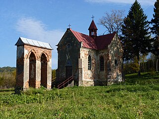
 Wzdow in 19th century
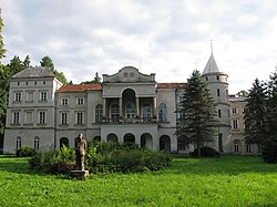
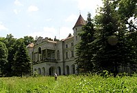 Wzdow in 2008

