Yagoua | |
|---|---|
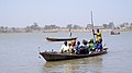
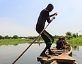
 Paddler at Yagoua | |
 Yagoua Location in Cameroon | |
| Coordinates: 10°20′34″N15°14′26″E / 10.34278°N 15.24056°E | |
| Country | |
| Province | Far North (Extrême-Nord) |
| Department | Mayo-Danay |
| Elevation | 356 m (1,168 ft) |
| Population (2012) | |
• Total | 41,957 |

Yagoua is a town and commune in the Far North Province of Cameroon. It is the capital of the department of Mayo-Danay.