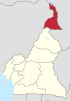
Dargala | |
|---|---|
Commune and town | |
| Country | |
| Time zone | UTC+1 (WAT) |
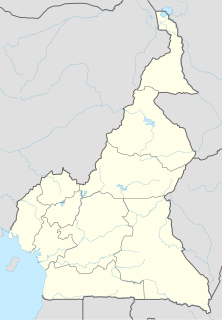
Dargala | |
|---|---|
Commune and town | |
| Country | |
| Time zone | UTC+1 (WAT) |
Banka, Cameroon is a town and commune in Cameroon.
Batcham is a town and commune in Cameroon.
Blangoua is a town and commune in Cameroon. It is located on the Chari River, which runs throughout some of Cameroon. It is the northernmost settlement of the country.
Dziguilao is a town and commune in Cameroon.
Gawaza is a town and commune in Cameroon.
Guidiguis is a town and commune in Cameroon, Far-North Region, Mayo-Kani Division.
Kai-Kai is a town and commune in Cameroon.
Petté is a town and commune in Cameroon.
Kalfou, Cameroon is a town and commune in Cameroon.
Kay-Hay is a town and commune in Cameroon.
Moulvoudaye is a town and commune in Cameroon.
Moutourwa is a town and commune in Cameroon.
Touloum is a town and commune in Cameroon.
Ndoukoula is a town and commune in Cameroon.
Njinikom is a town and commune in Northwest Region of Cameroon. It is mainly populated by Kom people.
Ngambé is a town and commune in Cameroon.
Ndelele is a town and commune in Cameroon.
Nkong-Zem is a town and commune in Cameroon.
Tchati-Bali is a town and commune in Cameroon.
Tokombéré is a town and commune in Cameroon. The town has approximately 10,000 inhabitants and the commune approximately 80,000. Surrounded by rocky hills, Tokombéré is a crossroads for multiple ethnic groups, including the Mada, Muyang, and Zulgo tribes. The town's religious makeup is nearly equal among Christians, Muslims, and animists. The town's development began in large part with the arrival of a priest from southern Cameroon, Baba Simon, in 1959. The Catholic mission remains an important and central location in Tokombéré, with its hospital, high school, elementary school, women's center, youth center, farmer's center, and more.
Coordinates: 10°37′54″N14°39′32″E / 10.6316°N 14.6588°E
| | This Cameroon location article is a stub. You can help Wikipedia by expanding it. |