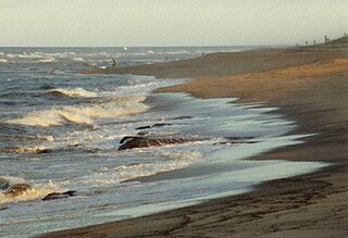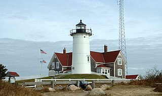
Harwich is a New England town on Cape Cod, in Barnstable County in the state of Massachusetts in the United States. At the 2010 census it had a population of 12,243. The town is a popular vacation spot, located near the Cape Cod National Seashore. Harwich's beaches are on the Nantucket Sound side of Cape Cod. Harwich has three active harbors. Saquatucket, Wychmere and Allen Harbors are all in Harwich Port. The town of Harwich includes the villages of Pleasant Lake, West Harwich, East Harwich, Harwich Port, Harwich Center, North Harwich and South Harwich.

Cape Cod is a geographic cape extending into the Atlantic Ocean from the southeastern corner of mainland Massachusetts, in the northeastern United States. Its historic, maritime character and ample beaches attract heavy tourism during the summer months.

Wellfleet is a town in Barnstable County, Massachusetts, United States, and is located halfway between the "tip" and "elbow" of Cape Cod. The town had a population of 2,750 at the 2010 census, which swells nearly sixfold during the summer. A total of 70% of the town's land area is under protection, and nearly half of it is part of the Cape Cod National Seashore. Wellfleet is famous for its oysters, which are celebrated in the annual October Wellfleet OysterFest.

Barnstable County is a county located in the U.S. state of Massachusetts. As of the 2010 census, the population was 215,888. Its county seat is Barnstable. The county consists of Cape Cod and associated islands.

Yarmouth is a town in Barnstable County, Massachusetts, United States, Barnstable County being coextensive with Cape Cod. The population was 23,793 at the 2010 census.

Bourne is a town in Barnstable County, Massachusetts, United States. The population was 19,754 at the 2010 census.

Chatham is a town in Barnstable County, Massachusetts, United States. Chatham is located at the southeast tip of Cape Cod, and has historically been a fishing community. First settled by the English in 1664, the township was originally called Monomoit based on the indigenous population's term for the region. Chatham was incorporated as a town on June 11, 1712, and has become a summer resort area. The population was 6,169 at the 2017 census, and can swell to 25,000 during the summer months. There are four villages that comprise the town, those being Chatham (CDC), South Chatham, North Chatham, and West Chatham. Chatham is home to the Monomoy National Wildlife Refuge, and the decommissioned Monomoy Point Light both located on Monomoy Island. A popular attraction is the Chatham Light, which is an operational lighthouse that is operated by the United States Coast Guard.

Falmouth is a town in Barnstable County, Massachusetts, United States; Barnstable County is coextensive with Cape Cod. The population was 31,532 at the 2010 census, making Falmouth the second-largest municipality on Cape Cod after Barnstable. The terminal for the Steamship Authority ferries to Martha's Vineyard is located in the village of Woods Hole in Falmouth. Woods Hole also contains several scientific organizations such as the Woods Hole Oceanographic Institution (WHOI), the Marine Biological Laboratory (MBL), the Woods Hole Research Center, NOAA's Woods Hole Science Aquarium, and the scientific institutions' various museums.

Sandwich is a town in Barnstable County, Massachusetts, the oldest town on Cape Cod. The town motto is Post tot Naufracia Portus, "after so many shipwrecks, a haven". The population was 20,675 at the 2010 census.

Hyannis is the largest of the seven villages in the town of Barnstable, Massachusetts, in the United States. It is the commercial and transportation hub of Cape Cod and was designated an urban area as of the 1990 census. Because of this, many refer to Hyannis as the "Capital of the Cape". It contains a majority of the Barnstable Town offices and two important shopping districts: the historic downtown Main Street and the Route 132 Commercial District, including Cape Cod Mall and Independence Park, headquarters of Cape Cod Potato Chips. Cape Cod Hospital in Hyannis is the largest on Cape Cod.

The Cape Cod Central Railroad is a heritage railroad located on Cape Cod, Massachusetts. It operates on a rail line known as the Cape Main Line which is owned by Massachusetts Department of Transportation. The line was previously owned and operated by the Cape Cod Railroad, the Old Colony Railroad, and later the New Haven Railroad, each of which operated passenger trains on the line from 1854 to 1959. Although it is the namesake of the Cape Cod Central Railroad (1861–68), the two companies are unrelated.
The Cape Cod Commission is a regional planning authority and department of Barnstable County, Massachusetts. It was created in 1990 by an Act of the Massachusetts General Court and confirmed by a majority of county voters.

The Cape Cod Rail Trail (CCRT) is a 25.5-mile (41.0 km) paved rail trail located on Cape Cod in Massachusetts. The trail route passes through the towns of Yarmouth, Dennis, Harwich, Brewster, Orleans, Eastham, and Wellfleet. It connects to the 6-plus mile (10 km) Old Colony Rail Trail leading to Chatham, the 2 mile Yarmouth multi-use trail, and 8 miles (13 km) of trails within Nickerson State Park. Short side trips on roads lead to national seashore beaches including Coast Guard Beach at the end of the Nauset Bike Trail in Cape Cod National Seashore. The trail is part of the Claire Saltonstall Bikeway.

The Joint Base Cape Cod is a joint base created by the Commonwealth of Massachusetts and the United States War Department in 1935. Governor James Curley signed the state bill to allocate and purchase land for a military facility, and establishing a formal commission to manage this new state military property and personnel. After 22,000 acres of land was secured in Cape Cod, the Massachusetts National Guard began erecting tents and a basic training program in the following year. Formerly the Massachusetts Military Reservation, it was renamed in 2013 to Joint Base Cape Cod.

The Massachusetts Coastal Railroad is the successor operator of portions of Bay Colony Railroad.

North Falmouth station was a railroad station on the Old Colony Railroad on Depot Road in North Falmouth, Massachusetts. Service to the station began in 1872 and ended in 1964, and the station burned down in 1969.

Barnstable is a town in the U.S. state of Massachusetts and the county seat of Barnstable County. Barnstable is the largest community, both in land area and population, on Cape Cod. At the 2010 census it had a population of 45,193. The town contains several villages within its boundaries. Its largest village, Hyannis, is the central business district of the county and home to Barnstable Municipal Airport, the airline hub of Cape Cod and the islands of Martha's Vineyard and Nantucket. Additionally, Barnstable is a 2007 winner of the All-America City Award.
The Upper Cape Regional Transfer Station (UCRTS) is a municipal waste transfer facility located within Joint Base Cape Cod. The facility is within the town limits of Falmouth, but on state-owned land at the southern end of the military base, and is about a mile west of the Falmouth entrance gate. It is one of two truck-to-rail trash transfer facilities on Cape Cod, with the other being the Yarmouth-Barnstable Regional Transfer Station.

The CapeFlyer is a passenger rail service in Massachusetts between Boston and Cape Cod that began in 2013. It is operated by the Cape Cod Regional Transit Authority (CCRTA) in collaboration with the Massachusetts Bay Transportation Authority (MBTA) and the Massachusetts Department of Transportation (MassDOT). The service runs on the weekends, beginning Friday evenings and including holidays, between Memorial Day weekend and Labor Day weekend.
The Southeastern Massachusetts Resource Recovery Facility is a waste-to-energy and recycling facility located in Rochester, Massachusetts. It is currently owned by Covanta Energy.


