
Yatala Labour Prison is a high-security men's prison located in the north-eastern part of the northern Adelaide suburb Northfield, South Australia. It was built in 1854 to enable prisoners to work at Dry Creek, quarrying rock for roads and construction. Originally known as The Stockade of Dry Creek or just The Stockade, it acquired its current name from a local Kaurna word relating to inundation by water, which was used for the Hundred of Yatala.

Osborne is a suburb in the Australian state of South Australia located on the Lefevre Peninsula in the west of Adelaide about 21 kilometres north-west of the Adelaide city centre.
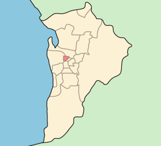
City of Prospect is an inner urban local government area (LGA) in Adelaide, South Australia. The council seat is the unusually-large suburb of Prospect, which makes up almost two thirds of the tiny council area, which is less than 8 km2 (3.1 sq mi). Established in 1872, it is one of the oldest local government bodies in South Australia.

Prospect is the seat of the City of Prospect and an inner northern suburb of greater Adelaide. It is located 5 km (3.1 mi) north of Adelaide's centre.
Clearview is a suburb of Adelaide, South Australia about 8 km north of the Adelaide city centre. The rectangular suburb is bordered by Grand Junction Road on the north, Hampstead Road on the east, Collins Street, Broadview on the south, and the suburb of Enfield on the west.

The City of Enfield was a local government area of South Australia from 1868 to 1996. It was known as Yatala South up until 1933, which was named for its local government area predecessor, the District Council of Yatala, and known as Enfield thereafter.
Yatala Vale is an outer northeastern rural suburb of Adelaide, South Australia. It is located in the City of Tea Tree Gully local government area, and is adjacent to Golden Grove and Fairview Park, as well as the rural districts of Upper Hermitage and Gould Creek.
Upper Hermitage is an outer northeastern rural suburb of Adelaide, South Australia. It is located in the City of Tea Tree Gully and Adelaide Hills Council local government areas, and is adjacent to the rural districts of Yatala Vale and Gould Creek.
Rosewater is one of the western suburbs of Adelaide and is located 10 km north-west of Adelaide's central business district. Although mainly residential, there are many shops along Grand Junction Road and the closed Rosewater Loop railway line runs through the suburb. Rosewater is split in half by Grand Junction Road and bordered on the east by Addison Road, and on the south by Torrens Road.

The Hundred of Adelaide is a cadastral hundred in the city of Adelaide spanning all the inner suburbs south of River Torrens. It is one of the eleven hundreds of the County of Adelaide, and was one of the first hundreds to be proclaimed. Like the city it surrounds, the Hundred was named after Queen Adelaide, and was named by Governor Frederick Robe in 1846. It is 106 square miles (270 km2); close to but not exactly one hundred square miles as with most of the other hundreds. Its north boundary is the Torrens River and the Sturt River forms the south east boundary, with the hundred extending to the Adelaide foothills.
Devon Park is an inner northern suburb of Adelaide, South Australia. It is located in the cities of Port Adelaide Enfield and Charles Sturt beside the Gawler railway line near, but not meeting, the intersection of Torrens Road and Churchill Road.

Pooraka is a suburb in Adelaide, South Australia. It is 12 km (7.5 mi) north of the central business district.
The District Council of Yatala was a local government area of South Australia established in 1853 and abolished in 1868.

Dry Creek or Dry Creek Drain is a seasonal stream in South Australia which passes through the Adelaide suburbs of Wynn Vale, Modbury, Walkley Heights and Pooraka. The nearby suburb of Dry Creek and Dry Creek railway station are named after the stream.

The Hundred of Yatala is a cadastral unit of hundred in South Australia covering much of the Adelaide metropolitan area north of the River Torrens. It is one of the eleven hundreds of the County of Adelaide stretching from the Torrens in the south to the Little Para River in the north; and spanning from the coast in the west to the Adelaide foothills in the east. It is roughly bisected from east to west by Dry Creek. It was named in 1846 by Governor Frederick Robe, Yatala being likely derived from yartala, a Kaurna word referring to the flooded state of the plain either side of Dry Creek after heavy rain.
The District Council of Yatala North was a local government area of South Australia on the central Adelaide Plains from 1868 to 1933. It was split from the abolished District Council of Yatala on 18 June 1868. The council area ranged approximately from Dry Creek in the south to the Little Para River in the north.

The Hundred of Port Adelaide is a cadastral hundred covering the vicinity of Port Adelaide, Lefevre Peninsula and the coast of the central Adelaide Plains south of Gawler River and west of Port Wakefield Road. It is one of the eleven hundreds of the County of Adelaide and was named in 1846 by Governor Frederick Robe.
The District Council of Hindmarsh was a local government area in South Australia from 1853 to 1875, seated at the inner north west Adelaide suburb of Hindmarsh.

The City of Woodville was a local government area in South Australia from 1875 to 1993, seated at the inner north west Adelaide suburb of Woodville.
This page is based on this
Wikipedia article Text is available under the
CC BY-SA 4.0 license; additional terms may apply.
Images, videos and audio are available under their respective licenses.