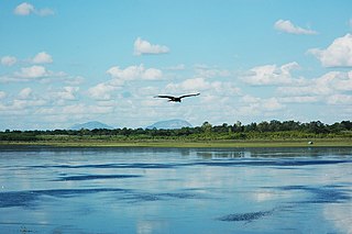
Shimoga, officially Shivamogga, is a city and the district headquarters of Shimoga district in the Karnataka state of India. The city lies on the banks of the Tunga River. Being the gateway for the hilly region of the Western Ghats, the city is popularly nicknamed the "Gateway of Malnad". The population of Shimoga city is 322,650 as per 2011 census. The city has been selected for the Smart Cities project, standing in the fourth position in the state and 25th in the country as of November 2020.

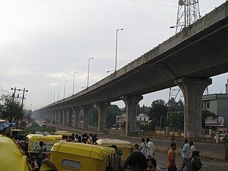
Whitefield is a suburb of Bangalore in the state of Karnataka, India. Established in 1882 as a settlement for the Eurasians and Anglo Indians of Bangalore, Whitefield remained a quaint little settlement at the eastern periphery of Bangalore city till the late 1990s when the local IT boom turned it into a major suburb. It is now a major part of Greater Bangalore. Whitefield is Bengaluru's first tech corridor to be connected by Namma Metro.
Anekal (ಆನೇಕಲ್) is a major town and taluk of Bengaluru Urban district, part of the Bangalore Metropolitan Region. It is a major town in the suburbs of Bengaluru. The Chandapura-Anekal stretch is an emerging residential hub in Bengaluru. It is approximately 36 km from the centre of Bengaluru and around 15 km from Hosur and Electronic City. It lies in the southern part of the Bangalore metropolitan area. Anekal is known for the Karaga and Dasara festivals.

The Bangalore Development Authority (BDA) of Bangalore, India, is a governmental organization and the principal planning authority for Bangalore in accordance with the Karnataka Municipal Corporation Act. Its functions, carried out under the Karnataka Town and Country Planning Act of 1961, include preparing a Comprehensive Development Plan for the Bangalore Metropolitan Region. It also oversees planning and development of infrastructure, provision of development-related sites and services, the housing needs of underprivileged citizens in Bangalore and is currently the city's largest land developer. No other authority or person may undertake development within the Bangalore Metropolitan Region without the permission of the BDA.

Bengaluru is the capital city of the state of Karnataka. Bengaluru, as a city, was founded by Kempe Gowda I, who built a mud fort at the site in 1537. But the earliest evidence for the existence of a place called Bengaluru dates back to c. 890.

Yelahanka is a premium locality in north Bangalore and also a Taluk of Bangalore Urban district in the Indian state of Karnataka. One of the zones of BBMP. It is the oldest part of present Municipal Bengaluru (Bangalore) city and the northern end of the city. It is Nadaprabhu Kempegowda I, of the Yelahanka Prabhu clans, who laid the foundation of present-day Bengaluru through the creation of a "mud fort town" in 1537 CE

Bruhat Bengaluru Mahanagara Palike (BBMP) is the administrative body responsible for civic amenities and some infrastructural assets of the Greater Bengaluru metropolitan area. It is the fourth largest Municipal Corporation in India and is responsible for a population of 8.4 million in an area of 741 km2. Its boundaries have expanded more than 10 times over the last six decades.

Tumkur officially Tumakuru is a city and headquarters of Tumakuru district in the Karnataka state of India. Tumkur is known for Siddaganga Matha, Tumkur hosts India's first mega food park, a project of the ministry of food processing. The India Food Park was inaugurated by Prime Minister of India in September 2014. Tumkur is also included in the Smart Cities Mission list and is among the 100 smart cities to be developed in India. Since 28 August 2010, Tumkur has been accorded the status of a city corporation.

Nagamangala is a PuraSabhe and a taluk in Mandya district, in the Indian state of Karnataka.

Jalahalli is a suburb in northern part of Bengaluru is one of the greenest areas of Bengaluru. It is mainly divided into Jalahalli East and Jalahalli West. Gangamma Circle is the junction between the roads connecting Jalahalli East, Jalahalli West, Jalahalli Village, and Jalahalli Cross. The National Academy of Customs and Narcotics in Bengaluru is located here.

The Nandi Infrastructure Corridor Enterprises Road, commonly known as NICE Road, is a partially implemented and largely scrapped 4 to 6 lane private tolled expressway in Karnataka, that was intended to connect the two important cities Bengaluru and Mysuru in the Indian state of Karnataka. It will not be implemented, as Bengaluru–Mysuru access-controlled Highway part of NH 275 is going to replace it as a section of the new Bengaluru–Mangaluru Industrial Corridor (EC-34).

Hesaraghatta Lake is a humanmade reservoir located 18 km to the north-west of Bengaluru in Karnataka state, India. It is a fresh water lake created in the year 1894 across the Arkavathy River to meet the drinking water needs of the city. Sir K. Seshadri Iyer, the then Dewan of erstwhile Mysore state and the then Chief Engineer of Mysuru, M. C. Hutchins, planned to build the scheme called the "Chamarajendra Water Works" to store a three-years' water supply to the city.
Murgod/Murugodu is a village in the southern state of Karnataka in India. It is located in the Savadatti taluk of Belagavi district in Karnataka, 491 km from the capital Bengaluru and 54 km from district headquarters Belagavi.

Bengaluru Pete is the area of Bangalore city which was established by Kempegowda I in 1537 with roads laid out in the cardinal directions, and entrance gates at the end of each road. Kempegowda also termed the Pete he built as his "gandu bhoomi" or "Land of Heroes". Pete forms a well–defined body of markets which were associated with various trades and professions of the populace in the locality markets and given the names of trades pursued in such markets. The well known markets are the Tharagupete–market for grains, the Balepete – for Bangles and musical instruments, the Chikkapete and the Nagarthpete for textile trade, the Ballapurpete and the Ganigarapete market where oil is extracted by people of the Ganiga community, the Tigalarapete–flower market of gardeners, the Cubbonpete – textile manufacture by people of the Devanga community.
Carmelaram is a suburb of Bangalore situated at Varthur Hobli, Sarjapur road. Carmelaram was a village but is now a part of Bruhat Bengaluru Mahanagara Palike.
Mandikal is a village located in present Chikkaballapura taluk, Karnataka, India. As of 2011, it had a population of 910. It is 5.06 km2 in area.

Bengaluru, formerly called Bangalore in English, is the capital and largest city of the southern Indian state of Karnataka. It has a population of more than 8 million and a metropolitan population of around 15 million, making it India's third most populous city and fourth most populous urban agglomeration. It is the most populous city and largest urban agglomeration in South India, and is the 27th largest city in the world. Located on the Deccan Plateau, at a height of over 900 m (3,000 ft) above sea level, Bengaluru has a pleasant climate throughout the year, with its parks and green spaces earning it the reputation of India's "Garden City". Its elevation is the highest of India's major cities.

Tannery Road is located in the North East of Bangalore Cantonment, India. It is a 4 km long narrow road with around 700 shops, named after the tanneries of the British India period located at the end of the Road. Tannery Road was officially renamed as Dr B S Ambedkar Road many years back, but it still is referred to by its old name. Tannery Road touches Fraser Town, Richards Town, Giddappa Block, Periyar Nagar and Pillanna Garden. The Tannery Road area is highly populated with a high density. The suburb presents a picture which is a shocking contrast to the hi-tech image of Bangalore. As elections has not brought about any changes, the residents express disillusionment with politicians and politics. Pot-holes and broken pavements are a common feature of Tannery Road, in addition to heavy traffic, water problems, garbage, etc. There is scant respect for traffic rules, and vehicles of all types zoom past in all directions. Residents have to dodge puddles of dirty water and garbage, to move around.

On the night of 11 August and the early hours of 12 August 2020, violent clashes took place around the residence of a legislator and the police stations of KG Halli and DJ Halli of the Indian city of Bangalore, Karnataka. A group of Muslims, angered by a Facebook post on Muhammad allegedly shared by Akhanda Srinivas Murthy's nephew, a state legislator of the Indian National Congress, arrived at his house in protest, which later turned violent.


